


Click Image to Enlarge
Ohio Counties
There is eighty-eight counties in the state of Ohio. Washington County the oldest in the state established on July 27, 1788. Noble County was formed on March 11, 1851 from portions of Guernsey, Morgan, Monroe and Washington counties. It was the last county to be formed in Ohio and, therefore, represents the youngest county in the state.Sandusky County, Ohio
Sandusky County Education, Geography, and History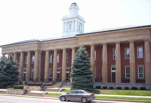
Sandusky County is a county in the state of Ohio. Based on the 2010 census, the population was 60,944. Its county seat is Fremont. The
county was formed on February 12, 1820 from portions of Huron County. It is named for a native word meaning "water" (Wyandot: saundustee).
The Fremont, OH Micropolitan Statistical Area includes all of Sandusky County.
Etymology - Origin of Sandusky County Name
Residents named the county after an Indian term for "at the cold water."
Demographics:
County QuickFacts: CensusBureau Quick Facts
Sandusky County History
On February 12, 1820, the Ohio government authorized the creation of Sandusky County. Residents named the county after an Indian term for "at the cold water." Sandusky County was originally part of territory set aside for Ohio's Indian people by the Treaty of Greeneville. White settlement of the
county occurred very slowly, due to the Great Black Swamp occupying most of the land.
Sandusky County is located in the northern part of Ohio. A small portion of the county's northern border lies along Lake Erie. The county seat is Fremont, which is the largest city in the county with a population of 17,375 people in 2000. Only three percent of the county's 409 square miles are
deemed urban. The county averages 151 people living in each square mile. Between 1990 and 2000, the county experienced a slight decrease in population. This is typical of Ohio's more rural counties, as residents seek better opportunities in the state's larger cities. In 2000, the county's residents
numbered 61,792 people.
Most of Sandusky County's residents find employment in agricultural positions, with seventy-percent of the county's acreage under cultivation. Sandusky County farmers are the fifth largest producers of tomatoes in Ohio. Manufacturing businesses, service industries, and retail positions finish
second, third, and fourth respectively. In 1999, the county's per capita income was 23,315 dollars, with 9.5 percent of the county's residents living below the poverty level.
Most voters in Sandusky County claim to be independents, yet in recent years, they have supported Republican Party candidates at the national level.
President of the United States Rutherford Birchard Hayes ranks as Sandusky County's most prominent resident. His home, Spiegel Grove, is now an historical landmark operated by the Ohio Historical Society. Union General James B. McPherson also lived in Sandusky County. He was killed during the
American Civil War and was buried in Clyde, Ohio
Sources
Sandusky County, Ohio History Central, July 24, 2008,
http://www.ohiohistorycentral.org/entry.php?rec=2008&nm=Sandusky-County
Geography: Land and Water
As reported by the Census Bureau, the county has a total area of 418 square miles (1,080 km2), of which 408 square miles (1,060 km2) is land and 9.3 square miles (24 km2) (2.2%) is water.
Neighboring Counties
Bordering counties are as follows:
- Ottawa County (north)
- Erie County (east)
- Huron County (southeast)
- Seneca County (south)
- Wood County (west)
Education


Click Image to Enlarge
