


Click Image to Enlarge
Ohio Counties
There is eighty-eight counties in the state of Ohio. Washington County the oldest in the state established on July 27, 1788. Noble County was formed on March 11, 1851 from portions of Guernsey, Morgan, Monroe and Washington counties. It was the last county to be formed in Ohio and, therefore, represents the youngest county in the state.Scioto County, Ohio
Scioto County Education, Geography, and History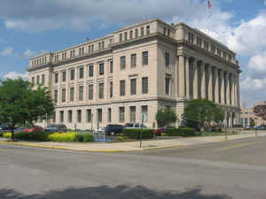
Scioto County is a county located in the south central region of the state of Ohio. Based on the 2010 census, the population was
79,499.Its county seat is Portsmouth. The county was founded March 24, 1803 from Adams County and is named for an Indian word referring to
deer or deer-hunting.
Scioto County comprises the Portsmouth, OH Micropolitan Statistical Area, which is also included in the Charleston-Huntington-Ashland,
WV-OH-KY Combined Statistical Area. It is located at the confluence of the Scioto and Ohio rivers.
Etymology - Origin of Scioto County Name
Residents took the county's name from a Native American word referring to the deer that were plentiful in the area.
Demographics:
County QuickFacts: CensusBureau Quick Facts
Scioto County History
On March 24, 1803, the State of Ohio authorized the creation of Scioto County. Residents took the county's name from a Native American word referring to the deer that were plentiful in the area. Located at the intersection of the Ohio River and the Scioto River, the county grew quickly because of
increasing river traffic. Scioto County continued to prosper with the construction of the Ohio and Erie Canal during the 1820s and the 1830s.
Scioto County is located in southern Ohio and its southern border lies on the Ohio River. In 2000, there were 79, 195 people living in the county. Scioto County is part of Appalachia and is predominantly rural, with 1.6 percent of the county's 612 square miles consisting of urban areas. The county
seat is Portsmouth. Scioto County experienced a 1.4 per cent decrease in population between 1990 and 2000. The county averages almost 129 people per square mile.
Service industries and retail businesses are the largest employers in Scioto County. Many county residents are employed in government, farming, and manufacturing. One of the county's larger employers is Shawnee State University in Portsmouth. The Southern Ohio Correctional Facility is also located
in Scioto County. In 1999, the per capita income in the county was 18,978 dollars, with twenty-one percent of the people living in poverty.
Most voters in Scioto County claim to be independents.
Among other prominent people, cowboy actor Roy Rogers lived in Scioto County for several years
Sources
Scioto County, Ohio History Central, July 24, 2008,
http://www.ohiohistorycentral.org/entry.php?rec=2010&nm=Scioto-County
Geography: Land and Water
As reported by the Census Bureau, the county has a total area of 616 square miles (1,600 km2), of which 610 square miles (1,600 km2) is land and 5.9 square miles (15 km2) (1.0%) is water. Many parts of Scioto County are heavily forested, especially in the western half of the county with Shawnee State Park.
Neighboring Counties
Bordering counties are as follows:
- Pike County (north)
- Jackson County (northeast)
- Lawrence County (east)
- Greenup County, Kentucky (south)
- Lewis County, Kentucky (southwest)
- Adams County (west)
Education
Colleges and universities
Scioto County used to be home to Ohio University Southern Campus; however, it moved to Lawrence County (Ironton) in the early 1980s. The former Ohio University buildings became home to Shawnee State University, which was founded in 1986 as Ohio's thirteenth and newest institution, after first becoming Shawnee State Community College. Scioto County is also home to Daymar College, which has in excess of 300 students (summer 2010).
K-12 schools
Scioto County has ten public school districts, one private school system, and one charter school system as well as several Christian schools. These districts include Bloom-Vernon (South Webster), Clay, Green, Minford, New Boston, Northwest, Notre Dame (Catholic), Portsmouth, Sciotoville Community School/East HS (charter), Valley, Washington-Nile (Ports. West) and Wheelersburg.


Click Image to Enlarge
