


Click Image to Enlarge
Ohio Counties
There is eighty-eight counties in the state of Ohio. Washington County the oldest in the state established on July 27, 1788. Noble County was formed on March 11, 1851 from portions of Guernsey, Morgan, Monroe and Washington counties. It was the last county to be formed in Ohio and, therefore, represents the youngest county in the state.Shelby County, Ohio
Shelby County Education, Geography, and History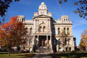
Shelby County is a county located in the state of Ohio. Based on the 2010 census, the population was 49,423.Its county seat is Sidney.
Its name honors Isaac Shelby, former governor of Kentucky.
Shelby County comprises the Sidney, OH Micropolitan Statistical Area, which is also included in the Dayton-Springfield-Sidney, OH Combined
Statistical Area.
Etymology - Origin of Shelby County Name
Residents named the county in honor of Isaac Shelby.
Demographics:
County QuickFacts: CensusBureau Quick Facts
Shelby County History
On January 7, 1819, the Ohio government authorized the creation of Shelby County. Residents named the county in honor of Isaac Shelby. Shelby County was originally part of territory set aside for Ohio's Indian people by the Treaty of Greeneville.
Shelby County is located in the western part of Ohio. The county seat is Sidney, which is the largest community in the county with a population of 20,211 people in 2000. No other community in Shelby County has a population over two thousand people. Only 1.6 percent of the county's 409 square miles
are deemed to be urban. The county averages 117 people living in each square mile. Between 1990 and 2000, the county experienced a 6.7 percent increase in population. This is unusual for Ohio's more rural counties, as residents usually seek better opportunities in the state's larger cities. In 2000,
the county's residents numbered 47,910 people.
Most of Shelby County's residents find employment in agricultural positions. Farmers bring in more than seventy million dollars combined per year. The county is especially well known for its dairy cattle. Manufacturing businesses also employ thousands of workers, with retail positions and service
industries employing a significantly smaller number of county residents. In 1999, the county's per capita income was 25,520 dollars, with 7.6 percent of the county's residents living below the poverty level.
Most voters in Shelby County claim to be independents, yet in recent years, they have overwhelmingly supported Republican Party candidates at the national level
Sources
Shelby County, Ohio History Central, July 24, 2008,
http://www.ohiohistorycentral.org/entry.php?rec=2012&nm=Shelby-County
Geography: Land and Water
As reported by the Census Bureau, the county has a total area of 411 square miles (1,060 km2), of which 408 square miles (1,060 km2) is land and 3.0 square miles (7.8 km2) (0.7%) is water.
Neighboring Counties
Bordering counties are as follows:
- Auglaize County (north)
- Logan County (east)
- Champaign County (southeast)
- Miami County (south)
- Darke County (west)
- Mercer County (mathematical point in northwest)
Education


Click Image to Enlarge
