


Click Image to Enlarge
Ohio Counties
There is eighty-eight counties in the state of Ohio. Washington County the oldest in the state established on July 27, 1788. Noble County was formed on March 11, 1851 from portions of Guernsey, Morgan, Monroe and Washington counties. It was the last county to be formed in Ohio and, therefore, represents the youngest county in the state.Union County, Ohio
Union County Education, Geography, and History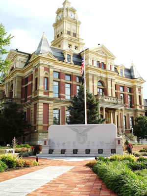
Union County is a county located in the US state of Ohio. Based on the 2010 census, the population was 52,300. Its county seat is Marysville.
Its name is reflective of its origins, it being the union of pieces of Franklin, Delaware, Madison, and Logan counties.
Union County is part of the Columbus, OH Metropolitan Statistical Area.
Etymology - Origin of Union County Name
The state formed the county from parts of Franklin, Delaware, Logan, and Madison Counties. Because the county was formed from a union of parts of other counties, residents chose the name Union for the new county.
Demographics:
County QuickFacts: CensusBureau Quick Facts
Union County History
On January 10, 1820, the Ohio government authorized the creation of Union County. The state formed the county from parts of Franklin, Delaware, Logan, and Madison Counties. Because the county was formed from a union of parts of other counties, residents chose the name Union for the new county.
Union County is located in west central Ohio. It is predominantly rural, with less than one percent of the county s 437 square miles consisting of urban areas. The county seat is Marysville. With a population of 15,942 people, Marysville was the county s largest community in 2000. Unlike most of
Ohio s predominantly rural counties, Union County experienced an increase in population (twenty-eight percent) between 1990 and 2000, increasing the total number of residents to 40,909 people. The main reason for this increase was the large number of residents from Columbus, in nearby Franklin
County, who sought to escape that city s busyness by moving to more rural, neighboring counties. Union County averages almost ninety-four people per square mile.
Manufacturing is the largest employer in Union County, followed by farming. Over seventy-three percent of the county s acreage is farmland. Service industries, such as health care and communications, and retail positions rank a distant third and fourth. Honda of America operates a plant in
Marysville. This facility is the county s single largest employer. Marysville is also home for the Ohio State Reformatory for Women. In 1999, the per capita income in the county was 23,776 dollars, with 6.7 percent of the people living in poverty.
Most voters in Union County claim to be independents, yet in recent years, they have overwhelmingly supported Republican Party candidates at the national level.
Sources
Union County, Ohio History Central, July 24, 2008,
http://www.ohiohistorycentral.org/entry.php?rec=2021&nm=Union-County
Geography: Land and Water
As reported by the Census Bureau, the county has a total area of 437 square miles (1,130 km2), of which 432 square miles (1,120 km2) is land and 5.1 square miles (13 km2) (1.2%) is water.
Neighboring Counties
Bordering counties are as follows:
- Marion County (northeast)
- Delaware County (east)
- Franklin County (southeast)
- Madison County (south)
- Champaign County (southwest)
- Logan County (west)
- Hardin County (northwest)
Education


Click Image to Enlarge
