


Click Image to Enlarge
Ohio Counties
There is eighty-eight counties in the state of Ohio. Washington County the oldest in the state established on July 27, 1788. Noble County was formed on March 11, 1851 from portions of Guernsey, Morgan, Monroe and Washington counties. It was the last county to be formed in Ohio and, therefore, represents the youngest county in the state.Vinton County, Ohio
Vinton County Education, Geography, and History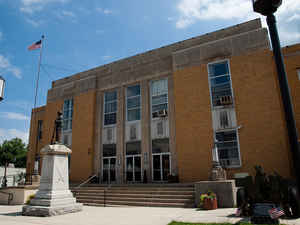
Vinton County is a county located in the state of Ohio. Based on the 2010 census, the population was 13,435, making it the least populous county in the state. Its county seat is McArthur. The county is named for Samuel Finley Vinton, a 19th-century United States Congressman from Ohio.
Etymology - Origin of Vinton County Name
Residents named the county after Samuel Finley Vinton, a member of the United States House of Representatives from Ohio.
Demographics:
County QuickFacts: CensusBureau Quick Facts
Vinton County History
On March 23, 1850, the Ohio government authorized the creation of Vinton County. Residents named the county after Samuel Finley Vinton, a member of the United States House of Representatives from Ohio.
Vinton County is located in southeastern Ohio. It is predominantly rural, with just six percent of the county s 414 square miles consisting of urban areas. It is in Appalachia. With a population of 1,888 people, McArthur, the county seat, was the county s largest community in 2000. Vinton County
experienced a sizable increase in population- 15.4 percent- between 1990 and 2000, raising the total number of residents to 12,806 people. Many residents of Ohio s rural communities are seeking better lives and more opportunities in the state s cities, but Vinton County is growing in population.
Still, Vinton County has the smallest population of all of Ohio s eighty-eight counties. Vinton County averages thirty-one people per square miles.
Farming is the primary occupation of Vinton County residents. The second largest employer in Vinton County is the government, with manufacturing businesses a close third. During the late nineteenth century, iron ore and coal mining were major businesses in the county. In 1999, the per capita income
in the county was 16,423 dollars. Almost nineteen percent of the people lived in poverty.
Most voters in Vinton County claim to be independents, yet in recent years, they have overwhelmingly supported Republican Party candidates at the national level
Sources
Vinton County, Ohio History Central, July 24, 2008,
http://www.ohiohistorycentral.org/entry.php?rec=2025&nm=Vinton-County
Geography: Land and Water
As reported by the Census Bureau, the county has a total area of 415 square miles (1,070 km2), of which 412 square miles (1,070 km2) is land and 2.6 square miles (6.7 km2) (0.6%) is water.
Neighboring Counties
Bordering counties are as follows:
- Hocking County (north)
- Athens County (northeast)
- Meigs County (east)
- Gallia County (southeast)
- Jackson County (south)
- Ross County (west)
Education
The entire county is served by the Vinton County Local School District


Click Image to Enlarge
