


Click Image to Enlarge
Ohio Counties
There is eighty-eight counties in the state of Ohio. Washington County the oldest in the state established on July 27, 1788. Noble County was formed on March 11, 1851 from portions of Guernsey, Morgan, Monroe and Washington counties. It was the last county to be formed in Ohio and, therefore, represents the youngest county in the state.Williams County, Ohio
Williams County Education, Geography, and History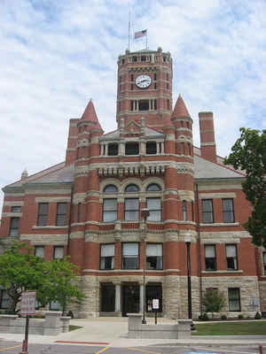
Williams County is a county located in the state of Ohio. Based on the 2010 census, the population was 37,642. Its county seat is Bryan. The county was created in 1820 and later organized in 1824. It is named for David Williams, one of the captors of John André in the American Revolutionary War.
Etymology - Origin of Williams County Name
Residents named the county in honor of David Williams, a hero of the American Revolution. Williams helped capture Benedict Arnold, the most notorious traitor in American history.
Demographics:
County QuickFacts: CensusBureau Quick Facts
Williams County History
On February 12, 1820, the Ohio government authorized the creation of Williams County. Residents named the county in honor of David Williams, a hero of the American Revolution. Williams helped capture Benedict Arnold, the most notorious traitor in American history. Williams County was originally
part of territory set aside for Ohio's Indian people by the Treaty of Greeneville. The land comprising this county also came under dispute between Ohio and Michigan during the "Toledo War."
Williams County is located in the northwestern part of Ohio. Its western border helps form the boundary between Ohio and Indiana, and its northern border helps form the boundary between Ohio and Michigan. The county seat is Bryan, which is the largest community in the county, with a population of
8,333 people in 2000. Just over one percent of the county's 422 square miles are deemed to be urban. The county averages ninety-three people living in each square mile. Between 1990 and 2000, the county experienced a six percent increase in population. This is unusual for Ohio's more rural counties,
as residents usually seek better opportunities in the state's larger cities. In 2000, the county's residents numbered 39,188 people.
Most of Williams County's residents find employment in agricultural positions, with seventy-five percent of the county's acreage under cultivation. Manufacturing, retail, and service positions finish second, third, and fourth respectively. In 1999, the county's per capita income was 25,226 dollars,
with 6.8 percent of the county's residents living below the poverty level.
Most voters in Williams County claim to be independents, yet in recent years, they have overwhelmingly supported Republican Party candidates at the national level
Sources
Williams County, Ohio History Central, July 24, 2008,
http://www.ohiohistorycentral.org/entry.php?rec=2034&nm=Williams-County
Geography: Land and Water
As reported by the Census Bureau, the county has a total area of 423 square miles (1,100 km2), of which 421 square miles (1,090 km2) is land and 2.1 square miles (5.4 km2) (0.5%) is water.
Neighboring Counties
Bordering counties are as follows:
- Hillsdale County, Michigan (north)
- Fulton County (east)
- Henry County (southeast)
- Defiance County (south)
- DeKalb County, Indiana (southwest)
- Steuben County, Indiana (northwest)
Education


Click Image to Enlarge
