


Click Image to Enlarge
Ohio Counties
There is eighty-eight counties in the state of Ohio. Washington County the oldest in the state established on July 27, 1788. Noble County was formed on March 11, 1851 from portions of Guernsey, Morgan, Monroe and Washington counties. It was the last county to be formed in Ohio and, therefore, represents the youngest county in the state.Wood County, Ohio
Wood County Education, Geography, and History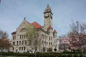
Wood County is a county located in the state of Ohio. Based on the 2010 census, the population was 125,488.Its county seat is Bowling
Green. The county was named for Captain Eleazer D. Wood, the engineer for General William Henry Harrison's army, who built Fort Meigs in the
War of 1812.
Wood County is part of the Toledo, OH Metropolitan Statistical Area. Its diagonnal northwest border is formed by the Maumee River, which has
its mouth at Maumee Bay on Lake Erie.
Etymology - Origin of Wood County Name
Residents named the county in honor of a hero of the War of 1812.
Demographics:
County QuickFacts: CensusBureau Quick Facts
Wood County History
On February 12, 1820, the Ohio government authorized the creation of Wood County. Residents named the county in honor of a hero of the War of 1812. Wood County was originally part of territory set aside for Ohio's Indian people by the Treaty of Greeneville. During the War of 1812, the county was
the site of Fort Meigs, an important American fort that protected Ohio from a British invasion from Canada. Today, the Ohio Historical Society operates a museum at Fort Meigs.
Wood County is located in the northwestern part of Ohio. The county seat is Bowling Green, which is the largest community in the county, with a population of 29,636 people in 2000. Bowling Green is also the site of Bowling Green State University. Two percent of the county's 617 square miles are
deemed to be urban. The county averages 196 people living in each square mile. Between 1990 and 2000, the county experienced a 6.9 percent increase in population. This growth primarily occurred due to residents of Toledo, Ohio, in neighboring Lucas County, seeking to escape the busyness of this
large city. In 2000, the county's residents numbered 121,065 people.
Most of Wood County's residents find employment in agricultural positions, with seventy-seven percent of the county's acreage under cultivation. Wood County farmers rank first in Ohio in wheat production, second in tomatoes, third in soybeans, and fourth in corn. Manufacturing, retail, and service
positions finish second, third, and fourth respectively. Many residents also work in Toledo. In 1999, the county's per capita income was 26,737 dollars, with 7.1 percent of the county's residents living below the poverty level.
Most voters in Wood County claim to be independents, yet in recent years, they have overwhelmingly supported Republican Party candidates at the national level.
Sources
Wood County, Ohio History Central, July 24, 2008,
http://www.ohiohistorycentral.org/entry.php?rec=2036&nm=Wood-County
Geography: Land and Water
As reported by the Census Bureau, the county has a total area of 620 square miles (1,600 km2), of which 617 square miles (1,600 km2) is land and 3.3 square miles (8.5 km2) (0.5%) is water
Neighboring Counties
Bordering counties are as follows:
- Lucas County (north)
- Ottawa County (northeast)
- Sandusky County (east)
- Seneca County (southeast)
- Hancock County (south)
- Putnam County (southwest corner)
- Henry County (west)
Education


Click Image to Enlarge
