


Click Image to Enlarge
Washington Counties
There are thity-nine counties in the state of Washington. Washington was carved out of the western part of Washington Territory and admitted to the Union as the 42nd state in 1889. The first counties were created from unorganized territory in 1845.Asotin County, Washington
Asotin County Education, Geography, and History
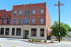
Asotin County is a county located in the state of Washington. Based on the 2010 census, the population was 21,623. The county seat is at
Asotin, and its largest city is Clarkston. The county was created out of Garfield County on October 27, 1883 and derives its name from a Nez
Perce word meaning "Eel Creek".
Asotin County is part of the Lewiston, ID-WA Metropolitan Statistical Area, which includes all of both Nez Perce County, Idaho, and Asotin
County.
Etymology - Origin of Asotin County Name
The Nez Percé name for Eel Creek.
Demographics:
County QuickFacts: CensusBureau Quick Facts
Asotin County History
Asotin County, formed out of Garfield County in 1883, is located in extreme southeastern Washington. In the 2000 Census, the county population was 20,551, and the population of Clarkston, its largest town, was 7,337. The county seat is the small town (pop. 1,095 in 2000) of Asotin, seven miles south of Clarkston.
Economic
Asotin County is located at the confluence of the Snake and Clearwater Rivers. The river system is home to a
thriving aluminum jet boat manufacturing industry and provides the wood processing and other industrial users direct
barge transportation to the West Coast.
There are three ports within the immediate area and adequate industrial land for business growth and expansion. The
highway grid supports access to Idaho and the Southern tier of Washington and the Northern tier of Oregon with
connections to North-South and East-West interstates.
The warm climate, excellent health care facilities, year-round golfing and other recreational opportunities provide exceptional amenities for those looking for an active community for retirement.
The region boasts a safe, rural, educated life-style, attracting businesses with its small town hospitality and impressing them with its commitment to area commerce.
Geography: Land and Water
As reported by the Census Bureau, the county has a total area of 641 square miles (1,659 km2), of which, 635 square miles (1,646 km2) of it is land and 5 square miles (14 km2) of it (0.83%) is water. It is part of the Palouse, a wide and rolling prairie-like region of the middle Columbia basin.
At 636 square miles, Asotin County is the sixth-smallest county in the state. It has a fertile agricultural region in the north-central
region, while farther south, the terrain becomes more rugged and is marked by creeks and gullies. Elevations dip to as low as 740 feet in the
northeastern corner near Clarkston, and rise to exceed 6,000 feet in the extreme southwestern region in the Blue Mountains. Asotin County's
history has been primarily an agricultural one centered on farming and fruit orchards.
Neighboring Counties
Bordering counties are as follows:
- Whitman County, Washington north
- Nez Perce County, Idaho east
- Wallowa County, Oregon south
- Garfield County, Washington northwest
Education


Click Image to Enlarge
