


Click Image to Enlarge
Washington Counties
There are thity-nine counties in the state of Washington. Washington was carved out of the western part of Washington Territory and admitted to the Union as the 42nd state in 1889. The first counties were created from unorganized territory in 1845.Grant County, Washington
Grant County Education, Geography, and History
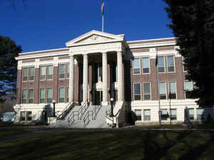
Grant County is a county located in the state of Washington. Based on the 2010 census, the population was 89,120. The county seat is
Ephrata, and the largest city is Moses Lake. The county was formed out of Douglas County on February 24, 1909 and is named for US President
Ulysses S. Grant.
Grant County comprises the Moses Lake, WA Micropolitan Statistical Area.
Etymology - Origin of Grant County Name
Ulysses Simpson Grant, the eighteenth president of the United States.
Demographics:
County QuickFacts: CensusBureau Quick Facts
Grant County History
Native American cultures in the area included the Interior Salish, Wenatchi, Okanagan. The first white settlers began
to arrive in the mid-to-late-19th century, primarily with the goal of raising livestock. One government official described the area in 1879
as, "…a desolation where even the most hopeful can find nothing in its future prospects to cheer."
When railroads arrived they also brought new settlers, and the economy began a shift from ranching to dryland farming. This transition
required the people to have ready access to water, and irrigation became a necessity. The first large-scale irrigation attempts began in 1898,
but it would be years before real success.
With the influx of dryland farming, the county soon boasted access to three major railway systems; the Great Northern Railway, Northern
Pacific Railroad and the Chicago, Milwaukee & St. Paul Railroad. In addition, the Columbia River in this area was navigable. This allowed
crops to be transported out of the area easily. Towns like Wilson's Creek, Quincy and Ephrata began to thrive.
The Washington State Legislature officially created Grant County February 24, 1909, and named after President Ulysses S. Grant. The county
seat was located in Ephrata. The population in the county at the time was only about 8700 people.
Covering a total of 2,660 square miles, Grant County - located in the Columbia Basin region of central Washington - is the state's fourth largest county. It was initially carved out of neighboring Douglas County in 1909. The original (and much larger) Douglas County had been created in 1883 when the Washington Territorial Legislature formed Lincoln and Spokane counties from a larger Spokane County, then separated the new Lincoln County into Lincoln and Douglas Counties only a few days later.
Economic
Located in the heart of Eastern Washington, Grant County is home to an international airport with a foreign trade zone, industrial power rates averaging 2.5 cents per kilowatt hour, inexpensive land, low tax rates and a sizable workforce, thus making it a formidable area for industrial expansion.
Geography: Land and Water
As reported by the Census Bureau, the county has a total area of 2,791 square miles (7,229 km2), of which,
2,681 square miles (6,944 km2) of it is land and 110 square miles (285 km2) of it (3.95%) is water.
Neighboring Counties
Bordering counties are as follows:
- Douglas County, Washington - north
- Okanogan County, Washington - northeast
- Adams County, Washington - east
- Lincoln County, Washington - east
- Franklin County, Washington - southeast
- Benton County, Washington - south
- Yakima County, Washington - southwest
- Kittitas County, Washington - west
Education


Click Image to Enlarge
