


Click Image to Enlarge
Washington Counties
There are thity-nine counties in the state of Washington. Washington was carved out of the western part of Washington Territory and admitted to the Union as the 42nd state in 1889. The first counties were created from unorganized territory in 1845.Pend Oreille County, Washington
Pend Oreille County Education, Geography, and History
Pend Oreille County is a county located in the northeast corner of the state of Washington. Based on the 2010 census, the population was
13,001. The county seat and largest city is Newport. The county was created out of Stevens County on March 1, 1911. It is the most recently
formed of the state's 39 counties. It is named after the Pend d'Oreilles tribe.
Pend Oreille County is included in the Spokane-Spokane Valley, WA Metropolitan Statistical Area.
Etymology - Origin of Pend Oreille County Name
It is named after the Pend d'Oreilles tribe, whose name is French for "earring" (literally "hangs from ear"), which refers to the large shell earrings that these people wore..
Demographics:
County QuickFacts: CensusBureau Quick Facts
Pend Oreille County History
Pend Oreille County was created 1 March 1911 from Stevens County. Pend Oreille County, in the extreme northeast corner of Washington, was the last county created in the state. The long narrow strip of land bordering the Idaho Panhandle comprised the easternmost part of Stevens County until designated a separate county in 1911. In 1912, Newport, the largest town, defeated three other contenders to become county seat. The name Pend Oreille derives from a French-Canadian fur trade moniker for local Indians who probably wore large ear pendants. The area that became the small, sparsely populated county was in many ways the last frontier in the state. Its inhabitants were first the indigenous peoples, then fur traders and explorers, followed by missionaries, then miners, loggers, and homesteaders. Industries such as timber, mining, and cement manufacture provided employment, but most of the profits flowed to outside investors, leaving little for local development. Today the county is working to upgrade its economy, while its scenic beauty and recreational opportunities are attracting tourism and settlement.
Geography: Land and Water
As reported by the Census Bureau, the county has a total area of 1,425 square miles (3,692 km2), of which,
1,400 square miles (3,627 km2) of it is land and 25 square miles (65 km2) of it (1.76%) is water.
Neighboring Counties
Bordering counties are as follows:
- Boundary County, Idaho east
- Bonner County, Idaho east
- Spokane County, Washington south
- Stevens County, Washington west
It also shares its northern border with British Columbia, Canada.
- Central Kootenay Regional District, British Columbia
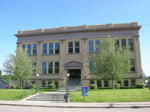
Education


Click Image to Enlarge
