


Click Image to Enlarge
Washington Counties
There are thity-nine counties in the state of Washington. Washington was carved out of the western part of Washington Territory and admitted to the Union as the 42nd state in 1889. The first counties were created from unorganized territory in 1845.Stevens County, Washington
Stevens County Education, Geography, and History
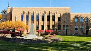
Stevens County is a county located in the state of Washington. As of the 2014 United States Census, its population was 43,650. The county
seat and largest city is Colville. The county was created in 1863 and named after Isaac Stevens, the first governor of Washington Territory.
Stevens County is included in the Spokane-Spokane Valley, WA Metropolitan Statistical Area.
Etymology - Origin of Stevens County Name
Isaac Ingalls Stevens, the first governor of the Washington Territory.
Demographics:
County QuickFacts: CensusBureau Quick Facts
Stevens County History
Stevens County was created 20 January 1863 from Walla Walla County. Named after Washington Territory's first governor, Stevens County stretches 100 miles along the east bank of Lake Roosevelt (once the left bank of the Columbia) above the Spokane River in the Selkirk Mountains. The Hudson's Bay Company founded the first European community in the county at Fort Colvile near Kettle Falls. Americans were first attracted by mineral riches in the 1850s and within 60 years, the county was one of the state's top silver and copper producers. Approximately 41,000 people make their homes there and work in forest products, agriculture, tourism and recreation, and public services. The character of the county is decidedly rural, but increasingly, commuters are making the southern end of the county a bedroom community of Spokane. The largest municipalities are Chewelah, Colville, Kettle Falls, Marcus, Northport, and Springdale, but only 7 percent of the population live within their limits.
Geography: Land and Water
As reported by the Census Bureau, the county has a total area of 2,541 square miles (6,580 km2), of which,
2,478 square miles (6,419 km2) of it is land and 62 square miles (161 km2) of it (2.45%) is water.
Neighboring Counties
Bordering counties are as follows:
- Pend Oreille County, Washington - east
- Spokane County, Washington - southeast
- Lincoln County, Washington - southwest
- Ferry County, Washington - west
It also shares its northern border with the Kootenay Boundary Regional District of British Columbia, Canada.
Education


Click Image to Enlarge
