


Click Image to Enlarge
West Virginia Counties
There are fifty-five counties in the state of West Virginia. Fifty of them existed at the time of the Wheeling Convention in 1861, before which West Virginia was part of the state of Virginia. The remaining five (Grant, Mineral, Lincoln, Summers and Mingo) were formed within the state after its admission to the United States on June 20, 1863. At that time, Berkeley County and Jefferson County, the two easternmost counties of West Virginia, refused to recognize their inclusion in the state. In March 1866, the US Congress passed a joint mandate assenting to their inclusion.Barbour County, West Virginia
Barbour County Education, Geography, and History
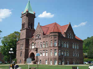
Barbour County is a county located in north-central West Virginia. Based on the 2010 census, the population was 16,589. The county seat is Philippi, which was chartered in 1844. Both county and city were named for Philip Pendleton Barbour (1783 - 1841), a US Congressman from Virginia and Associate Justice of the US Supreme Court. The county was formed in 1843 when the region was still part of the state of Virginia. In 1871, a small part of Barbour County was transferred to Tucker County, West Virginia.
Etymology - Origin of Barbour County Name
Named in honor of the distinguished Virginia jurist Judge Philip Pendleton Barbour (1783-1841)
Demographics:
County QuickFacts: CensusBureau Quick Facts
Early History of Barbour County, West Virginia
Barbour County was created by an act of the Virginia General Assembly on March 3, 1843 from parts of Harrison, Lewis and Randolph counties. Most historians claim that the county was named in honor of the distinguished Virginia jurist Judge Philip Pendleton Barbour (1783-1841). He was born in Orange County Virginia on May 25, 1783, studied law, was a member of the Virginia General Assembly (1812-1814), represented Virginia in the US House of Representatives (1814-1825, 1827-1830), served as Speaker of the US House of Representatives (1821-1823), and as Associate Justice of the US Supreme Court (1836-1841). Others claim that it was also named for his older brother James Barbour (1775-1842). He was the Governor of Virginia (1812-1814), a member of the US Senate (1815 to 1825), Secretary of War during John Quincy Adams' Administration (1825-1828), and the US Envoy to Great Britain in 1828.
Richard, Cotteral and Charity Talbot, and their mother, were the first English settlers in Barbour County. They arrived in 1780. Richard was then 16 years old, Cotteral was 18 and Charity was 20. They built a cabin about two miles northwest of the current county seat, Philippi, along the waters of what would later be called Hacker's Creek. They were forced to abandon their cabin several times due to Indian uprisings, and twice had to leave the county entirely due to Indian raids. In 1788, Richard married Margaret Dowden, then 11 years old, and they had 13 children. Also in 1788, Cotteral married Elizabeth Reger. Most of the two family's children remained in Barbour County and for several generations the Talbot family name was by far the most numerous in the county.
Philippi, named in honor of Philip Pendleton Barbour, was established as the county seat by the act creating the county. The act mistakenly spelled the town Phillippa. The town was originally called Anglin's Ford, in honor of William Anglin who had settled there in the early 1780s. It was later called Booth's Ferry in honor of Daniel Booth who had come to own the land sometime around 1800. The town's current name was established by the act creating the county and the spelling was corrected to Philippi when the state legislature chartered the town on February 14, 1844. The first meeting of the county court was held on April 3, 1843 at the home of William F. Wilson.
Although previous encounters between Confederate and Union troops had taken place at Gloucester Port, Baltimore and Sewell's Point, the Battle of Philippi, on June 3, 1861, is said to have been the first significant land battle between the Union and Confederate Armies during the Civil War. The Union forces, under the command of General B. F. Kelly, surprised and routed the Confederate forces, under the command of Colonel George A. Porterfield.
The Philippi Bridge, built in 1852, was the first bridge captured during the Civil War. Local legend has it that President Lincoln and Jefferson Davis, President of the Confederacy, held a secret meeting at the bridge shortly after the Civil War began in a futile effort to end the conflict.
Formation of Barbour County
On March 3, 1843 the General Assembly of Virginia passed the bill establishing the County of Barbour out of parts of the Counties of Harrison, Lewis and Randolph. The county was named in honor to and in memory of Philip P. Barbour of Virginia. The first court was held at the home of William F. Wilson on the first Monday of April, 1843. The bill described the boundary lines forming the new county:
Beginning opposite the mouth of Sandy Creek, on the east side of Valley River, with the several meanders thereof, to McDaniel's Ferry, thence a straight line to the dividing ridge of the waters of Simpson's Creek and Bartletts Run (so as to include Reuben Davisson's farm in the new county); thence a straight line to the old farm now occupied by Samuel Bartlett; thence to the head of Goodwins run; thence a straight line to William Beans on Gnatty Creek; thence a straight line to the head of Pecks Run; thence with the dividing ridge between the head of Pecks Run and Hackers Creek to the gap of said ridge, where the road crosses, leading down to Hackers Creek; thence a straight line to Samuel Black's residence including the farm of the said Black within the new county) on Buckhannon River; thence a straight line to the mouth of Sarvis Run, on the middle fork of the Valley River; thence a straight line to the gap of the Laurel Hill mountain where the widow Corley's corner tree stands; thence with the top of the said mountain until where it comes to the Preston County line; thence with the Preston and Randolph County line to the beginning.
From: West Virginia Heritage Encyclopedia, compiled by Hardesty.
Geography: Land and Water
As reported by the Census Bureau, the county has a total area of 343 square miles (890 km2), of which 341 square miles (880 km2) is land and
1.8 square miles (4.7 km2) (0.5%) is water.
Barbour County is situated on the Allegheny Plateau at the western edge of the Allegheny Mountains (represented by Laurel Mountain at the County's
eastern boundary). Most of the County is drained by the Tygart Valley River which traverses it from south to north and on which its three largest
settlements - Philippi, Belington, and Junior - are sited. Tributaries of the Tygart in the County include Teter Creek, Laurel Creek, Hacker's
Creek, the Buckhannon River and the West Fork River. A portion of the County in the west drains into the Middle Fork River, principally through Elk
Creek. Audra State Park - the County's only state park - is situated on the Middle Fork in the southwest corner. Teter Creek Lake Wildlife
Management Area - the County's only WMA - is located on that stream and lake in the eastern portion. All of the mentioned streams are part of the
greater Monongahela River watershed.
Neighboring Counties
Bordering counties are as follows:
- East: Tucker County
- North: Taylor County
- Northeast: Preston County
- Northwest: Harrison County
- Southeast: Randolph County
- Southwest: Upshur County
Education


Click Image to Enlarge
