


West Virginia Geography: The Land
Geography and Landforms of West Virginia
 Find an overview of West
Virginia geography, topography, geographic land regions, land areas, and major rivers.
Find an overview of West
Virginia geography, topography, geographic land regions, land areas, and major rivers.
Access West Virginia almanac, furnishing more details on the state geography, geographical and land regions, climate and weather, elevation, land areas, bordering states, and other statistical data.
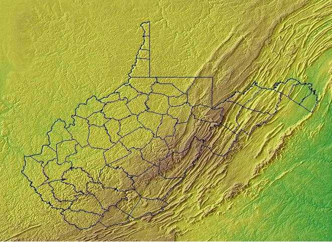
West Virginia is bordered by Ohio, Pennsylvania
and Maryland on the north and by Virginia on the south. On the east, the state borders Pennsylvania, Maryland and Virginia, and on the west it is bordered
by Ohio and Kentucky.
West Virginia's nickname, the Mountain State, is well deserved. Some of the most rugged land in the country can be found in this, one of the smaller states; only nine states are smaller in total area. Most of the level land areas found in West Virginia are flat strips that lie along the major rivers. If you're traveling in this state and you're not traveling along a river, chances are you'll either be going uphill or you'll be going downhill.
The highest point in West Virginia is Spruce Knob at 4,861 feet above sea level and the lowest point is the Potomac River at 240 feet above sea level. The state's nickname is the Mountain State, and West Virginia features some of the most rugged land in the United States.
West Virginia Highest, Lowest, & Mean Elevations |
|
|---|---|
| Mean Elevation | 1,500 ft. |
| Highest Point | Spruce Knob 4,861 ft. |
| Lowest Point | Potomac River 240 ft. |
West Virginia Land Area (Square Miles) |
|
| Geographic Center | In Braxton County, 4 mi. E of Sutton Longitude: 80° 42.2'W Latitude: 38° 35.9'N |
| Total Area | 24,229.76 sq. mi. 41st |
| Land Area | 24,077.73 sq. mi. 99.38% |
| Water Area | 152.03 sq. mi. 0.62% |
| Forested Land Area | 78.5% |
| Dimensions (Length - Width) |
240 miles - 130 miles |
West Virginia: Physiographic Regions
All of West Virginia is a part of the Appalachian Mountain system. It is commonly subdivided into two major physiographic regions:
- the Appalachian Plateau Province and the
- Mid-Atlantic Ridge and Valley Province.
Mid-Atlantic Ridge and Valley
The Mid-Atlantic Ridge and Valley extends from western Maryland, through the mountains of Virginia and eastern West Virginia. Most
of this physiographic area consists of long mountainous ridges and intervening valleys, but it also includes the higher Allegheny Mountains of West
Virginia. Predominant vegetation consists of oak and oak-hickory forests on the ridges and northern hardwood forest in the Allegheny Mountains. Important
relict patches of spruce-fir exist in the Allegheny Mountains and on higher mountains along the ridge and valley of Virginia. Much of the lower valleys
are in agricultural production or urban development. Human populations are relatively sparse throughout the physiographic area and are largely confined
to the larger valleys. Suburban and second-home development is rapidly encroaching from large urban centers to the East. Timber extraction has been
a major activity throughout the history of this region, and it continues to be important on both public and privately owned forest lands. Extraction
of minerals, oil and gas, and coal are also important land uses throughout this region. At present, one of the most important disturbance factors affecting
forested habitats in this region is the prevalence and spread of native and exotic insect pests and disease. Beginning with American chestnut blight,
a series of such elements threaten the integrity and health of Appalachian forest ecosystems.
This region includes a wide strip of the Appalachian Mountains and the Blue Ridge Mountains. It is heavily forested and hide caverns and underground streams.
Along the western edge of the mountains is the Allegheny Front, the place where the more sharp, rugged mountains of the east meet the more rolling terrain of the Appalachian Plateau. Many of the peaks in this area of West Virginia rise to over 4,000 feet above sea level. Spruce Knob, the highest point in West Virginia, rises 4,861 feet above sea level in the Appalachian Ridge and Valley Region.
Appalachian Plateau Province
The Appalachian Plateau Province covers the western two-thirds of the state and coincides with the Ohio River drainage basin. It is a region severely dissected by streams into a maze of hills and valleys, and, in places, the original plateau surface shows as the uniform top levels of the remaining ranges. The eastern portion of the plateau, with the highest mountains of the state, is referred to as the Allegheny Mountain section.
West Virginia Landscape and Landforms:
Northern Cumberland Plateau
This is a largely forested, gently rolling tableland ranging from 300 m. To 580 m. in elevation. It is defined by the higher Eastern Highland Rim of the Interior Low Plateaus on the west and the Cumberland Mountains of the Ridge and Valley physiographic area on the east. The Cumberland Plateau extends south out of this physiographic area, where it is included with the Southern Ridge and Valley, and narrowly northward as well. As defined, the Northern Cumberland Plateau includes the eastern third of Kentucky, southwestern West Virginia, a small area in western Virginia, and a swath across Tennessee barely extending into Alabama and Georgia. Mixed mesophytic forest dominated by oaks, hickory, and, historically, American chestnut, is the most common cover type. Various pine species become more dominant on drier sites.
Ohio Hills
Landforms within the Ohio Hills consist primarily of dissected, unglaciated plateaus ranging in elevation from 150 m to 450 m, with some valleys as low as 100 m and some mountainous areas reaching 1,100 m. A majority of the planning unit was dominated historically by oak-hickory forests; today these cover roughly 4.3 million ha (10.7 million ac), or 54% of the physiographic area. Numerous patches of northern hardwood forest occur on north-facing hillsides, particularly near the edges of the Allegheny Mountains in West Virginia and Allegheny Plateau in Ohio. Historically, oak-hickory and oak-pine regeneration was dependent on fire, and recent policies of fires suppression in the southern Appalachians has had major (primarily negative) effects on native forest composition and structure. Human populations are relatively sparse through most the physiographic area and are largely confined to the larger valleys; Pittsburgh, PA and Morgantown, WV are the largest cities. Roughly 40% of the physiographic area is in agricultural production or urban development, mostly in the northern half. Timber extraction has been a major activity throughout the history of this region, and it continues to be important on both public (10% of area) and privately owned forest lands. Extraction of minerals, oil and gas, and coal are also important land uses throughout this region, with a new wave of mining underway in the form of highly destructive mountaintop removal.
West Virginia Landscape Areas
MID-OHIO VALLEY
This area is made up of small towns and countryside, hiking and biking, hunting and fishing, glass and history.
POTOMAC HIGHLANDS
The great outdoors, waiting for you to explore - on skis, on bikes, on foot, in canoes, at the end of a rope or underground is the Potomac Highlands.
NORTHERN PANHANDLE
Located in the northernmost tip of West Virginia, it is a crossroads of history and modern pleasures.
MOUNTAIN LAKES
There are deep blue lakes, starry nights and the beauty of nature of its unspoiled best is the heartland of West Virginia.
MOUNTAINEER COUNTRY
This region is an intriguing mix of pioneer forts, covered bridges, ethnic festivals, university sports, scenic trails and whitewater thrills.
NEW RIVER/GREENBRIER VALLEY
Located in southeastern West Virginia this area offers breathtaking mountain views, incredible whitewater, some of the state's most scenic public
parks and a centuries-old spa legacy.
EASTERN PANHANDLE
This area is a rolling countryside and will take you to picturesque towns, elegant inns and bed and breakfasts, spas and plenty of shopping, from incredible discount items to fine handcrafts.
METRO VALLEY
Attractions include art, history and children's museums, theater music and dance, shopping and the lure of glass. This area has city lights, style and the warmth and accessibility of small towns.

