


Click Image to Enlarge
West Virginia Counties
There are fifty-five counties in the state of West Virginia. Fifty of them existed at the time of the Wheeling Convention in 1861, before which West Virginia was part of the state of Virginia. The remaining five (Grant, Mineral, Lincoln, Summers and Mingo) were formed within the state after its admission to the United States on June 20, 1863. At that time, Berkeley County and Jefferson County, the two easternmost counties of West Virginia, refused to recognize their inclusion in the state. In March 1866, the US Congress passed a joint mandate assenting to their inclusion.Grant County, West Virginia
Grant County Education, Geography, and History
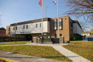
Grant County is a county located in the state of West Virginia. Based on the 2010 census, the population was 11,937. Its county seat is Petersburg. The county was created from Hardy County in 1866 and named for General Ulysses Simpson Grant. After the American Civil War, there was an effort by former Confederates to name it 'Lee County' instead after General Robert E. Lee, but the effort proved fruitless
Etymology - Origin of Grant County Name
For Ulysses S. Grant Army during the Civil War, Secretary of War (1868), and 18th President of the United States (1869-1877).
Demographics:
County QuickFacts: CensusBureau Quick Facts
Early History of Grant County, West Virginia
Grant County was created by an act of the state legislature on February 14, 1866 from parts of Hardy County. It was named in honor of General Ulysses Simpson Grant (1822-1885), graduate of the Military Academy at West Point, General of the Union Army during the Civil War, Secretary of War (1868), and 18th President of the United States (1869-1877). Although his two Presidential Administrations were rocked by scandals, and historians generally consider him one of the nation's least respected Presidents, he remained very popular with the public for his accomplishments during the Civil War.
When the county was originally formed, the county seat was temporarily held at John May's Mill, near the North Fork of Luney's Creek. Soon afterwards, a courthouse was constructed in Maysville, named for John and Henry May, two brothers who settled there in 1831.
Most historians believe that Petersburg, the current site for the county seat, was named for Jacob Peterson in 1745. He operated the first general store in the area. Others suggest that it may have been named for Peter Jefferson, father of Thomas Jefferson, who was part of the John Lewis surveying party that passed through the county in 1746.
When the first post office was opened within the present site of Petersburg in 1833 the town was renamed Lunice Creek because Virginia already had a Petersburg. The town was incorporated in 1845 as Lunice Creek. The original name for the town was restored when West Virginia became a state. The town was incorporated by the West Virginia legislature in 1910.
The Fairfax Stone, marking Maryland's southwestern border, is situated in the extreme western angle of the county. It was placed there on October 17, 1746.
Geography: Land and Water
As reported by the Census Bureau, the county has a total area of 480 square miles (1,200 km2), of which 477 square miles (1,240 km2) is land and 2.9 square miles (7.5 km2) (0.6%) is water
Neighboring Counties
Bordering counties are as follows:
- North: Garrett County, Md.
- Northeast: Mineral County; Hampshire County
- Southeast: Hardy County
- Southwest: Pendleton County; Randolph County
- West: Tucker County
Education


Click Image to Enlarge
