


Click Image to Enlarge
West Virginia Counties
There are fifty-five counties in the state of West Virginia. Fifty of them existed at the time of the Wheeling Convention in 1861, before which West Virginia was part of the state of Virginia. The remaining five (Grant, Mineral, Lincoln, Summers and Mingo) were formed within the state after its admission to the United States on June 20, 1863. At that time, Berkeley County and Jefferson County, the two easternmost counties of West Virginia, refused to recognize their inclusion in the state. In March 1866, the US Congress passed a joint mandate assenting to their inclusion.Greenbrier County, West Virginia
Greenbrier County Education, Geography, and History
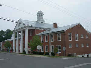
Greenbrier County, is a county located in the state of West Virginia. Based on the 2010 census, the population was 35,480. Its county seat is Lewisburg. The county was formed in 1778 from Botetourt and Montgomery counties in Virginia.
Etymology - Origin of Greenbrier County Name
For the principal river which drains the county.
Demographics:
County QuickFacts: CensusBureau Quick Facts
Early History of Greenbrier County, West Virginia
Greenbrier County was created by an act of the Virginia General Assembly in October 1777 from parts of Montgomery and Botetourt counties (Virginia). It was named in honor of the principal river that drains through the county. It is considered the mother county of southern West Virginia because the following 11 counties were created, either in whole or in part, from its original territory: Boone, Cabell, Jackson, Kanawha, Mason, Monroe, Nicholas, Putnam, Roane, Wayne and Webster.
According to the 1790 census, Greenbrier County had the fourth largest population (6,015) of the nine counties that were then in existence and fell within the current boundaries of West Virginia. Berkeley County had the largest population (19,713) and there were 55,873 people living within the present state's boundaries at that time.
John Peter Salley, Charles St. Clair, John Howard, and his son Josiah Howard were the first Englishmen to set foot in present day Greenbrier County. They traveled through the Greenbrier Valley in 1742. In 1750, Dr. Thomas Walker and five companions passed through the county. Dr. Walker reported in his journal that he had learned from the Indians that there were some settlements in the Greenbrier Valley but he was not able to find them. At about that same time, Jacob Marlin and Stephen Sewell built a cabin along the Greenbrier River at the mouth of Knapp's Creek, at what is now known as Marlinton. Marlin and Sewell quarreled and Marlin returned back east. Sewell stayed and was later killed by Indians. In 1769, Robert McClanachan, Thomas Renick and William Renick built homes near where the town of Frankford now stands. Captain McClanachan was later killed at the Battle of Point Pleasant.
Lewisburg, the county seat, was originally called The Savannah, then Fort Savannah, and, in 1774, Camp Union (named for the rendezvous point for General Andrew Lewis' army prior to the decisive Battle of Point Pleasant in 1774). The town then became known as Lewisburg, in honor of General Andrew Lewis (1720-1781). The town's name was officially recognized as Lewisburg when the town was incorporated by the Virginia Generally Assembly in 1782.
General Andrew Lewis was born in Ulster, Ireland in 1720 and was brought to America by his father, John Lewis. Andrew Lewis entered the colonial service and rose rapidly through the ranks. He was a major in George Washington's regiment that surrendered to the French at Fort Necessity in 1754, and was wounded in the Battle of Monongahela. He later served with distinction during the Revolutionary War, but was most famous for commanding nearly 1,000 militiamen to a hard-fought victory over the confederated Indian tribes in the famous Battle of Point Pleasant on October 10, 1774.
The Battle of Point Pleasant was considered a turning point in the war against the Indians and a precursor of the American Revolutionary War. During the battle, one-half of General Lewis' commissioned officers, including his brother, Colonel Charles Lewis, were killed, as were 75 of his non-commissioned soldiers. Another 140 soldiers were wounded. The actual number of Indians engaged or killed in the battle is not known, but included warriors from the Shawnee, Delaware, Mingo, Wyandotte and Cayuga tribes, lead by their respective chiefs and by Cornstalk, Sachem of the Shawnees and King of the North Confederacy. The remaining Indians fled into Ohio with Lewis' men in pursuit. Now on the defensive, the Indians later agreed to a peace treaty, ending what had become known as Lord Dunmore's War (John Murray, fourth Earl of Dunmore, was Governor of Virginia at the time). General Lewis died in 1781 from a fever.
Two of the boldest massacres committed by Indians in West Virginia's history took place in Greenbrier County. In June 1763, Cornstalk, a young Shawnee Chief, led a band of about 60 of this tribesman into the county. On June 26th, he pretended to be friendly and gained the confidence of the settlers at Muddy Creek. When their defenses were down, his warriors killed them all. Among the dead were the families of Frederick Sea, Joseph Carrol and Salty Yolkum. The next day, Cornstalk repeated his deception at the Clendenin Settlement, near the current site of Lewisburg, killing more than fifty settlers. From: West Virginia Heritage Encyclopedia, compiled by Hardesty.
Geography: Land and Water
As reported by the Census Bureau, the county has a total area of 1,025 square miles (2,650 km2), of which 1,020 square miles
(2,600 km2) is land and 4.9 square miles (13 km2) (0.5%) is water. It is the second-largest county in West Virginia by area.
Much of the area of the northern and western parts of the county is either public (Monongahela National Forest), coal land, or private forest,
owned by companies such as MeadWestvaco and CSX.
Neighboring Counties
Bordering counties are as follows:
- East: Bath County, Va.
- North: Webster County
- Northeast: Pocahontas County
- Northwest: Nicholas County
- South: Monroe County
- Southeast: Alleghany County, Va.
- Southwest: Summers County
- West: Fayette County
Education


Click Image to Enlarge
