


Click Image to Enlarge
West Virginia Counties
There are fifty-five counties in the state of West Virginia. Fifty of them existed at the time of the Wheeling Convention in 1861, before which West Virginia was part of the state of Virginia. The remaining five (Grant, Mineral, Lincoln, Summers and Mingo) were formed within the state after its admission to the United States on June 20, 1863. At that time, Berkeley County and Jefferson County, the two easternmost counties of West Virginia, refused to recognize their inclusion in the state. In March 1866, the US Congress passed a joint mandate assenting to their inclusion.Hampshire County, West Virginia
Hampshire County Education, Geography, and History
Hampshire County is a county located in the state of West Virginia. Based on the 2010 census, the population was 23,964. Its county seat is
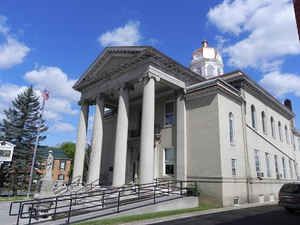
Romney, West Virginia's oldest town (1762). The county was created by the Virginia General Assembly in 1754, from parts of Frederick and
Augusta Counties (Virginia) and is the oldest county in the state of West Virginia. The county lies in both West Virginia's Eastern Panhandle
and Potomac Highlands regions.
Hampshire County is part of the Winchester, VA-WV Metropolitan Statistical Area.
Etymology - Origin of Hampshire County Name
For the English Shire of the same name.
Demographics:
County QuickFacts: CensusBureau Quick Facts
Early History of Hampshire County, West Virginia
Hampshire County was created by the Virginia General Assembly on December 13, 1753 from parts of Frederick and Augusta counties (Virginia) and is the oldest county in the state. Although its creation was authorized in 1753, it was not actually organized until 1757 because the area was not considered safe due to the outbreak of the French and Indian War (1754-1763). According to Samuel Kercheval's A History of the Valley of Virginia (Strasburg, VA: Shenandoah Publishing House, 1925), the county was named in honor of several prize hogs. The story goes that Lord Fairfax, who owned the Royal Grant to the area, came upon some very large hogs in Winchester and asked where they had been raised. He was told that they were from the South Branch of the Potomac Valley (now Hampshire County). He remarked that when a county was formed west of Frederick that he would name it in honor of Hampshire County, England, famous for its very fat hogs.
The first meeting of the county court was held in 1757 and was presided by the Right Honorable Thomas Bryan Martin, Lord Fairfax's nephew. By that time, Hampshire County's population had fallen dramatically as most of the settlers had fled the county in fear of the Indians. The only families remaining lived near Fort Pearsall, near the present day Romney, and Fort Edward, at Capon Bridge.
Once the Indians were defeated at the Battle of Point Pleasant in 1774 (see Greenbrier County history) settlers, once again, returned to the county. By 1790, when the first national census was taken, Hampshire County had 7,346 residents, making it the second most populous county in the present state at that time. Berkeley County was the present state's most populous county, with 19,713 people. At that time, there were nine counties in the present state with a total population of 55,873 people.
Romney, the county seat, claims to be the oldest town in the state. Both Shepherdstown (in Jefferson County, and then known as Mecklenburg) and Romney were chartered by the Virginia General Assembly on December 23, 1762. However, Romney claims that it is the oldest town in the state because its incorporation was listed before Shepherstown's in the Virginia Statutes at Large and its earliest settlers arrived in 1725 while Shepherdstown's earliest settlers did not arrive until 1727. However, given the paucity of written records in the era, it is difficult to substantiate the claim that Romney's earliest settlers arrived before Shepherdstown's earliest settlers, and both towns continue to claim the title of oldest town in the state.
Romney was first settled by hunters and traders around 1725. In 1738, John Pearsall (or Pearsoll) and his brother Job built homes in the town. Their settlement was then known as Pearsall's Flats. In 1748, Lord Fairfax sent a surveying party, including 16 year-old George Washington, to survey his lands along the Potomac and South Branch Rivers. Washington spent three summers and falls surveying Lord Fairfax's estate, which included present-day Hampshire County. In April 1748, he laid off several lots in an area known as the Trough, about 10 miles south of Romney, and he is known to have been in present-day Romney on October 19, 1749. Oral traditions claimed that Washington laid present-day Romney out into lots at that time, but written records from that era indicate that Romney was surveyed and laid out into lots prior to Washington's arrival by James Genn, another surveyor employed by Lord Fairfax.
In 1756, Fort Pearsall was constructed on Job Pearsall's plantation for protection against Indian raids and George Washington provisioned and garrisoned the Fort at various times until 1758. At that time, there were at least 100 people living in the general area. Following the end of hostilities in the area, Lord Fairfax recognized that more settlers would be interested in moving into the area and that he could earn some extra revenue by selling plots in the town. He sent a survey party to Romney in 1762 to formally lay out the town into 100 lots. Lord Fairfax then renamed the town Romney, in honor of a port city on the English Channel. Some confusion ensued for several decades concerning the ownership of land within the town as counterclaims were made by the original settlers and those who purchased lots laid out by Lord Fairfax's surveyors.
Hampshire County was the site of numerous battles during the 18th and 19th centuries. During the early 1700s, a fierce battle between the Catawba Indians, who lived in the county, and an invading party of Delaware Indians left hundreds dead at what is called the Hanging Rocks on the Wappatomaka River. It is believed that very few of the Delawares escaped. In 1753, Chief Killbuck led a group of Shawnee and other Indian warriors in a "death claim" for the lands near the Blue Ridge Mountains and the Ohio River. The residents in the Romney area built Fort Pearsall and formed themselves into a "regiment" under the command of George Washington to protect themselves. During the Civil War, the Hampshire Guards and Frontier Riflemen joined the Confederate Army. Romney changed hands at least 56 times during the war. On June 11, 1861 it changed hands twice in the same day.
Geography: Land and Water
As reported by the Census Bureau, the county has a total area of 645 square miles (1,670 km2), of which 640 square miles (1,700 km2) is land and 4.4 square miles (11 km2) (0.7%) is water
Neighboring Counties
Bordering counties are as follows:
- North: Allegany County, Md.
- Northeast: Morgan County
- Northwest: Mineral County
- Southwest: Hardy County; Grant County
- Southeast: Frederick County, Va.
Education


Click Image to Enlarge
