


Click Image to Enlarge
West Virginia Counties
There are fifty-five counties in the state of West Virginia. Fifty of them existed at the time of the Wheeling Convention in 1861, before which West Virginia was part of the state of Virginia. The remaining five (Grant, Mineral, Lincoln, Summers and Mingo) were formed within the state after its admission to the United States on June 20, 1863. At that time, Berkeley County and Jefferson County, the two easternmost counties of West Virginia, refused to recognize their inclusion in the state. In March 1866, the US Congress passed a joint mandate assenting to their inclusion.Mineral County, West Virginia
Mineral County Education, Geography, and History
Mineral County is a county located in the state of West Virginia. It is part of the Cumberland, MD-WV Metropolitan Statistical Area. Based on the 2010 census, the population was 28,212. Its county seat is Keyser. The county was founded in 1866.
Mineral County is included in the Cumberland, MD-WV Metropolitan Statistical Area.
Etymology - Origin of Mineral County Name
For the mineral resources found there
Demographics:
County QuickFacts: CensusBureau Quick Facts
Early History of Mineral County, West Virginia
Mineral County was created by an act of the General Assembly on February 1,
1866, from parts of Hampshire County. The county was named in honor of the
abundant minerals located in the county.
John Lederer, a German physician and explorer employed by Sir William Berkeley,
colonial governor of Virginia, was the first Englishman to set foot in present
day Mineral County. He explored the area in 1669. One of the earliest settlers
in the county was a farmer named Brown. He entertained George Washington in his
cabin when Washington passed through the county in 1748 on behalf of the Ohio
Company, a land investment company. In 1755, Colonel George Washington gave the
order to build a stockade and fort on the east side of Patterson's Creek, at the
present site of Frankfort. The Fort (later called Ashby's Fort, in honor of
Colonel John Ashby who commanded the militia there for many years) served as
part of the colonists' line of defense during the French and Indian Wars
(1754-1763).
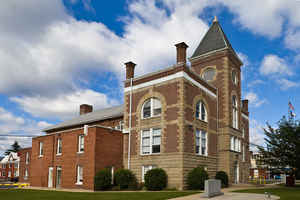
Part of the land where the county seat, Keyser, is located was originally purchased from Lord Fairfax by Christopher Beelor in 1752. He became the town's first, permanent English settler, but a band of Indians forced him to abandon the area in 1773. He died in 1774 and his widow, Mary, inherited the land and soon afterward returned with her new husband, George Kyger. When her second husband died in 1807, she fold the farm to James Mosley of Baltimore for 2,000 pounds. The other part of the land on which Keyser is currently located was originally owned by Abram Inskeep. He granted it Patrick McCarthy in 1802. McCarthy was one of the earliest settlers in the area, arriving in 1780. After he bought the land, the area became known as Paddy's Town. The McCarthy family soon became the most prominent in the region, owning and operating the general store, several mills and an iron foundry. In 1852, the Baltimore and Ohio Railroad extended into the region and the town's name was changed to New Creek. During the Civil War, Keyser served as a key supply point and reportedly changed hands 14 times between 1861 and 1864. The town's name was changed to Keyser to honor William Keyser, vice-president of the railroad, when it was incorporated in 1874.
Nancy Hanks, Abraham Lincoln's mother, was born on the Doll farm on Mike's Run, near Keyser.
Geography: Land and Water
As reported by the Census Bureau, the county has a total area of 329 square miles (850 km2), of which 328 square miles (850
km2) is land and 1.4 square miles (3.6 km2) (0.4%) is water.
The northern terminus of the Allegheny Front in West Virginia lies in Mineral County, and contains the highest point in the county. Known as the
Pinnacle it is 3,104 feet (946 m) above sea level. From the abandoned fire tower you can see four states on a clear day, Pennsylvania, Maryland,
West Virginia, and Virginia. The Allegheny Front is the largest mountain in the county; on the north end it is also known as Green Mountain. On top
of the Allegheny Plateau is located the town of Elk Garden, West Virginia in the southwestern portion of the county. The Potomac River Valley lies
to west and north of the mountain, and the New Creek Valley lies to the east.
Knobly Mountain lies between the New Creek and Patterson Creek valleys. It is the longest mountain in Mineral County stretching from the Grant
County line in the south to the Potomac River in the north at Ridgeley, West Virginia.
To the east of the Patterson Creek Valley lie a series of low hills which form the eastern border of the county with Hampshire County.
North Branch Potomac River is the largest river, though not actually in the county. It forms the northern border of the county and the state border
with actual border being the low water mark on the south side. Jennings Randolph Lake is located on this stream.
New Creek enters the North Branch Potomac River at Keyser with the headwaters starting at Dam Site 14 in Grant County, West Virginia. It is the
water supply for the city of Keyser.
Patterson Creek enters the Potomac River east of Cumberland, Maryland with headwaters being in Grant County, West Virginia. The Patterson Creek
watershed contains two-thirds of Mineral County.
Neighboring Counties
Bordering counties are as follows:
- Northeast: Allegany County, Md.
- Northwest: Garrett County, Md.
- Southeast: Hampshire County
- South: Hardy County
- Southwest: Grant County
Education
High schools
Mineral County Schools includes two high schools: Frankfort High School located near Short Gap and Keyser High School located south of Keyser.
Colleges
Potomac State College, a two-year school, is located in the county seat of Keyser, West Virginia on the site of Civil War Fort Fuller.
Eastern West Virginia Community & Technical College holds classes at Mineral Counties Vocational and Technical School.


Click Image to Enlarge
