


Click Image to Enlarge
West Virginia Counties
There are fifty-five counties in the state of West Virginia. Fifty of them existed at the time of the Wheeling Convention in 1861, before which West Virginia was part of the state of Virginia. The remaining five (Grant, Mineral, Lincoln, Summers and Mingo) were formed within the state after its admission to the United States on June 20, 1863. At that time, Berkeley County and Jefferson County, the two easternmost counties of West Virginia, refused to recognize their inclusion in the state. In March 1866, the US Congress passed a joint mandate assenting to their inclusion.Monongalia County, West Virginia
Monongalia County Education, Geography, and History
Monongalia County, known locally as Mon County, is a county located in the state of West Virginia. Based on the 2010 census, the population
was 96,189, making it the fourth-most populous county in West Virginia. Its county seat is at Morgantown. The county was founded in 1776.
Monongalia County is included in the Morgantown, WV Metropolitan Statistical Area
Etymology - Origin of Monongalia County Name
For the Monongahela River
Demographics:
County QuickFacts: CensusBureau Quick Facts
Early History of Monongalia County, West Virginia
Monongalia County was one of the first three counties, along with Ohio and Youghiogheny counties, formed within the state. It was created by an act of the Virginia General Assembly in October 1776 from parts of the District of West Augusta (Virginia). It was named in honor of the Monongahela River, named by the Algonquain (Deleware) Indians. The river's name means river of crumbling banks or high banks fall down. When the bill creating the county was being prepared the spelling was changed to Monongalia. It is not known if the spelling was changed on purpose or was an error.
Monongalia County is known as the mother county for northern West Virginia. Eighteen of West Virginia's 55 counties and parts of three Pennsylvania Counties (Greene, Fayette and Washington counties) were created in whole or in part from Monongalia County. This latter territory was lost to Pennsylvania following the extension of the Mason-Dixon line in 1781.
The first organizational meeting in the county took place at the home of Jonathan Coburn on December 8, 1776. The first county seat was located at the home of Theophilus Phillips, two miles from the present site of Geneva, Pennsylvania. After the Mason-Dixon line made his home a part of Pennsylvania, the county seat was moved to the home of Zackquill Morgan in 1782, in present day Morgantown.
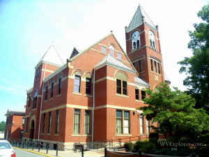
Morgantown, the county seat, was originally settled by Thomas Decker, who led a group of settlers to Decker's Creek, in the present site of Morgantown, during the fall of 1758. The settlement was destroyed the following spring by a party of Delaware and Mingo Indians. All but one of the original settlers, including Thomas Decker, were killed or captured in the attack.
There is conflicting accounts concerning who arrived in the county next. Some accounts suggest that David Morgan arrived at the current site of Morgantown in 1768 and gave his settlement right to Zackquill (or Zackwell) Morgan. Other accounts suggest that Bruce Worley and his brother, Nathan, arrived before them, in 1766. Most historians cite the sworn deposition of Colonel William Crawford and credit Zackquill Morgan as the next settler in the county. Colonel Crawford indicated that Zackquill Morgan, James Chew, and Jacob Prickett moved into the area in 1766, and that he had visited the Morgan farm, near Decker's Creek.
Colonel Zackquill Morgan, son of Morgan Morgan, received a legal certificate for 400 acres of land in the Morgantown area in 1781. In October 1785, at Colonel Morgan's request, the Virginia General Assembly specified that 50 acres of his land was to be laid out in lots, and a town, named Morgantown, established on the site. Purchasers of the lots were to build upon them within four years, but because of Indian hostilities the four year time limit was later extended an additional five years. In 1793, the Pittsburgh Gazette began delivering its paper to Morgantown and opened a road to it. The opening of the road helped the town began to grow , especially during the early 1800s as many pioneers heading west stopped in Morgantown for supplies. The city was incorporated on February 3, 1858.
In 1790, when the first national census was taken, Monongalia County had the sixth largest population (4,768) of the nine counties that were then in existence and fell within the current boundaries of West Virginia. Berkeley County had the largest population (19,713), Randolph County had the smallest population (951), and there were a total of 55,873 people living within the present state's boundaries at that time.
West Virginia University, the state's land grant university, was established in Morgantown in 1867.
Geography: Land and Water
As reported by the Census Bureau, the county has a total area of 366 square miles (950 km2), of which 360 sq mi (930 km2) is land and 5.8 sq mi (15 km2) (1.6%) is water.
Neighboring Counties
Bordering counties are as follows:
- Northeast: Fayette County, Pa.
- Northwest: Greene County, Pa.
- South: Taylor County
- Southeast: Preston County
- Southwest: Marion County
- West: Wetzel County
Education
The county's public schools are operated by Monongalia County Schools. The county is also home to West Virginia's largest university, West Virginia University, located in Morgantown.


Click Image to Enlarge
