


Click Image to Enlarge
West Virginia Counties
There are fifty-five counties in the state of West Virginia. Fifty of them existed at the time of the Wheeling Convention in 1861, before which West Virginia was part of the state of Virginia. The remaining five (Grant, Mineral, Lincoln, Summers and Mingo) were formed within the state after its admission to the United States on June 20, 1863. At that time, Berkeley County and Jefferson County, the two easternmost counties of West Virginia, refused to recognize their inclusion in the state. In March 1866, the US Congress passed a joint mandate assenting to their inclusion.Ohio County, West Virginia
Ohio County Education, Geography, and History
Ohio County is a county located in the Northern Panhandle of the state of West Virginia. Based on the 2010 census, the population was
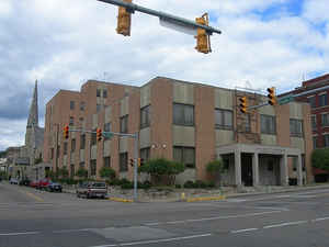
44,443. Its county seat is Wheeling. The county was formed from the District of West Augusta, Virginia in 1776. It was named for the Ohio
River, which forms its western boundary. West Liberty (formerly Black's Cabin) was the county seat from 1777 to 1797.
Ohio County is part of the Wheeling, WV-OH Metropolitan Statistical Area.
Etymology - Origin of Ohio County Name
For the Ohio River, Indian name meaning "great river"
Demographics:
County QuickFacts: CensusBureau Quick Facts
Early History of Ohio County, West Virginia
Ohio County was created by an act of the Virginia General Assembly in October 1776 from parts of the District of West Augusta (Virginia). It was named in honor of the Ohio River that forms the county's western boundary. The river's name was derived from the Indian word Ohionhiio, meaning great or beautiful river.
Robert Cavelier de La Salle was probably the first European to set foot in present Ohio County. He sailed down the Ohio River in 1669. In 1749, Louis Bienville de Celeron sailed down the Ohio River and buried a lead plate in present day Ohio County claiming all of the lands drained by the Ohio River for King Louis XV of France. He met several English fur traders on his journey and ordered them off of French soil and wrote strong letters of reprimand to the colonial governors protesting the English's presence on French soil.
The first county court meeting was held on January 16, 1777 at Black's cabin near where West Liberty currently stands. West Liberty served as the county seat from 1776 to 1797, and was legally established on the lands of Reuben Foreman and Providence Mounce on November 29, 1787.
In 1790, Ohio County had the fifth largest population (5,212) of the nine counties that were then in existence and fell within the current boundaries of West Virginia. Berkeley County had the largest population (19,713), Randolph County had the smallest population (951), and there were a total of 55,873 people living within the present state's boundaries at that time.
Wheeling, the county seat since 1797, was originally settled by Colonel Ebenezer Zane and his brothers, Jonathan and Silas, in 1769. Fort Fincastle was built in 1774 to protect the settlers from Indians. The fort was later renamed Fort Henry, in honor of Patrick Henry, and was the site of a famous battle in September 27, 1777 between approximately 400 to 500 Indians, armed and supplied by the British, and the Fort's 42 men under the command of a Colonel Shepherd.
Early in the morning of the 27th, 23 men were killed in a series of ambushes in a corn field. The remainder of Shepherd's command remained in the Fort, where the women and children living in the town had taken refuge. The Indians then attacked the Fort, firing on it throughout the day. During a lull in the battle, and with their ammunition nearly gone, Elizabeth Zane made a successful mad, heroic dash to her brother Ebenezer's house to retrieve a load of gunpowder. She returned to the Fort with her prize in her hands and bullets flying over her head. The gunpowder came in handy as the Indians soon renewed their attack. Later that evening, a group of 14 men from Cross Creek fought their way through the Indian's lines of attack and entered the Fort. At daybreak, another force of 40 men from Short Creek arrived and fought their way through the Indian lines to the Fort. Their commander, Major Samuel McColloch, became separated from his men and was pursued by the Indians. Surrounded on
three sides by Indians and facing a 150 foot precipice, he urged his horse over the side. Miraculously, both he and his horse survived the leap and made their escape. Frustrated at losing McColloch and recognizing that the Fort was now reinforced, the Indians set fire to the town, killed about 300 cattle belonging to the settlers, and then left the area.
Colonel Ebenezer Zane platted the town in 1793, and a year later it received its first post office which named the community in honor of the Zane family, calling it Zanesburg. The town was officially established on December 25, 1795 by an act of the Virginia General Assembly. The town was later incorporated, on January 16, 1806, and called Wheeling. According to John Brittle, who was held captive by Delaware Indians from 1791 to 1796, the town's name originated from the Indian word "Weeling" which means "place of the skull." It was said that when the first white settlers came down the Ohio River and entered Wheeling Creek, they were attacked and killed by Delaware Indians. The Indians beheaded one of the men, placed his head on the end of a pole, and pointed the face pointed toward the river to scare off any other whites that might make their way into the Delaware's territory.
Wheeling was transformed into one the nation's most important trading centers and rest stops for the pioneers heading west following the extension of the National Road to its borders in 1818.
Wheeling was the site of several firsts, both for the state and for the nation. The first bank in present day West Virginia, The Northwestern Bank of Virginia, opened in Wheeling in 1817. The first telegraph line to West Virginia reached Wheeling in 1847. The first suspension bridge in the world was completed in Wheeling in 1849. Wheeling was West Virginia's first state capitol until 1870 and again in 1875 and 1880. The first telephone in West Virginia was installed in Wheeling in 1880. The Bloch Brothers Tobacco Company in Wheeling originated outdoor advertising in 1890 when they began painting Mail Pouch Tobacco signs on bridges and barns across the nation.
Geography: Land and Water
As reported by the Census Bureau, the county has a total area of 109 square miles (280 km2), of which 106 square miles (270
km2) is land and 3.2 square miles (8.3 km2) (2.9%) is water.
It is the third-smallest county in West Virginia by area. The highest point of elevation in Ohio County is approximately 1,420 feet (430 m) and
located about 1-mile (1.6 km) southwest of West Alexander, PA. The county is drained by Wheeling and other small creeks.
Neighboring Counties
Bordering counties are as follows:
- North: Brooke County
- Northeast: Washington County, Pa.
- Northwest: Jefferson County, Ohio
- South: Marshall County
- Southwest: Belmont County, Ohio
Education
Colleges and universities
West Liberty University
Wheeling Jesuit University
West Virginia Northern Community College
West Virginia Business College
Public schools
All public schools within Ohio County operate under the jurisdiction of Ohio County Schools with the consolidated high school housing grades 9-12, middle schools housing grades 6-8, and elementary schools housing grades K-5.


Click Image to Enlarge
