


Click Image to Enlarge
West Virginia Counties
There are fifty-five counties in the state of West Virginia. Fifty of them existed at the time of the Wheeling Convention in 1861, before which West Virginia was part of the state of Virginia. The remaining five (Grant, Mineral, Lincoln, Summers and Mingo) were formed within the state after its admission to the United States on June 20, 1863. At that time, Berkeley County and Jefferson County, the two easternmost counties of West Virginia, refused to recognize their inclusion in the state. In March 1866, the US Congress passed a joint mandate assenting to their inclusion.Pendleton County, West Virginia
Pendleton County Education, Geography, and History
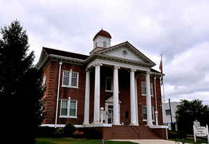
Pendleton County is a county located in the state of West Virginia. Based on the 2010 census, the population was 7,695, making it the fifth-least populous county in West Virginia. Its county seat is Franklin. The county was created by the Virginia General Assembly in 1788 from parts of Augusta, Hardy, and Rockingham Counties and was named for Edmund Pendleton (1721-1803), a distinguished Virginia statesman and jurist. Pendleton County was strongly pro-Confederate during the American Civil War, however there were pockets of Union support.
Etymology - Origin of Pendleton County Name
For Edmund Pendleton, distinguished statesman and jurist of Virginia
Demographics:
County QuickFacts: CensusBureau Quick Facts
Early History of Pendleton County, West Virginia
Pendleton County was created by an act of the Virginia General Assembly on December 4, 1787 from parts of Augusta, Harding and Rockingham counties (Virginia). It was named in honor of Edmund Pendleton (1721-1803).
Edmund Pendleton was born in Caroline County, Virginia on September 9, 1721. He studied law and was admitted to the bar in 1744. In 1751, he served as a justice of the peace and was a member of the Virginia General Assembly from 1752 to 1774. He was President of the Virginia Convention of 1775 and 1778 (that ratified the US Constitution), represented Virginia in the Continental Congress (1774-1775), and served as the Governor of Virginia (1774-1776). He later served as the President of the Virginia Court of Appeals. Judge Pendleton died on October 23, 1803.
In 1790, when the first national census was taken, Pendleton County had the seventh largest population (2,452) of the nine counties that were then in existence and fell within the current boundaries of West Virginia. Berkeley County had the largest population (19,713), Randolph County had the smallest population (951), and there were a total of 55,873 people living within the present state's boundaries at that time.
John Van Meter, a Dutch trader from New Jersey was probably the first European to set foot in the county. He accompanied a band of Delaware Indians on a raid against the Catawba Indians in 1732. The Delaware Indians lost the battle, but Van Meter later told his sons, John and Isaac, about the fine lands along the South Branch River and his sons later purchased a warrant for 40,000 acres in the area.
In 1735, four squatters named Coburn, Howard, Walker and Rutledge, moved into the South Branch River area, near the current county's boundary. John and Isaac Van Meter (killed by Indians in 1757) and Peter Casey arrived in the early 1740s, as did two other men named Pancake and Foreman. When George Washington passed through the area in 1748, he noted that there were about 200 people living in the area. Most of these settlers were squatters living just outside of or on the present county's boundaries. At that time, Robert Green, of Culpeper, along with James Wood and William Russell, had purchased rights to almost all of the present county. It is believed that in 1745 a man named Burner was the first European to build a cabin within the future site of Pendleton County.
The first legitimate, title-bearing settlers in the county were six families who bought title to 1,860 acres for 61 pounds and 6 shillings ($230.33) from Robert Green in 1747. They were the families of Roger Dryer; his son William and his son-in-law, Matthew Patton; John Patton, Jr.; John Smith; and William Stephenson. There are no records to indicate if they relocated that year of the next, but it is assumed that they moved to the county in 1747.
Seybert's Fort, named for Captain Jacob Seybert of Pendleton County, was one of the earliest structures in the county. It was built by settlers about 12 miles west of Franklin in 1756 as a place of refuge during Indian uprisings. On April 28, 1758, with about 30 settlers, mostly women and children, gathered inside, the Fort was attacked by a band of about 40 Shawnee Indians led by Chief Killbuck. The Fort was surrounded by the Indians and after two days siege, Captain Seybert agreed to surrender the Fort to the Indians in exchange for their safe passage out of the area. Unfortunately, when the Fort's gates were opened, the settlers were attacked and all of them were taken captive except for a man named Robinson who escaped. After setting the Fort on fire, the Indians took their captives about a quarter of a mile to the east and on a hillside separated them into two rows and seated them on logs. The captives in one row were spared and the captives in the other, including Captain Seybert, were tomahawked to death. The 11 remaining captives were taken to the Shawnee Indian village at Chillecothe, Ohio. Five of the captives, including Captain Seybert's son, Nicholas, later escaped to tell the tale of their misadventures.
The county seat, Franklin, was settled by Francis (Frank) Evick and was originally named Frankford in his honor. The town was chartered by the Virginia General Assembly on December 19, 1794. The town's name was later changed to Franklin because there was another Frankford in the state.
Geography: Land and Water
As reported by the Census Bureau, the county has a total area of 698 square miles (1,810 km2), of which 696
square miles (1,800 km2) is land and 2.1 square miles (5.4 km2) (0.3%) is water.
It is the fifth-largest county in West Virginia by area.
Spruce Knob, located in Pendleton County, is the highest point in the state and in the Alleghenies, its elevation being 4,863 feet. Parts of the Monongahela and George Washington National Forests are also located in Pendleton.
Neighboring Counties
Bordering counties are as follows:
- Northeast: Grant County; Hardy County
- Southeast: Rockingham County, Va.; Augusta County, Va.
- Southwest: Highland County, Va.; Pocahontas County
- West: Randolph County
Education


Click Image to Enlarge
