


Click Image to Enlarge
West Virginia Counties
There are fifty-five counties in the state of West Virginia. Fifty of them existed at the time of the Wheeling Convention in 1861, before which West Virginia was part of the state of Virginia. The remaining five (Grant, Mineral, Lincoln, Summers and Mingo) were formed within the state after its admission to the United States on June 20, 1863. At that time, Berkeley County and Jefferson County, the two easternmost counties of West Virginia, refused to recognize their inclusion in the state. In March 1866, the US Congress passed a joint mandate assenting to their inclusion.Pocahontas County, West Virginia
Pocahontas County Education, Geography, and History
Pocahontas County is a county located in the state of West Virginia. Based on the 2010 census, the population was 8,719. Its county seat is Marlinton. The county was established in 1821 and is named after the Native American chief's daughter from Jamestown, Virginia.
Etymology - Origin of Pocahontas County Name
For Pocahontas, the Indian princess
Demographics:
County QuickFacts: CensusBureau Quick Facts
Early History of Pocahontas County, West Virginia
Pocahontas County was created by an act of the Virginia General Assembly on December 21, 1821 from parts of Bath, Pendleton and Randolph counties. It was named in honor of Pocahontas (1595-1617), the Indian princess who was the daughter of Chief Powhatan, the King of the Confederated tribes of Atlantic Virginia.
Pocahontas is famous for having saved the life of Captain John Smith, founder and Governor of Jamestown, the first, permanent English settlement in America. According to the story, the English settlers had run out of food and went to the Indians seeking corn, but were refused any help. Recognizing that the colony would stare without more food, Captain John Smith attacked the local Indians settlement and secured the provisions necessary to keep the colony going. He was later captured by the Indians and condemned to death. He was dragged to a large stone where his head was to be crushed. Pocahontas, then about 12 years old, begged her father to spare Smith's life. When it appeared that the sentence was about to be carried out anyway, she covered Smith's head with her own body to shield him. Smith was then released and a few days later reached an agreement with Powhatan to allow the settlers to hunt in the area in exchange for two cannon and a grindstone. Pocahontas then spent much of her time with the settlers, learned their language and, when she was 17, married John Rolfe (or Rolph), one of the settlers. In 1616, she accompanied her husband to London where she was received with royal honors for her role in saving Smith and the colony. The following year, she was preparing to return to the colony with her husband but became ill and died, at the age of 22, from smallpox. She left behind her husband and their infant son, Thomas Rolfe. Pocahontas' real (Indian) name was Matoaka.
Jacob Marlin and Stephen Sewell were the first English settlers to reach the county. They built and shared a cabin on the banks of the Greenbrier River in 1749. The current county seat, Marlinton, was named in Jacob Marlin's honor. It is said that they lived together for awhile, but had a religious disagreement over an infant baptism. Sewell stormed out of the cabin and lived temporarily in a large, hollow tree. The tree stood as a tourist attraction until 1930. Their settlement as originally known as Marlin's Bottom but was changed Marlinton shortly after Colonel John T. McGraw bought the land in 1890. Marlin was later killed by Indians and after a few years Sewell returned back east.
The first permanent English settler in the county was Colonel John McNell, who built a cabin in a valley in the county called Little Levels in 1765. He was soon joined by Charles and James Kennison. They subsequently enlisted and accompanied General Andrew Lewis at the Battle of Point Pleasant.
The Battle of Point Pleasant in Mason County was considered a turning point in the war against the Indians and a precursor of the American Revolutionary War. During the battle on October 10, 1774, General Andrew Lewis' army of 1,100 waged what was probably the most fiercely contested battle ever fought with the Indians within the state of Virginia. One-half of General Lewis' commissioned officers, including his brother Charles were killed, as were 75 of his non-commissioned soldiers. Another 140 soldiers were wounded. The actual number of Indians engaged or killed in the battle is not known, but included warriors from the Shawnee, Delaware, Mingo, Wyandotte and Cayuga tribes, lead by their respective chiefs and by Cornstalk, Sachem of the Shawnees and King of the North Confederacy. The remaining Indians fled into Ohio with Lewis' men in pursuit. Now on the defensive, the Indians later agreed to a peace treaty, ending what had become known as Lord Dunmore's War (John Murray, fourth Earl of Dunmore, was Governor of Virginia at the time).
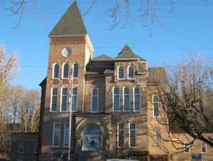
The first meeting of the Pocahontas County court was held in the home of John Bradshaw near Huntersville, on March 5, 1822. Mr. Bradshaw named the town in honor of the large number of hunters who came there during the trading season. It served as the county seat until 1891 when the county's residents voted to move the county seat to Marlinton. At that time, Marlinton had only about 100 residents, but Colonel John McGraw, of Grafton, through the Pocahontas Development Company, had offered $5,000 for the construction of a new courthouse if the county seat was moved to Marlinton. He owned much of the land in the area and was able to convince the railroad to extend a line to the town. Once the railroad line was completed in 1901, the town began to grow.
The Battle of Droop Mountain, the most extensive battle of the Civil War in West Virginia, was fought within the county in 1863.
Geography: Land and Water
As reported by the Census Bureau, the county has a total area of 942 square miles (2,440 km2), of which 940
square miles (2,400 km2) is land and 1.5 square miles (3.9 km2) (0.2%) is water.
It is the third-largest county in West Virginia by area.
The highest point is Thorny Flat on Cheat Mountain in the northwestern part of the county, elevation 4848 feet (1478 m).
The county is the site of the headwaters for eight rivers: Cherry River, Cranberry River, Elk River, Gauley River, Greenbrier River, Tygart
Valley River, Williams River, and Shavers Fork of the Cheat River. The Monongahela National Forest protects much of the river headwaters,
thereby helping to ensure improved downstream water quality.
Neighboring Counties
Bordering counties are as follows:
- East: Highland County, Va.
- North: Randolph County
- Northeast: Pendleton County
- Northwest: Webster County
- Southeast: Bath County, Va.
- Southwest: Greenbrier County
Education


Click Image to Enlarge
