


Click Image to Enlarge
West Virginia Counties
There are fifty-five counties in the state of West Virginia. Fifty of them existed at the time of the Wheeling Convention in 1861, before which West Virginia was part of the state of Virginia. The remaining five (Grant, Mineral, Lincoln, Summers and Mingo) were formed within the state after its admission to the United States on June 20, 1863. At that time, Berkeley County and Jefferson County, the two easternmost counties of West Virginia, refused to recognize their inclusion in the state. In March 1866, the US Congress passed a joint mandate assenting to their inclusion.Webster County, West Virginia
Webster County Education, Geography, and History
Webster County is a county located in the state of West Virginia. Based on the 2010 census, the population was 9,154. Its county seat is Webster Springs. The county was founded in 1860 and named for Daniel Webster
Etymology - Origin of Webster County Name
In honor of Daniel Webster, New England orator and statesman
Demographics:
County QuickFacts: CensusBureau Quick Facts
Early History of Webster County, West Virginia
Webster County was created by an act of the Virginia General Assembly on January 10, 1860 from parts of Braxton, Nicholas and Randolph counties. Because of its isolation and the lack of main roads connecting it to other settlements, Webster County was one of the last counties in the state to be settled. At the time of its formation in 1860, the county's population was just 1,730.
The county was named in honor of Daniel Webster (1782-1852), famous orator and long-time member of Congress from New England. He was born on January 18, 1782 in Salisbury, New Hampshire. He was educated at Exeter and Phillips Andover Academies and graduated from Dartmouth College in 1801. He studied the law and was admitted to the bar in 1805. He represented New Hampshire in the US House of Representatives (1813-1817) and moved to Boston in 1816. He then represented Massachusetts in the US House of Representatives (1823-1827), and in the US Senate (1827-1841). He served as President John Tyler's Secretary of State (1841-1843), returned to the US Senate (1845-1850), and then served, once again, as US Secretary of State from 1850 until his death on October 24, 1852. He was also a noted jurist who, early in his career, made the winning arguments in the landmark case McCulloch vs. Maryland (1819) that provided the federal government all implied powers deemed "necessary and proper" to carry out its duties.
Peter and Adam Stroud, German immigrants, were the first European settlers in present day Webster County. They settled near present day Camden-on-Gauley in 1769. Peter unintentionally built his cabin near a branch of the Shawnee Indians' hunting trail. Early in the spring of 1772 or 1773 a band of Shawnee Indians discovered his cabin and viewing it as an invasion of their hunting grounds, attacked the cabin, killing Peter, his wife, and his seven children. Adam Stroud saw the smoke from his brother's burning cabin rising across the Gauley River and, with his eldest son, investigated. The trail left by the murderers led in the general direction of Bulltown, home of Captain Bull, a Delaware Indian Chief and five other Indian families, located in present day Braxton County. Captain Bull was regarded by most of the settlers in the region as friendly. But there were some white families who suspected Captain Bull of providing information to and harboring unfriendly Indians. After burying his brother and his family, Adam Stroud traveled over the mountains to Hacker's Creek. After listening to Adam Stroud's tale, four men from Hacker's Creek joined with Adam Stroud and attacked Bulltown. They killed all of the Indians living there, and threw their bodies into the nearby river. News of Captain Bull's death spread across the western frontier and set off a series of serious incidents between the Indians and the English settlers, ending the eight years of relative peace on the western frontier. Adam Stroud left the county after the attack on Bulltown (he moved to Hampshire County). It was another 20 years before anyone else tried to settle in the county.
In 1797, Arthur McClure moved to Upper Glade. He was followed by William E. Dodrill, known as "English Bill". He settled along the Birch River in 1799. Colonel Isaac Gregory was one of the earliest and most prominent settlers in the county. He built a two-story log cabin just above Beaver Run on a hill overlooking the Gauley River in 1800. He later served two terms as the Nicholas County Sheriff and served in the American Army during the War of 1812. Isaac Duifield arrived in the county around 1803 and was followed by several families who arrived around 1810, including the families of Tunice Muckelwain (or McElwain), James Dyer, William, Benjamin, and David Hamrick, and John Miler.
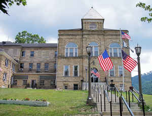
Webster Springs, the county seat, was incorporated in 1892. The act creating the county in 1869 specified that the county seat was to be called Addison, in honor of Addison McLaughlin who had donated the land where the county courthouse was to be built. The town, however, was actually called "Fort Lick" by the inhabitants, in reference to the salt springs located at the fork of the Back Fork River and the Elk River. Early settlers made salt from the "lick" and many others claimed that the salt had medicinal qualities. The Virginia General Assembly attempted to enforce its earlier action on March 21, 1873 by declaring that the town's legal name was Addison. When the town was incorporated in 1892, the Virginia General Assembly once again gave the town the legal name of Addison. Addison is still the town's legal name, but has long been known by its post office name, Webster Springs. The town's first, permanent settler was Polly Arthur who arrived in 1860.
In 1868, Webster Springs had only five residences, a post office, a school and a tavern (owned by Peter Cogar). The other residents of the town were the families of James Woodzell, Ike Cool, Pat Duffy, George Wolverton and Martin Lowe. The town's population grew very slowly, primarily because of the lack of good roads to other settlements.
Geography: Land and Water
As reported by the Census Bureau, the county has a total area of 556 square miles (1,440 km2), of which 553 square miles (1,430 km2) is land and 2.8 square miles (7.3 km2) (0.5%) is water
Neighboring Counties
Bordering counties are as follows:
- North: Lewis County
- Northeast: Upshur County; Randolph County
- Northwest: Braxton County
- South: Greenbrier County
- Southeast: Pocahontas County
- Southwest: Nicholas County
Education


Click Image to Enlarge
