


Click Image to Enlarge
West Virginia Counties
There are fifty-five counties in the state of West Virginia. Fifty of them existed at the time of the Wheeling Convention in 1861, before which West Virginia was part of the state of Virginia. The remaining five (Grant, Mineral, Lincoln, Summers and Mingo) were formed within the state after its admission to the United States on June 20, 1863. At that time, Berkeley County and Jefferson County, the two easternmost counties of West Virginia, refused to recognize their inclusion in the state. In March 1866, the US Congress passed a joint mandate assenting to their inclusion.Wood County, West Virginia
Wood County Education, Geography, and History
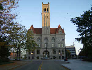
Wood County is a county located in the state of West Virginia. Based on the 2010 census, the population was 86,956, making it the fifth-most
populous county in West Virginia. Its county seat is Parkersburg. The county was formed in 1798 from the western part of Harrison County and
it was named for James Wood, governor of Virginia from 1796 to 1799.
Wood County is included in the Parkersburg-Vienna, WV Metropolitan Statistical Area, which is included in the Parkersburg-Marietta-Vienna,
WV-OH Combined Statistical Area.
Etymology - Origin of Wood County Name
In honor of James Wood, Governor of Virginia, 1796-1799
Demographics:
County QuickFacts: CensusBureau Quick Facts
Early History of Wood County, West Virginia
Wood County was created by an act of the Virginia General Assembly on December 21, 1798 from parts of Harrison County. According to the national census of 1800, Wood County had 1,217 residents, the smallest population of the 13 counties then in existence within the present state of West Virginia. Berkeley County, with 22,006 people, was the most populous county.
Wood County was named in honor of James Wood (1747-1813). He was born in Frederick County, Virginia. In 1763, when he was 16, he enlisted in the military and served as a private during Pontiac's War. The following year, at age 17, he organized and commanded a company in the expedition against the Shawnee Indians. In 1775, he was elected to the House of Burgesses from Frederick County. He represented Frederick County in the Virginia Convention of 1776 and, later that year, was appointed a Colonel in the Virginia military. He served with distinction during the American Revolutionary War and was named superintendent of the prisoners of war held by the Virginia militia. In 1783, he was promoted to the rank of Brigadier General and put in command of the troops defending the border against Indian raids. In 1784, he was elected a member of the Virginia executive council and, by seniority, was the lieutenant Governor of the State. He then served as the Governor of Virginia (1796-1799). He was an ardent opponent of slavery throughout his lifetime and served as President of the society for the promotion of abolition of slavery in Virginia in 1801. He continued as a member of the executive council of Virginia following his governorship. He served on the executive council until his death, on June 16, 1813.
Robert Cavelier de La Salle was probably the first European to set foot in present Wood County. He sailed down the Ohio River in 1669. In 1749, Louis Bienville de Celeron sailed down the Ohio River and may have set foot in the present county. He claimed all of the lands drained by the Ohio River for King Louis XV of France. He met several English fur traders on his journey and ordered them off of French soil and wrote strong letters of reprimand to the colonial governors protesting the English's presence on French soil.
Christopher Gist was the first Englishman to leave a written account of his travels through the county. He passed through the county on his way to Ohio in 1751. In 1769, Captain William Crawford and several others were the next Englishmen to pass through the county. The following year, George Washington surveyed some land given to him in the county for his military service. In 1773, Robert Thornton, of Pennsylvania, claimed 400 acres which included part of what is presently the city of Parkersburg. In 1783, after acquiring even more land in the county, he sold 1,350 acres, including the parcels of land on which Parkersburg now stands, to Alexander Parker for $50. After his death, the land passed onto his daughter, Mary. The title to portions of Mary Parker's land was disputed by several others, including John Stokley who had started his own settlement, called Stokleyville, on a portion of her land. After a court battle, Stokley was awarded title to about 650 of the original 1,350 acres. In 1800, Stokley laid out what he called the town of Newport, and it was named the county seat later that year. In 1810, Mary Parker's heirs won a countersuit against Stokley and gained possession of the land. On December 11, 1810, the new owners laid out a new town, which they called Parkersburg, in honor of Alexander Parker. After Mary Parker agreed to donate land for a courthouse and other county buildings the Virginia General Assembly named Parkersburg the county seat. The city was chartered in 1820 and incorporated by the West Virginia state legislature on February 11, 1911.
Blennerhassett's Island is situated on the Ohio River, approximately two miles south of Parkersburg. Harman Blennerhassett was born in England to a distinguished and wealthy Irish family, graduated from the University of Dubin, and was a noted attorney and respected scholar. He moved to Marietta, Ohio in 1798 and, being of ample financial means, bought what would be known as Blennerhassett Island and had a nationally famous mansion built for him there. In 1805, Vice-President Aaron Burr, who had killed Alexander Hamilton in a duel in 1804, landed uninvited on the island, but was welcomed as an honored guest. During his three day visit, Burr convinced Blennerhassett to finance an armed force to capture the Wichita territory in the West and, in the event war were to break out between Spain and the United States, to proceed to Mexico. A flotilla of about 20 small ships were constructed at Marietta and in December 1806 the fleet, with 30 well-armed men aboard, set sail down the Ohio River, supposedly toward Mexico. Fearing that the fleet was part of a scheme by Aaron Burr to overthrow the government, Colonel Hugh Phelps, commander of the Wood County militia, was ordered to intercept the ships. Unfortunately, the ships had already left when he arrived at the Blennerhassett mansion. Mrs. Blennerhassett insisted to the Colonel that her husband was not part of a plot to overthrow the government and ordered him and his troops not to disturb her property. The troops ransacked the mansion and the grounds. Burr and Blennerhassett were later captured and transported to Richmond and imprisoned. Burr was tried for treason and was acquitted. Blennerhassett was never brought to trial, but his reputation and standing in the country was ruined. He and his family moved to Europe where he died in 1831.
Geography: Land and Water
As reported by the Census Bureau, the county has a total area of 377 square miles (980 km2), of which 366
square miles (950 km2) is land and 11 square miles (28 km2) (2.8%) is water.
Wood County's northern and western boundary is the Ohio River. The Little Kanawha River flows northwestward through the county to its mouth at
the Ohio River in Parkersburg. Tributaries of the Little Kanawha River in Wood County include Worthington Creek, Tygart Creek, and Walker
Creek.
Neighboring Counties
Bordering counties are as follows:
- East: Ritchie County
- North: Washington County, Ohio
- Northeast: Pleasants County
- Northwest: Athens County, Ohio
- Southeast: Wirt County
- Southwest: Jackson County; Meigs County, Ohio
Education


Click Image to Enlarge
