

Click Image to Enlarge
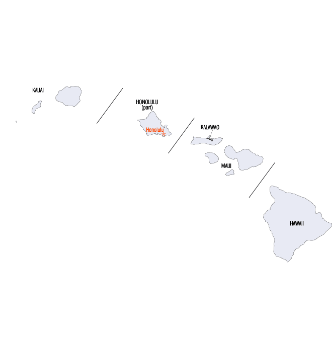
Hawaii Counties
There five counties in Hawaiʻi. All the counties were created in 1905 from unorganized territory, seven years after the Territory of Hawaii was created.Hawaii Counties: History and Information
Find a brief history of Hawaii Counties
The State of Hawaii is a state in the United States, located on an archipelago in the central Pacific Ocean southwest of the continental United States, southeast of Japan, and northeast of Australia. The state was admitted to the Union on August 21, 1959, making it the 50th state. Its capital is Honolulu on the island of Oahu.
This state encompasses nearly the entire volcanic Hawaiian Island chain, which is made up of hundreds of islands spread over 1,500 miles (2,400 km). At the southeastern end of the archipelago, the eight "main islands" are (from the northwest to southeast) Niʻihau, Kauaʻi, Oʻahu, Molokaʻi, Lanaʻi, Kahoʻolawe, Maui, and Hawaiʻi. The last is by far the largest, and is often called the "Big Island" or "Big Isle" to avoid confusion with the state as a whole. This archipelago is physiographically and ethnologically part of the Polynesian subregion of Oceania.
The five counties of Hawaii on the Hawaiian Islands enjoy somewhat greater status than many counties on the United States mainland. Counties in Hawaii are the only legally constituted government bodies below that of the state. No formal level of government (such as city governments) exists below that of the county in Hawaii. (Even Honolulu is governed as the City and County of Honolulu, a county that covers the entire island of Oahu.)
| Find a brief history of Hawaii Counties | ||||
|---|---|---|---|---|
| County | 2000 Population |
Square Miles |
County Seat |
Created |
| Hawaii County | 148,677 | 4,028 | Hilo | 1905 |
| Honolulu City and County | 876,156 | 600 | Honolulu | 1905 |
| Kauai County | 58,463 | 622 | Lihue | 1905 |
| Kalawao County | 90 | 5.2 | NA | 1905 |
| Maui County | 128,094 | 1,159 | Wailuku | 1905 |

Click Image to Enlarge
