

Click Image to Enlarge
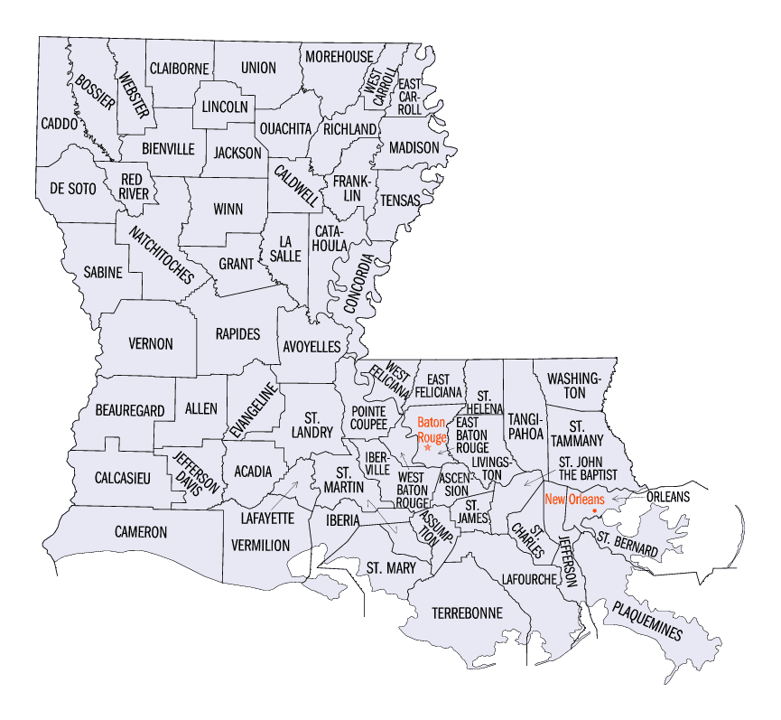
Louisiana Parishes
Louisiana is divided into sixty-four parishes. On March 31, 1807, the territorial legislature divided the state into 19 parishes, without getting rid of the old counties (which continued to exist until 1845). In 1811, a constitutional convention organized the state into seven judicial districts, each consisting of groups of parishes. In 1816, the first official map of the state used the term, as did the 1845 constitution. Since then, the official term has been parishes.Calcasieu Parish, Louisiana
Calcasieu Parish Education, Geography, and History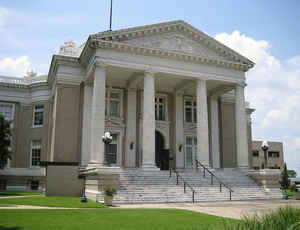
Calcasieu Parish is a parish located in the state of Louisiana. Based on the 2010 census, the
population was 192,768. Calcasieu Parish was
formed on March 24, 1840The parish seat is
Lake Charles. The parish is named in honor Calcasieu, of meaning crying eagle, is said to be the name of an Atakapa
Native American leader.
Calcasieu Parish is part of the Lake Charles, LA Metropolitan Statistical Area with a population of 194,138. It is also located near the
Beaumont-Port Arthur (Texas), Lafayette, and Alexandria metropolitan areas.
Etymology - Origin of Calcasieu Parish Name
The parish was named in honor Calcasieu, of meaning crying eagle, is said to be the name of an Atakapa Native American leader.
Demographics:
County QuickFacts: CensusBureau Quick Facts
Calcasieu County History
Calcasieu Parish was formed out of St. Landry Parish by an act of the State Legislature on March 24, 1840, and the
parish was named in honor Calcasieu, of meaning crying eagle, is said to be the name of an Atakapa Native American
leader. The Parish seat is Lake Charles. Courthouse was destroyed by a disastrous fire on April 23, 1910, as well as
most of downtown Lake Charles, and many of the records of the parish were burned or damaged.
The area had been inhabited by white families since about 1815. These families formed settlements along the Calcasieu
River. When the parish was formed, the boundaries were "...all the territory in the parish of St. Landry, within the
following boundaries, to-wit: Commencing at the mouth of the River Mermentau, thence up said river to the mouth of the
Bayou Nez Pique, thence up said bayou to the mouth of Cedar Creek, thence due north to the dividing line between the
parishes of St. Landry and Rapides, thence along said line to the Sabine River, thence down the said river to the mouth,
thence along the sea coast to the place of beginning...." Quoted from the legislative act of formation. The Calcasieu
Parish Seat is Lake Charles.
Geography: Land and Water
As reported by the Census Bureau, the parish has a total area of 1,094 square miles (2,830 km2), of which 1,064 square miles (2,760 km2) is land and 31 square miles (80 km2) (2.8%) is water.
Calcasieu Parish is located in southwest Louisiana. Major waterways in this parish are, Lake Charles, Calcasieu Lake, Intracoastal Canal, Ouiski Chitto Creek, English Bayou, West Fork and Calcasieu River.
Neighboring Parishes
Bordering parishes and counties are as follows:
- North: Beauregard Parish
- East: Jefferson Davis Parish
- Southeast: Cameron Parish
- West: Orange County, Tex.
- Northwest: Newton County, Tex.
Education
Public schools are operated by the Calcasieu Parish Public School System.


Click Image to Enlarge
