


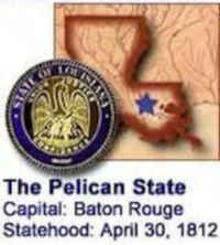
Louisiana State Almanac: Facts and Figures
Quick Facts, Figures, and Overview of the State of Louisiana
Louisiana is one of the West South Central states of the US. The capital of this State is Baton Rouge. It is the 25th most populous state of all the 50 states in USA. Louisiana is bordered to the west by Texas; to the north by Arkansas; to the east by the state of Mississippi; and to the south by the Gulf of Mexico. Louisiana's name came a French explorer that named the area La Louisianne after Louis XIV of France in 1682.
Louisiana economy was long dominated by agriculture. By the 1990s, however, exploitation of the state's vast petroleum and natural-gas deposits had made Louisiana the second most important mineral-producing state in the US. Tourism was a rapidly growing sector of the economy, and manufacturing was also important. The state also produces large crops of sweet potatoes, rice, sugar cane, pecans, soybeans, corn, and cotton. Leading manufactured items include chemicals, processed food, petroleum and coal products, paper, lumber and wood products, transportation equipment, and apparel.
Louisiana Almanac: Facts on the State of Louisiana |
|||
|---|---|---|---|
| Official Name | Louisiana | ||
| Capital | Baton Rouge | ||
| Nicknames | Pelican State ...and more | ||
| Motto | Union, justice and confidence | ||
| Location Region |
30.44896 N, 091.12604 W Southern Southwestern |
||
| Constitution Ratified | 1974 | ||
| Statehood | April 30, 1812 18th state |
||
| Population | 4,533,372 (2010) 102.58 sq. mi. 22nd |
||
| Largest City (by population) |
10 largest cities (2010):New Orleans, 343,829; Baton Rouge, 229,493; Shreveport, 199,311; Metairie, 138,481; Lafayette, 120,632; Lake Charles, 71,993; Kenner, 66,702; Bossier City, 61,315; Monroe, 48,815; Alexandria, 47,723 | ||
| Bordering States | North: Arkansas East: Mississippi (Mississippi River forms a portion of the Eastern border) South: Gulf of Mexico West: Texas (Sabine River forms much of the Western border) Coastline: 397 mi. |
||
| Major Industry | agriculture (rice, cotton, soybeans), salt production, oil and natural gas, fishing (especially shellfish) | ||
| Major Rivers | Mississippi River, Red River, Ouachita River, Atchafalaya River, Sabine River | ||
| Major Lakes | Lake Pontchartrain, Lake Maurepas, Toledo Bend Reservoir, Grand Lake, White Lake, Calcasieu Lake, Catahoula Lake | ||
| Louisiana Parishes | 64 Parishes in Louisiana | ||
| Largest Parishes (by population) |
Orleans Parish 343,829 (2010) 181 sq. mi. |
||
| Largest Parishes (by area) |
Vernon Parish 1,328 sq. mi. |
||
| State forests | 1 (8,000 ac.) | ||
| State parks | 35 | ||
| Electoral Votes | 9 | ||
| US Congress | 2 Senators; 7 Representatives | ||
| Time Zone | Central Standard Time | ||
| Zip Codes | NANPA | ||
| State Quick Facts | Census Bureau Quick Facts | ||
Louisiana Climate and Weather |
||
|---|---|---|
| Louisiana's summers are beastly hot and winters are mild. The average temperature range for the northern part of the state is 38-60 F/3-16 C in winter and 70-95 F/21-35 C in summer. Winter in the southern portion runs 44-67 F/7-19 C, with summer at 70-95 F/21-35 C. It does get even hotter, and humidity can make that heat seem much, much worse. Spring and fall offer a pleasant range of temperatures - 50-78 F/10-26 C. | ||
| Highest Temperature | 114 degrees August 10, 1936 - Plain Dealing |
|
| Lowest Temperature | -16 degrees February 13, 1899 - Minden |
|
| Avg. Temp: High - Low |
93.3 degrees 36.2 degrees |
|
Louisiana Points of Interest |
||
| Civil battlefields and hundreds of historical sites, plantation tours, bayou fishing venues, the stylish capital city of Baton Rouge, Cajun country in the Mississippi Delta Region, Lake Charles, swamp tours, zydeco music and of course the fabulous city of New Orleans is the major draw, known particularly for its picturesque French Quarter and the annual Mardi Gras celebration, held since 1838. Other major points of interest include the Superdome in New Orleans, historic plantation homes near Natchitoches and New Iberia, Chalmette National Historic Park, and the state capital at Baton Rouge.- to name just a few. | ||
Louisiana Highest, Lowest, and Mean Elevations (Feet) |
||
| Mean Elevation: 100 feet | ||
| Highest Point: Driskill Mountain: 535 feet
|
||
| Lowest Point: | New Orleans -8 feet |
|
Louisiana Land Area (Square Miles) |
||
| Geographic Center | Located in Avoyelles Parish, 3 miles SE of Marksville. Longitude: 92°32.2'W Latitude: 30°58.1'N |
|
| Total Area | 51,839.70 sq. mi. 31st |
|
| Land Area | 43,561.85 sq. mi. | |
| Water Area | 8,277.85 sq. mi. 15.96% |
|
| Forested Land Area | 49.4% | |
| Dimensions (Length - Width) |
380 miles - 130 miles | |
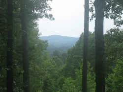 Driskill Mountain, located 7 miles
southeast of Arcadia, is the highest point in Louisiana at 535 feet above sea level.
Driskill Mountain, located 7 miles
southeast of Arcadia, is the highest point in Louisiana at 535 feet above sea level.Acadia, Allen, Ascension, Assumption, Avoyelles, Beauregard, Bienville, Bossier, Caddo, Calcasieu, Caldwell, Cameron, Catahoula, Claiborne, Concordia, DeSoto, East Baton Rouge, East Carroll, East Feliciana, Evangeline, Franklin, Grant, Iberia, Iberville, Jackson, Jefferson Davis, Jefferson, Lafayette Consolidated Government, Lafourche, LaSalle, Lincoln, Livingston, Madison, Morehouse, Natchitoches, Orleans, Ouachita, Plaquemines, Pointe Coupee, Rapides, Red River, Richland, Sabine, St. Bernard, St. Charles, St. Helena, St. James, St. John The Baptist, St. Landry, St. Martin, St. Mary, St. Tammany, Tangipahoa, Tensas, Terrebonne, Union, Vermilion, Vernon, Washington, Webster, West Baton Rouge, West Carroll, West Feliciana, Winn

