


Louisiana Geography: The Land
Geography and Landforms of Louisiana
 Find an overview of Louisiana
geography, topography, geographic land regions, land areas, and major rivers.
Find an overview of Louisiana
geography, topography, geographic land regions, land areas, and major rivers.
Access Louisiana almanac furnishing more details on the state geography, geographical and land regions, climate and weather, elevation, land areas, bordering states, and other statistical data.
The highest point in the state, Driskill Mountain, near Arkansas, is located in the West Gulf Coastal Plain. The lowest point in the state is in New Orleans and is 8 feet below sea level. This is the second lowest place in the United States next to Death Valley in California.
Louisiana Highest, Lowest, & Mean Elevations |
||
|---|---|---|
| Mean Elevation | 100 ft. | |
| Highest Point | Driskill Mountain 535 ft. |
|
| Lowest Point | New Orleans -8 ft. |
|
Louisiana Land Area (Square Miles) |
||
| Geographic Center | Located in Avoyelles Parish, 3 miles SE of Marksville. Longitude: 92° 32.2'W Latitude: 30° 58.1'N |
|
| Total Area | 51,839.70 sq. mi. 31st |
|
| Land Area | 43,561.85 sq. mi. | |
| Water Area | 8,277.85 sq. mi. 15.96% |
|
| Forested Land Area | 49.4% | |
| Dimensions (Length - Width) |
380 miles - 130 miles | |
Louisiana: Physiographic Regions
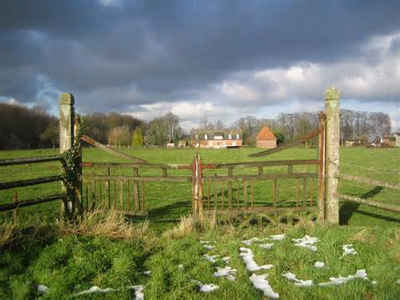
Louisiana can be divided into three main geographic land areas, the East Gulf Coastal Plain, the Mississippi Alluvial Plain, and the West Gulf Coastal Plain.
East Gulf Coastal Plain
The East Gulf Coastal Plain consists of marshland east of the Mississippi River, and then rises slightly to rolling hills north of Lake Pontchartrain.
The East Gulf Coastal Plain extends from the Florida Parishes of Louisiana over most of Mississippi, some of western Tennessee and Kentucky, the southwestern 2/3 of Alabama, and the western panhandle of Florida. Its southern boundary is the Gulf of Mexico and its western boundary the drop into the Mississippi Alluvial Valley. On the north it extends to the highlands of the Interior Low Plateaus and southern Appalachians. To the east, there is an arbitrary break with the South Atlantic Coastal Plain at the Alabama-Georgia border south through Florida along the Apalachicola River. The flat to rolling topography is broken by numerous streams and river bottoms. Uplands are dominated by pine, originally longleaf and slash in the south and shortleaf mixed with hardwoods in the north. These are fire-maintained systems that give way to loblolly pine and hardwoods in damper areas and bottomland hardwood forest in extensive lowland drainages.
Mississippi Alluvial Plain
This is the most fertile area of the state. The Mississippi Alluvial Plain is located along the Mississippi River and is characterized by ridges and hollows. This area includes the huge Mississippi Delta area covering about one-quarter of the state.
This area includes the floodplain of the Mississippi River that cuts into the Gulf Coastal Plain, extending north to and including the delta at the confluence of the Mississippi and Ohio Rivers and south toward the Gulf of Mexico. The Alluvial Valley includes most of eastern Louisiana, eastern Arkansas, northwest Mississippi, small portions of west Tennessee and Kentucky, the bootheel of Missouri, and the Cache River lowlands of Illinois. Nonforested marsh in southern portions of the floodplain is included in the Coastal Prairie physiographic area. Water shaped this land. The ridges and swales, levees, oxbows, and terraces of the Valley all resulted from meanderings and floods of the Mississippi River. Small changes in elevation determine how wet a site is, the plant community that grows there, and habitat conditions for birds.
West Gulf Coastal Plain
The West Gulf Coastal Plain includes the area west of the Alluvial Plain. In the south, along the gulf, are barrier beaches. Behind the barrier beaches are marshes that extend about 20 miles north into the interior of Louisiana. To the north of the marshlands are the Louisiana Prairies, characterized by gently rolling landscape. The land gradually rises in the north, toward Arkansas.
The Coastal Prairies physiographic area covers approximately 880 km of coastal shoreline from Atchafalaya Basin, Louisiana to Baffin Bay, Texas. The inland boundary of this area ranges from 15 km to 150 km from the coast, capturing a complex of marshes and upland grassland and a very small amount of forested habitat. Marsh vegetation is determined largely by the salt content of the water, with community types ranging from salt marsh to brackish to fresh water marsh. Nearly all grassland habitats have been converted to agricultural use, primarily pasture lands and rice farms. Forested areas occur primarily along major riverine systems and on coastal cheniers (ancient beachfront ridges), mottes and salt domes, and man-made levees and spoil banks. The Chenier Plain is an important sub-unit of the physiographic area that is located from Atchafalaya Bay, Louisiana westward to East Bay, Texas. Wooded subunits comprise only about 6% of the Chenier Plain and occur on the cheniers themselves. These are long narrow bands of woodlands dominated by hackberry and live oak that run parallel to the Gulf Coast and range in width from about 30 to 500 m and in length from about 1 to 50 km. Bottomland hardwood forests along the major river systems that drain the Coastal Prairies range in composition from cypress-tupelo to hackberry-ash-elm to water oak-willow oak dominated forests.
The West Gulf Coastal Plain covers northwest Louisiana, southwest Arkansas, easternmost Texas, and the southeast corner of Oklahoma. In general, uplands are dominated by pines and bottomlands by hardwood forests. The pine is originally longleaf in the southern portion and shortleaf with a significant hardwood element in the northern portion. The southern edge of the physiographic area occurs where trees become less dominant and the grasslands of the Coastal Prairies begin. The West Gulf Coastal Plain extends east to the Mississippi Alluvial Valley and north to edge of the Ouachita highlands. Drier climate and changing soils to the west mark the edge of the distribution of pine in eastern Texas and the beginnings of the Oaks and Prairies physiographic area.

