

Click Image to Enlarge
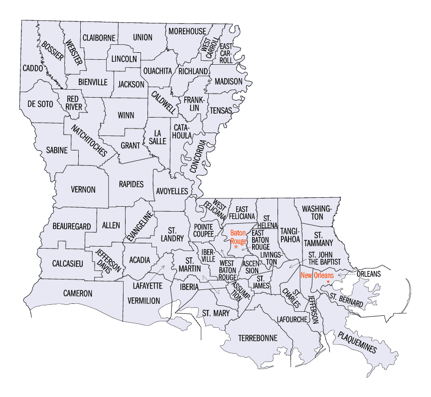
Louisiana Parishes
Louisiana is divided into sixty-four parishes. On March 31, 1807, the territorial legislature divided the state into 19 parishes, without getting rid of the old counties (which continued to exist until 1845). In 1811, a constitutional convention organized the state into seven judicial districts, each consisting of groups of parishes. In 1816, the first official map of the state used the term, as did the 1845 constitution. Since then, the official term has been parishes.West Carroll Parish, Louisiana
West Carroll Parish Education, Geography, and History
West Carroll Parish is a parish located in the northeastern part of the state of Louisiana. Based on the 2010 census, the population was 11,604. The parish seat is Oak Grove. The parish was founded in 1877.
Etymology - Origin of West Carroll Parish Name
Carroll Parish was named in honor of Charles Carroll in 1832, a philanthropist, statesman and the last surviving signer of the US Declaration of Independence.
Demographics:
County QuickFacts: CensusBureau Quick Facts
West Carroll County History
Carroll Parish was created by an Act was approved on March 14, 1832, out of the northern part of the original Concordia Parish created in 1809 and the eastern part of Ouachita Parish. Carroll Parish was named in honor of Charles Carroll in 1832, a philanthropist, statesman and the last surviving signer of the US Declaration of Independence. Lake Providence was the first seat of government. Carroll Parish was divided into two parishes in 1871. The division solved a feud over the site of the seat of government. Lake Providence was named the parish seat of East Carroll Parish. Bayou Macon formed the boundary between the two parishes. Oak Grove became the parish seat of West Carroll Parish. West Carroll Parish was created on 1877, from Carroll Parish. The Parish seat is Lake Providence. The Parish seat is Oak Grove.
Geography: Land and Water
As reported by the Census Bureau, the parish has a total area of 361 square miles (930 km2), of which 360 square miles (930 km2) is land and 0.9 square miles (2.3 km2) (0.3%) is water.
Neighboring Parishes
Bordering parishes and counties are as follows:
- Northeast: Chicot County, Ark.
- Southeast: East Carroll Parish
- Southwest: Richland Parish
- West: Morehouse Parish
Education
West Carroll Parish public schools are operated by the West Carroll Parish School Board. The public school system consist of four high schools and five elementary schools that consistently rank at the top of the state in test scores and on the athletic field.


Click Image to Enlarge
