


Click Image to Enlarge
Missouri Counties
Missouri has one hundred and fourteen counties and one independent city. St. Louis City is separate from St. Louis County and is referred to as a "city not within a county." Following the Louisiana Purchase and the admittance of Louisiana into the United States in 1812, five counties were formed out of the Missouri Territory at the first general assembly. Most subsequent counties were apportioned from these five original counties.Ralls County, Missouri
Ralls County Education, Geography, and History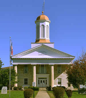
Ralls County is a county located in the northeastern portion of the state of Missouri. Based on the 2010 census, the population was
10,167.Its county seat is New London. The county was organized November 16, 1820 and named for Daniel Ralls, Missouri state legislator.
Ralls County is part of the Hannibal, MO Micropolitan Statistical Area, which is also included in the Quincy-Hannibal, IL-MO Combined
Statistical Area.
Etymology - Origin of Ralls County Name
Named for Daniel Ralls, Missouri legislator.
Demographics:
County QuickFacts: CensusBureau Quick Facts
History of Ralls County
Originally a part of Pike County. Formed on November 16, 1820, and then including eight other counties and parts of four others lying to the north and west. With the organization of Marion County in 1826, Randolph in 1829, Monroe in 1831, and Audrain in 1836, Ralls assumed its present limits. On the north is Marion County; on the east, the Mississippi River; on the south, Pike and Audrain; on the west, Monroe and Marion. Ralls was named for Daniel Ralls, member of the state legislature from Pike County, a Virginian who emigrated in his youth to Kentucky, thence in 1818 to Missouri four miles west of New London. He died on October 20, 1820, while the legislature was in session, a few days after he was carried from his sick bed to cast the deciding vote which made Thomas H. Benton a US Senator. (STATE LAWS, 1ST SESSION OF 1ST GENERAL ASSEMBLY, 17-18; B.B. Megown, W.T. Waters)
Source: Leech, Esther. "Place Names Of Six East Central Counties Of Missouri." M.A. thesis., University of Missouri-Columbia, 1933.
Geography: Land and Water
As reported by the Census Bureau, the county has a total area of 484 square miles (1,250 km2), of which 470 square miles (1,200 km2) is
land and 14 square miles (36 km2) (2.9%) is water
Neighboring Counties
Bordering counties are as follows:
- Marion County (north)
- Pike County, Illinois (northeast)
- Pike County (southeast)
- Audrain County (south)
- Monroe County (west)
Education
Public schools
Ralls County R-II School District - Center


Click Image to Enlarge
