


Missouri Geography: The Land
Geography and Landforms of Missouri
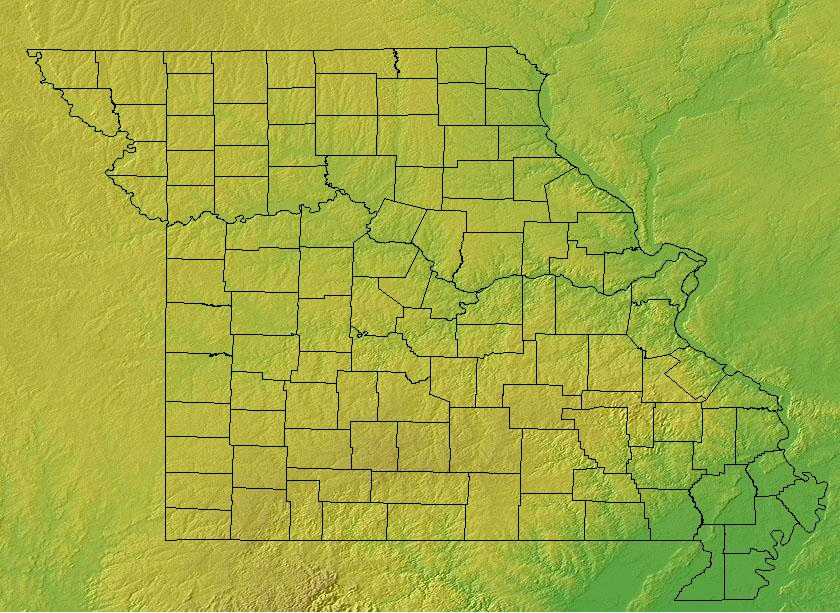 Find an overview of Missouri geography,
topography, geographic land regions, land areas, and major rivers.
Find an overview of Missouri geography,
topography, geographic land regions, land areas, and major rivers.
Access Missouri almanac, furnishing more details on the state geography, geographical and land regions, climate and weather, elevation, land areas, bordering states, and other statistical data.
Missouri is bordered by Iowa on the north and by Arkansas and Tennessee on the south. Illinois, Kentucky and Tennessee border the state on the east, and Nebraska, Kansas and Oklahoma form the western border. The highest point in Missouri is Taum Sauk Mountain at 1772 feet.
Major rivers in the state include the Mississippi River, the Missouri River, the Current River and the Osage River.
Missouri Highest, Lowest, & Mean Elevations |
|
|---|---|
| Mean Elevation | 800 ft. |
| Highest Point | Taum Sauk Mountain 1,772 ft. |
| Lowest Point | St. Francis River 230 ft. |
Missouri Land Area (Square Miles) |
|
| Geographic Center | In Miller County, 20 mi. SW of Jefferson City Longitude: 92° 37.9'W Latitude: 32° 48.9'N |
| Total Area | 69,704.31 sq. mi. 21st |
| Land Area | 68,885.93 sq. mi. |
| Water Area | 818.39 sq. mi. 1.17% |
| Forested Land Area | 31.9% |
| Dimensions (Length - Width) |
300 miles - 240 miles |
Missouri: Physiographic Regions
Missouri comprises four major land regions:
- Dissected Till Plains
- The Osage Plains
- The Mississippi Alluvial Plain
- The Ozark Plateau
Dissected Till Plains
The Dissected Till Plains are north of the Missouri River. This area is covered with rich soil that is particularly good for growing corn. This
well-watered prairie is criss-crossed by many slow-moving rivers and streams.
The Dissected Till Plains were formed around 400,000 years ago by the Nebraskan glaciations. Glacial scouring left behind the rolling hills and rich,
fertile soils found today in the region.
The Dissected Till Plains occupy much of Iowa, eastern Nebraska, northwest Missouri, and small parts of northwest Illinois, southern Minnesota, and northeast Kansas. This area was glaciated, uplifted, and subsequently eroded into a flat-to-rolling terrain that slopes gently toward the Missouri and Mississippi River Valleys. Natural vegetation is a mosaic of tallgrass bluestem prairie and oak-hickory forest with oak savannahs characteristic of transition zones. Bottomland hardwoods grow in river valleys.
Mississippi Alluvial Plains
This land, once swampy, has been drained to form a rich farmland suitable for growing cotton, soybeans, and rice. The southern portion of Missouri
that juts into Arkansas, is called the Boot Heel because of its shape.
The alluvial plain consists of both Pleistocene (Ice Age) and recent deposits of clay, silt, sand, and gravel that were laid down by the Mississippi
River as it meandered across this broad floodplain.
Mississippi Alluvial Valley includes the floodplain of the Mississippi River that cuts into the Gulf Coastal Plain, extending north to and including the delta at the confluence of the Mississippi and Ohio Rivers and south toward the Gulf of Mexico. The Alluvial Valley includes most of eastern Louisiana, eastern Arkansas, northwest Mississippi, small portions of west Tennessee and Kentucky, the bootheel of Missouri, and the Cache River lowlands of Illinois. Nonforested marsh in southern portions of the floodplain is included in the Coastal Prairie physiographic area. Water shaped this land. The ridges and swales, levees, oxbows, and terraces of the Valley all resulted from meanderings and floods of the Mississippi River. Small changes in elevation determine how wet a site is, the plant community that grows there, and habitat conditions for birds.
Osage Plains
The Osage Plains, covering west-central Missouri, the southeastern third of Kansas, most of central Oklahoma, and extending into north-central Texas, is the southernmost of three tallgrass prairie physiographic areas. It grades into savannah and woodland to the east and south, and into shorter mixed-grass prairie to the west. The Osage Plains consist of three subregions. The Osage Plains proper occupy the northeast segment. Although sharply demarcated from the Ozark uplift, the Plains are nonetheless a transitional area across which the boundary between prairie and woodland has shifted over time. In the central portion of the physiographic area lies the second subregion, the Flint Hills. This large remnant core of native tallgrass prairie is a rocky rolling terrain that stretches from north to south across Kansas and extends into Oklahoma. To the west and south of these hills are the Blackland Prairies and Crosstimbers. This vegetatively complex region of intermixed prairie and scrubby cedar-mesquite woodland extends into north-central Texas. As in the rest of the Great Plains, fire, herbivory, topography, and drought maintained prairie and established the location of woodlands.
Ozark Plateau
The largest land area in Missouri, this area is also known for its large springs, lakes, and clear rivers. The Ozark Plateau is located in the southwestern corner of Missouri, and is great for gardens and strawberries. The St. Francois Mountains are in the southeast. This area is the highest and most rugged section of the state. Taum Sauk Mountain, the highest point in Missouri, is located in the St. Francois Mountains.
Ozarks and Ouachitas
The Ozarks and Ouachitas are two distinct mountain ranges separated from each other by the Arkansas River Valley. The Ozarks occupy most of southern Missouri and extend into northern Arkansas. They consist of three dissected plateaus covered with oak-dominated forest with glade and savannah inclusions. To the south, the Ouachitas are a ridge and valley system covering central Arkansas and extending into eastern Oklahoma. Here shortleaf pine is interspersed with deciduous forest. The physiographic area transforms into prairie to the north and west and drops off into the Mississippi Alluvial Valley to the east and the West Gulf Coastal Plain to the south. The Ozark/Ouachitas are similar in many respects to the Interior Low Plateaus that lie directly to the east of the Mississippi Valley.

