


Click Image to Enlarge
Missouri Counties
Missouri has one hundred and fourteen counties and one independent city. St. Louis City is separate from St. Louis County and is referred to as a "city not within a county." Following the Louisiana Purchase and the admittance of Louisiana into the United States in 1812, five counties were formed out of the Missouri Territory at the first general assembly. Most subsequent counties were apportioned from these five original counties.Wayne County, Missouri
Wayne County Education, Geography, and History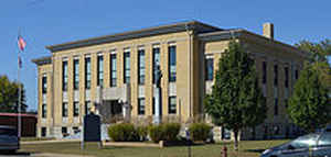
Wayne County is a county located in the Ozark foothills in the state of Missouri. Based on the 2010 census, the population was 13,521. The county seat is Greenville. The county was officially organized on December 11, 1818, and is named after General "Mad" Anthony Wayne who served in the American Revolutionary War
Etymology - Origin of Wayne County Name
Named for Anthony Wayne, a Revolutionary War general.
Demographics:
County QuickFacts: CensusBureau Quick Facts
History of Wayne County
Organized by an act of the Territorial Legislature in 1815, dividing the county of New Madrid, and establishing the county of Lawrence... In December, 1818, an act was passed for erecting the southwest part of the county of Cape Girardeau and the eastern part of the county of Lawrence into a separate and distinct county: "Beginning at the southeast corner of the county of Madison, running south on the ridge which divides Crooked Creek and Castor until it strikes the edge of the "Big Swamp," between Jenkin's Creek and Castor; thence down the main channel of said river until it strikes the New Madrid County line, thence south so far that a due west line will leave the plantation of Ed. N. Matthews on the north, thence west to the Osage boundary line, thence north with said line so far that a due east line will intersect the place of beginning." The new county was named Wayne and because of its great size was often spoken of as the "State of Wayne," or "Mother of Counties." Commissioners appointed to fix upon a site for the public buildings were Overton Bettis, James Logan, Solomon Bollinger, William Street, and Ezekiel Rubottom. Courts were held in the home of Ransom Bettis. A county or territorty formed in 1818 from New Madrid, one of the counties of the Missouri Territory. From it was cut off Taney County in 1837, and Ozark in 1841. Named for General Anthony Wayne of Stony Point, of Revolutionary fame, who died December 15, 1796. (Eaton (46) V, p. 72) The first settlements in the county were made in 1800 near the present site of Patterson and Greenville. Joseph Parish, Thomas Ring, Francis Clark, Joseph Doubleway, and Ephraim Stout settled near Patterson. Jacob and Isaac Kelly, Charles, David, and Robert Logan, and E.O. and R. Bettis near Greenville. These men obtained Spanish Land grants while Missouri was still a part of the Spanish territory of Louisianan. The name was given in honor of General Anthony (Mad Anthony) Wayne (1745-1796), of Revolutionary War fame. Wayne was born in East town, Pennsylvania in 1745. He served in the Revolutionary War, when he was associated with General N. Greene. His greatest military work, however, began in 1792 when President Washington appointed him General-in-chief and he organized a company of settle Indian troubles in the Northwest territory. He built Forts Recovery (1793), Fort Adams, Fort Greenville, Fort Defiance, and Fort Wayne (1794). General Wayne terminated a generation of warfare in the Ohio Valley by the treaty of Greenville which was signed August 3, 1795. Wappapello Dam has just been finished (1943), reducing the land area of Wayne County by several thousand acres, but providing protection from St. Francois River floods. (Campbell 437, Bennett, Douglass I 80, Goodspeed 336)
Source: Hamlett, Mayme L. "Place Names Of Six Southeast Counties Of Missouri." M.A. thesis., University of Missouri-Columbia, 1938. Bell, Margaret E. "Place Names In The Southwest Border Counties Of Missouri." M.A. thesis., University of Missouri-Columbia, 1933.
Geography: Land and Water
As reported by the Census Bureau, the county has a total area of 774 square miles (2,000 km2), of which 759 square miles (1,970 km2) is
land and 15 square miles (39 km2) (1.9%) is water
Neighboring Counties
Bordering counties are as follows:
- Madison County (north)
- Bollinger County (east)
- Stoddard County (southeast)
- Butler County (south)
- Carter County (southwest)
- Reynolds County (west)
- Iron County (northwest)
Education
Of all adults 25 years of age and older in Wayne County, 59.7% possessed a high school diploma or higher while 6.8% had a bachelor's degree or higher as their highest educational attainment.
Public schools
Clearwater R-I School District - Piedmont
Greenville R-II School District - Greenville
Private schools
Victory Baptist Academy - Piedmont - (PK-11) - Baptist


Click Image to Enlarge
