


Click Image to Enlarge
Texas Counties
Texas is divided into two hundred and fifty-four counties, more than any other state. Texas was originally divided into municipalities, a unit of local government under Spanish and Mexican rule. When the Republic of Texas gained its independence in 1836, there were 23 municipalities, which became the original Texas counties. Many of these would later be divided into new counties. The most recent county to be created was Kenedy County in 1921. The most recent county to be organized was Loving County in 1931Burleson County, Texas
Burleson County Education, Geography, and History
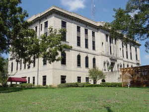
Burleson County is a county located in the state of Texas. Based on the 2010 census, the population was 17,187. Its county seat is Caldwell.
The county is named for Edward Burleson, a general and statesman of the Texas Revolution.
Burleson County is part of the College Station-Bryan, TX Metropolitan Statistical Area.
Etymology - Origin of Burleson County Name
Edward Burleson, a general and statesman of the Texas Revolution
Demographics:
County QuickFacts: CensusBureau Quick Facts
Burleson County History
In the first legislature of the State of Texas (1846), a bill was introduced creating a new county called Burleson County carved out of land in Milam and Washington Counties. Burleson County was named for Gen Edward Burleson (1793-1851), who had fought in the Texas War for Independence and in Indian Wars.
Gen. Burleson was a congressman, senator, and vice president of the republic of Texas; and also served in the first state senate. Burleson County lost some area in 1874 when Lee County was created. In 1880 the Gulf, Colorado and Santa Fe Railway built into Burleson county followed by the Houston & Texas Central railroad.
Handbook of Texas Online
Population increase soon produced demands for the organization of local government. In 1830 the territory of
present Burleson County south of the Old San Antonio Road was included in the Precinct of Viesca, while the area of
the future county north of the road, part of Robertson's colony, was incorporated into Viesca Municipality. In 1835
the region north of the road became part, first, of Milam Municipality, and then of Milam County, after the
foundation of the republic in 1836. The territory south of the road and north of Yegua Creek was initially included
in Washington Municipality, organized in 1835, and then in Washington County in 1836. In 1840 the area of the
present county south of the Old San Antonio Road was transferred from Washington to Milam County. A small settlement
and trading post established by Lewis L. Chiles by 1840 at the place where the Old San Antonio Road crossed Davidson
Creek in what is now Burleson County was chosen to become the seat of the newly constituted Milam County. A new
townsite, soon known as Caldwell, was platted in 1840 by George B. Erath.
Finally, on March 24, 1846, the state's First Legislature established Burleson County, named for Gen. Edward
Burleson, and designated Caldwell the county seat. The county acquired its
present boundaries in 1874, when its western reaches beyond East Yegua Creek were given to the new Lee County, thus
reducing Burleson County by some 31 percent. More at
Charles Christopher Jackson, "BURLESON COUNTY," Handbook of Texas Online (http://www.tshaonline.org/handbook/online/articles/hcb18),
accessed January 23, 2016. Uploaded on June 12, 2010. Published by the Texas State Historical Association.
Judicial Burleson County
Burleson County was established for judicial and other purposes on January 15, 1842. It included all of what is now Burleson County and the northwest portion of what is now Lee County. Caldwell was named the county seat. A few weeks afterwards a Texas Supreme Court decision, Stockton v. Montgomery (1842), declared all judicial counties unconstitutional. The present Burleson County was established in 1846.
BIBLIOGRAPHY: James Wilmer Dallam, A Digest of the Laws of Texas (Baltimore: Toy, 1845). Hans Peter Nielsen Gammel,
comp., Laws of Texas, 1822-1897 (10 vols., Austin: Gammel, 1898).
Geography: Land and Water
As reported by the Census Bureau, the county has a total area of 678 square miles (1,755 km2), of which, 666
square miles (1,724 km2) of it is land and 12 square miles (32 km2) of it (1.81%) is water.
Neighboring Counties
Bordering counties are as follows:
- Robertson County (north)
- Brazos County (northeast)
- Washington County (southeast)
- Lee County (southwest)
- Milam County (northwest)
Education


Click Image to Enlarge
