


Texas Geography: The Land
Geography and Landforms of Texas
 Find
an overview of Texas geography, topography, geographic land regions, land areas, and major rivers.
Find
an overview of Texas geography, topography, geographic land regions, land areas, and major rivers.
Access Texas almanac furnishing more details on the state geography, geographical and land regions, climate and weather, elevation, land areas, bordering states, and other statistical data.
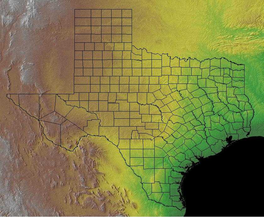
Texas is the largest of the 48 contiguous states
in the US Because of this, it has a wide diversity of landforms. There are six main geographic areas in Texas: East Texas, the Gulf Coast, the Rio
Grande Valley, the Blackland Prairies, the High Plains and West Texas.
In the south, the Gulf Coast Plain meets the Gulf of Mexico. The North Central Plains slope upward creating some hills. The Great Plains extend to the Panhandle where they are broken by low mountains, a southern extension of the Rocky Mountains called Trans-Pecos.
Texas Highest, Lowest, & Mean Elevations |
|
|---|---|
| Mean Elevation | 1,700 ft. |
| Highest Point | Guadalupe Peak 8,749 ft |
| Lowest Point | Gulf of Mexico Sea level |
Texas Land Area (Square Miles) |
|
| Geographic Center | In McCulloch County, 15 mi. NE of Brady Longitude: 99° 27.5'W Latitude: 31° 14.6'N |
| Total Area | 268,580.82 sq. mi. 2nd |
| Land Area | 261,797.12 sq. mi. 97.48% |
| Water Area | 6,783.70 sq. mi. 2.52% |
| Forested Land Area | 51.6% |
| Dimensions (Length - Width) |
790 miles - 660 miles |
Texas: Physiographic Regions
The major physiographic divisions of the state are the
- Gulf Coastal Plain in the east and southeast;
- the North Central Plains, covering most of central Texas;
- the Great Plains, extending from west-central Texas up into the panhandle; and the
- Basin and Range mountainous trans-Pecos area in the extreme west.
Gulf Coastal Plain
The West Gulf Coastal Plain covers northwest Louisiana, southwest Arkansas, easternmost Texas, and the southeast corner of Oklahoma. In general, uplands are dominated by pines and bottomlands by hardwood forests. The pine is originally longleaf in the southern portion and shortleaf with a significant hardwood element in the northern portion. The southern edge of the physiographic area occurs where trees become less dominant and the grasslands of the Coastal Prairies begin. The West Gulf Coastal Plain extends east to the Mississippi Alluvial Valley and north to edge of the Ouachita highlands. Drier climate and changing soils to the west mark the edge of the distribution of pine in eastern Texas and the beginnings of the Oaks and Prairies physiographic area.
North Central Plains
Landforms in the Central Plains region of Texas is part of a larger Central Plains region of North America. It is made up of 3 separate areas. They are the Grand Prairie, the Cross Timbers, and the Rolling Plains. Each of these areas has a different type of landform, and they include prairies, forests, and plains.
The North Central Plains of Texas are a southwestern extension into Texas of the interior, or central, lowlands that extend northward to the Canadian border, paralleling the Great Plains to the West. The North Central Plains of Texas extend from the Blackland Belt on the east to the Caprock Escarpment on the west. From north to south, they extend from the Red River to the Colorado River.
Great Plains
The Great Plains region of Texas is part of the larger Great Plains of North America. The 3 separate areas in this region include the High Plains, the Edward Plateau, and the Llano Basin. The landforms in these areas include plains, plateaus , canyons , escarpments , and basins
The Great Plains, which lie to the east of the base of the Rocky Mountains, extend into northwestern Texas. This area, commonly known as the High Plains, is a vast, flat, high plain covered with thick layers of alluvial material. It is also known as the Staked Plains or the Spanish equivalent, Llano Estacado.
Basin and Range: Trans-Pecos (a southern extension of the Rocky Mountains )
This region has 150 mountains in its mountain range. There are some plateaus and basins. The Rio Grande forms this region's southern border and New Mexico borders it to the north. There is also Big Bend National Park in this region.
The Basin and Range province, with its center in Nevada, surrounds the Colorado Plateau on the west and south and enters far West Texas from southern New Mexico on the east. It consists of broad interior drainage basins interspersed with scattered fault-block mountain ranges. Although this is the only part of Texas regarded as mountainous, these should not be confused with the Rocky Mountains. Of all the independent ranges in West Texas, only the Davis Mountains resemble the Rockies
Texas Landscape and Landforms:
Chihuahuan Desert
In the United States, the Chihuahuan Desert includes the Trans-Pecos of Texas, southern New Mexico, and a small area in southeast Arizona. Broad
basins and valleys bordered by sloping alluvial fans and terraces make up the dry lowlands of this region, punctuated by occasional mesas and mountain
ranges. The Rio Grande and Pecos are the primary rivers of the Chihuahuan Desert. In this arid region, riparian corridors provide important habitat
for breeding, in-transit, and wintering birds. Other drainages end in closed basins and include few permanent streams. Arid grass and shrubland are
the primary lowland vegetation types, often dominated by creosote. This grades uphill into oak-juniper woodlands and even coniferous forest in the
highest reaches. The Madrean mountains mark its western edge, the Edwards Plateau its east, and the reduced shrubbiness of the shortgrass plains its
north. The Chihuahuan Desert extends south across much of the Central Plateau of Mexico, bordered by the Sierra Madre Occidental and Oriental.
Coastal Prairies
The Coastal Prairies physiographic area covers approximately 880 km of coastal shoreline from Atchafalaya Basin, Louisiana to Baffin Bay, Texas. The inland boundary of this area ranges from 15 km to 150 km from the coast, capturing a complex of marshes and upland grassland and a very small amount of forested habitat. Marsh vegetation is determined largely by the salt content of the water, with community types ranging from salt marsh to brackish to fresh water marsh. Nearly all grassland habitats have been converted to agricultural use, primarily pasture lands and rice farms. Forested areas occur primarily along major riverine systems and on coastal cheniers (ancient beachfront ridges), mottes and salt domes, and man-made levees and spoil banks. The Chenier Plain is an important sub-unit of the physiographic area that is located from Atchafalaya Bay, Louisiana westward to East Bay, Texas. Wooded subunits comprise only about 6% of the Chenier Plain and occur on the cheniers themselves. These are long narrow bands of woodlands dominated by hackberry and live oak that run parallel to the Gulf Coast and range in width from about 30 to 500 m and in length from about 1 to 50 km. Bottomland hardwood forests along the major river systems that drain the Coastal Prairies range in composition from cypress-tupelo to hackberry-ash-elm to water oak-willow oak dominated forest
Edwards Plateau
The Edwards Plateau is entirely contained within Texas. This hilly area is clearly demarcated by the Balcones Fault escarpment to the east and south,
but grades into the Chihuahuan Desert to the west and the Great Plains to the north. The plateau can be divided into four subregions. The central and
western portions of the plateau are characterized by broad, relatively level uplands moderately dissected by gently sloping stream divides. The deeply
dissected portion adjacent to the escarpment, the Balcones Canyonlands, is popularly known as the Texas Hill Country. This region is highly dissected
by fast-moving streams through steep-sided canyons. The northeast plateau, the Lampasas Cut Plains, is characterized by broad valleys. The final subregion
is the Central Mineral Valley or Llano Uplift. This area has a granitic substrate that clearly differentiates this area from surrounding areas.
The Edwards Plateau was originally a grassy savannah with the most common trees being mesquite, juniper, and live oaks. Some of this community type
still remains, but agricultural practices have heavily modified most of the area. The eastern and wetter end of the Plateau is characterized by diverse
woodlands including hardwoods (primarily oaks) and Ashe Juniper. Periodic, naturally-occurring fire was a major ecological force in the western plateau
that maintained live oak savannahs and produced a mosaic of habitats across broad landscapes.
Oaks and Prairies
The Oaks and Prairies extend from approximately the Red River of Oklahoma south to San Antonio, Texas, east to the acidic sandy soils of the East Texas Pineywoods and west to the Eastern Cross Timbers. Within this area, the Texas Blackland Prairie represents the southernmost extension of the North American tallgrass prairie. In this subregion, the principal habitat is tallgrass that typically occurs on higher areas with good drainage. Eleven plant associations have been described in the Blackland Prairie, and dominant vegetation includes big bluestem, little bluestem, Indiangrass, switchgrass, brownseed paspalum, and gramagrass. Also present in the Oaks and Prairies physiographic area are bottomland hardwood forests, where burr oak, Shumard oak, black walnut, American elm, cedar elm, and white ash are common components. Riparian forests include cottonwood, sycamore, black willow, and green ash. Common trees of upland hardwood forests occurring on the upper slopes and summits of Austin chalk escarpments include Texas oak, San Saba oak, Mexican plum, and cedar elm. There is often an associated dense scrub layer within these forests, including species such as aromatic sumac, poison oak, Carolina buckthorn, and coralberry. There are occasional wetlands and freshwater marshes in the Oaks and Prairies area, primarily associated with the peripheral areas of streams, rivers, and reservoirs.
Osage Plains
The Osage Plains, covering west-central Missouri, the southeastern third of Kansas, most of central Oklahoma, and extending into north-central Texas, is the southernmost of three tallgrass prairie physiographic areas. It grades into savannah and woodland to the east and south, and into shorter mixed-grass prairie to the west. The Osage Plains consist of three subregions. The Osage Plains proper occupy the northeast segment. Although sharply demarcated from the Ozark uplift, the Plains are nonetheless a transitional area across which the boundary between prairie and woodland has shifted over time. In the central portion of the physiographic area lies the second subregion, the Flint Hills. This large remnant core of native tallgrass prairie is a rocky rolling terrain that stretches from north to south across Kansas and extends into Oklahoma. To the west and south of these hills are the Blackland Prairies and Crosstimbers. This vegetatively complex region of intermixed prairie and scrubby cedar-mesquite woodland extends into north-central Texas. As in the rest of the Great Plains, fire, herbivory, topography, and drought maintained prairie and established the location of woodlands.
Pecos and Staked Plains
The Staked and Pecos Plains cover the western panhandle of Texas, the west end of the panhandle of Oklahoma, and extensive areas in eastern New Mexico. These high and dry plains are covered with a shortgrass prairie dominated by grama and buffalo grasses. There are also extensive areas of shinnery, a midgrass prairie with low shrubs. The area grades into taller grass to the east, to Trans-Pecos shrub savannah to the south, and more chaparral and pinyon-juniper in the Mesas and Plains area to the west. The northern border of Oklahoma is established as an arbitrary northern limit.
Rolling Red Plains
The Rolling Red Plains extend north from the Edwards Plateau in Texas to western sections of Oklahoma. The landscape is flat to rolling plains, with natural vegetation consisting of mixed grass plains, short grass high plains, shinnery oak grasslands, and mesquite grasslands plains. The mixed grass plains association is the transition zone between the tall grass prairie association and other associations that are located in the western part of the physiographic area. Grasses and forbs are the dominant vegetation. The shinnery oak grasslands are located in broad rolling topographic relief of the western and northern part of the area. Oak mottes occur throughout broad expanses of tall, mixed, or short grasses. The mesquite- grassland type is perhaps the most extensive of communities in the area. This association typically occurs on flat to gently rolling topography, and is characterized by open canopy of short mesquite trees with an understory of prickly pear and thorny scrub. These natural communities were maintained by a variety of harsh weather events, including severe winter weather, cycles of hot temperatures and drought, and tornadoes.
South Texas Brushlands
The South Texas Brushlands physiographic area, entirely in southern Texas, is part of the Tamaulipan biotic province that extends into Mexico at least as far as the Rio Soto la Marina in Tamaulipas and the Monterrey region of eastern Nuevo Leon. These parts of Mexico should be added to the Partners in Flight planning unit as soon as possible. The area is dominated by chaparral, or brushland habitat, and fairly recent agricultural fields. However, the region also includes fairly extensive grasslands, oak forests, and some tall riparian forests. In the brushlands, much of the area was originally covered by mesquite-acacia savanna, and areas of semi-open thorn scrub generally less than 3 meters tall alternating with grassy areas. The relative coverage of grassy areas is questionable, and may have varied during wet-dry cycles. Forested areas included live oak mottes and taller riparian zone forests along the Rio Grande, Nueces and other rivers. Cenizo, or purple sage, covered some of the area as well, mainly on caliche capped ridges along the Rio Grande and Bordas escarpment. Coastal acreage, relatively small in this physiographic area, were once dominated by a complex of coastal marsh, upland grasslands, and floodplain forest.
Texas Geographical Areas:
East Texas
The land between the Sabine and the Trinty Rivers is East Texas. It is similar to the areas of the Deep South of the US, including pine trees, Cyprus, swamps, and the remnants of cotton plantations begun before the Civil War. The discovery of vast oil fields in this area more recently has brought new industry to this area of East Texas.
Gulf Coast
Major port cities in Texas including Houston, Galveston, Corpus Christi and Brownsville make up this area known as the Gulf Coast. An important industry in this area is tourism.
Rio Grande Valley
The Rio Grande Valley contains large cattle ranches. It and the long border between Mexico and Texas is predominantly plain.
Blackland Prairies
This area includes the important cities of Waco, Dallas, Fort Worth and San Antonio. The Blackland Prairies represent some of the best farmland in Texas.
High Plains
The High Plains are to the west of the Balcones Escarpent. The climate is semi-arid and has extremes in weather. Amarillo and Lubbock are major cities there.
West Texas
The primary industry in West Texas is ranching, with little suitable for farming and small amounts of rainfall or water. West Texas is also a semi-arid climate. Guadalupe Peak and Davis Mountains are located in West Texas.

