


Click Image to Enlarge
Texas Counties
Texas is divided into two hundred and fifty-four counties, more than any other state. Texas was originally divided into municipalities, a unit of local government under Spanish and Mexican rule. When the Republic of Texas gained its independence in 1836, there were 23 municipalities, which became the original Texas counties. Many of these would later be divided into new counties. The most recent county to be created was Kenedy County in 1921. The most recent county to be organized was Loving County in 1931Cottle County, Texas
Cottle County Education, Geography, and History
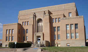
Cottle County is a county in the state of Texas. Based on the 2010 census, its population was 1,505. Its county seat is Paducah. The county was founded in 1876 and later organized in 1892. It is named for George Washington Cottle,who died defending the Alamo.
Etymology - Origin of Cottle County Name
George Washington Cottle, who died defending the Alamo
Demographics:
County QuickFacts: CensusBureau Quick Facts
Cottle County History
Cottle County is a county in the US state of Texas. Cottle is named for George Washington Cottle, who died defending the Alamo. Its seat is Paducah.
Handbook of Texas Online
A killing on the county line in 1889 induced residents to petition for county organization so that the suspect's
trial could be held in the county. Cottle County was organized in 1892, with Paducah as county seat; four public
school districts were established that year. Cottle County voters supported the Democratic candidate for president
in 1892 and continued to support Democrats in national races through 1992, with the single exception of 1928. In
1893 the county's first newspaper, the Paducah Post, began to print, and the state legislature authorized a
$12,000 bond to build a county jail. More at
John Leffler, "COTTLE COUNTY," Handbook of Texas Online (http://www.tshaonline.org/handbook/online/articles/hcc24),
accessed January 23, 2016. Uploaded on June 12, 2010. Published by the Texas State Historical Association.
Geography: Land and Water
As reported by the Census Bureau, the county has a total area of 902 square miles (2,335 km2), of which, 901
square miles (2,334 km2) of it is land and 1 square miles (1 km2) of it (0.05%) is water.
Neighboring Counties
Bordering counties are as follows:
- Childress County (north)
- Hardeman County (northeast)
- Foard County (east)
- King County (south)
- Motley County (west)
- Hall County (northwest)
Education


Click Image to Enlarge
