


Click Image to Enlarge
Texas Counties
Texas is divided into two hundred and fifty-four counties, more than any other state. Texas was originally divided into municipalities, a unit of local government under Spanish and Mexican rule. When the Republic of Texas gained its independence in 1836, there were 23 municipalities, which became the original Texas counties. Many of these would later be divided into new counties. The most recent county to be created was Kenedy County in 1921. The most recent county to be organized was Loving County in 1931King County, Texas
King County Education, Geography, and History
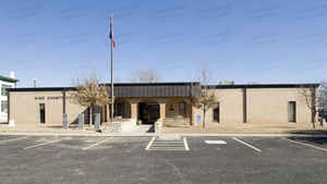
King County is a county located in the state of Texas. Based on the 2010 census, its population was 286, making it the second-least populous county in Texas and the third-least populous of any county in the United States. King County has no incorporated communities. Its county seat is the Census Designated Place of Guthrie The county was created in 1876 and organized in 1891. It is named for William Philip King, who died at the Battle of the Alamo.
Etymology - Origin of King County Name
William Phillip King, who died at the Battle of the Alamo
Demographics:
County QuickFacts: CensusBureau Quick Facts
King County History
Apache and Comanche were early tribes in the area. The Red River War of 1874-1875 was a United States Army campaign to
force the removal of Natives in Texas and their relocation to reservations, to open the region to white settlers.
On August 21, 1876, the Texas legislature formed King County from Bexar County. By 1880 the United States Census counted forty residents in
the county. In 1891, the county was organized. Guthrie was designated as the county seat. The county was named for William Philip King, who died at the Battle of the Alamo.
Handbook of Texas Online
The area that is now King County was occupied by Apache Indians until the early eighteenth century, when Comanches
moved into the region. Comanches of the Wanderers band controlled the area until the late nineteenth century. The
material culture of the Wanderers reflected the tribe's nomadic habits. Their tepees were easily moved and set up as
they roamed the area hunting buffalo and other game, as well as the several
plants the group used for food. Like other Comanche bands, the Wanderers were fierce warriors, skilled horsemen, and
relentless raiders. In the 1870s the United States Army pushed the Indians out of the area and opened the region to
white settlement. On August 21, 1876, the Texas legislature formed King County from lands previously assigned to
Bexar County. By 1880 the United States Census counted forty residents in the county. Some of the earliest settlers
were Isom Lynn, A. C. Tackett, Brants Baker, and Bud Arnett. In 1890 there were twenty ranches and farms
encompassing 4,413 acres in the county, and the population had grown to 173. In 1891, the county was organized, with
the small town of Guthrie designated as the county seat. By 1900 the county had fifty-three farms and ranches,
encompassing more than 480,232 acres. The population had grown to 490 More at
John Leffler, "KING COUNTY," Handbook of Texas Online (http://www.tshaonline.org/handbook/online/articles/hck08),
accessed January 24, 2016. Uploaded on June 15, 2010. Published by the Texas State Historical Association.
Geography: Land and Water
As reported by the Census Bureau, the county has a total area of 913 square miles (2,366 km2), of which, 912
square miles (2,363 km2) of it is land and 1 square miles (3 km2) of it (0.11%) is water.
Neighboring Counties
Bordering counties are as follows:
- Cottle County (north)
- Foard County (northeast)
- Knox County (east)
- Stonewall County (south)
- Dickens County (west)
Education


Click Image to Enlarge
