


Click Image to Enlarge
Texas Counties
Texas is divided into two hundred and fifty-four counties, more than any other state. Texas was originally divided into municipalities, a unit of local government under Spanish and Mexican rule. When the Republic of Texas gained its independence in 1836, there were 23 municipalities, which became the original Texas counties. Many of these would later be divided into new counties. The most recent county to be created was Kenedy County in 1921. The most recent county to be organized was Loving County in 1931Newton County, Texas
Newton County Education, Geography, and History
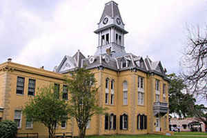
Newton County is the easternmost county in the state of Texas. Based on the 2010 census, its population was 14,445.Its county seat is
Newton. The county is named for John Newton, a veteran of the American Revolutionary War.
Newton County is included in the Beaumont-Port Arthur, TX Metropolitan Statistical Area.
Etymology - Origin of Newton County Name
John Newton, a veteran of the Revolutionary War
Demographics:
County QuickFacts: CensusBureau Quick Facts
Newton County History
Newton County is the easternmost county in the US state of Texas. Its county seat is Newton. Newton county is named for John Newton, a veteran of the American Revolutionary War.
Handbook of Texas Online
Newton County (L-22) is in southeastern Texas on the Louisiana border. Newton, the geographic center and largest
town of the county, is seventy miles northeast of Beaumont at 30051' north latitude and 93045' west longitude.
Newton County comprises 950 square miles of the lower regions of the East Texas timber belt. Common trees include
longleaf and shortleaf pines, oak, magnolia, hickory, and cypress. The rolling terrain, dominated by loamy topsoils,
ranges from 30 to 300 feet above sea level. The Sabine River forms the county's eastern boundary. Major tributaries
in the county include, from north to south, Little Cow Creek, Quicksand Creek, Big Cow Creek, and Big Cypress Creek.
Oil and gas dominate the county's mineral resources. Temperatures range from an average high in July of 930 F to an
average January low of 400 F. Rainfall averages just over fifty-four inches annually, the highest for any county in
the state. The growing season extends for 228 days per year. Indians were the earliest human inhabitants of Newton
County. Artifacts attributed to members of the Caddo confederacies have been located in present-day Newton County.
The Atakapans, whose name means "man-eaters" in Choctaw, occupied the coastal regions around the Sabine River and
may also have ventured into Newton County. The Coushattas, who migrated to lower East Texas during the early 1800s,
also came through the county. In fact, one of the earliest trails through the area was known as the Coushatta Trace.
The lands which eventually comprised Newton County were included in Lorenzo de Zavala's
1829 grant from the Mexican government. At least twenty-one settlers received title to land now in the county in
1834 and 1835. Most of the area of present-day Newton County was part of the Municipality of Liberty from 1831 to
1834 and the Municipality of Bevil, which later became Jasper County, from 1834 to 1846. The area north of the
Little Cow Creek, which includes one-fifth of the present county, was within the Municipality of San Augustine in
1834-35 and the Municipality of Sabine from 1835 to 1837, before becoming part of Jasper County in 1837. The state
legislature marked off Newton County on April 22, 1846, from the eastern half of Jasper County and named it in honor
of John Newton, a veteran of the American Revolution. The county's boundaries have remained unchanged since that
time save for a small cession along the western border to Jasper in 1852. More at
Robert Wooster, "NEWTON COUNTY," Handbook of Texas Online (http://www.tshaonline.org/handbook/online/articles/hcn03),
accessed January 24, 2016. Uploaded on June 15, 2010. Published by the Texas State Historical Association.
Geography: Land and Water
As reported by the Census Bureau, the county has a total area of 940 square miles (2,433 km2), of which, 933
square miles (2,416 km2) of it is land and 7 square miles (17 km2) of it (0.73%) is water.
Neighboring Counties
Bordering counties are as follows:
- Sabine County (north)
- Vernon Parish, Louisiana (northeast)
- Beauregard Parish, Louisiana (east)
- Calcasieu Parish, Louisiana (southeast)
- Orange County (south)
- Jasper County (west)
Education


Click Image to Enlarge
