


Click Image to Enlarge
Texas Counties
Texas is divided into two hundred and fifty-four counties, more than any other state. Texas was originally divided into municipalities, a unit of local government under Spanish and Mexican rule. When the Republic of Texas gained its independence in 1836, there were 23 municipalities, which became the original Texas counties. Many of these would later be divided into new counties. The most recent county to be created was Kenedy County in 1921. The most recent county to be organized was Loving County in 1931Oldham County, Texas
Oldham County Education, Geography, and History
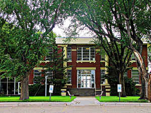
Oldham County is a county located in the state of Texas. Based on the 2010 census, its population was 2,052. Its county seat is Vega. The
county was created in 1876 and organized in 1881.
Oldham County is included in the Amarillo, TX Metropolitan Statistical Area.
Etymology - Origin of Oldham County Name
Williamson Simpson Oldham, a Confederate legislator in Texas
Demographics:
County QuickFacts: CensusBureau Quick Facts
Oldham County History
Oldham County was formed in 1876 and organized in 1881, and named for Williamson Simpson Oldham, Sr., a Texas pioneer and Confederate Senator. At the time of its organization, nearly the entire county was a part of the XIT Ranch. The county seat was originally at the town of Tascosa, which in the 1880s was one of the largest towns in the Panhandle. As the railroads came through the county, however, they bypassed Tascosa; several new towns and farms sprang up along the rail lines, and by 1915 Tascosa had a courthouse and almost no residents; the county seat was moved to Vega that year.
Handbook of Texas Online
Oldham County's history has revolved around the Canadian River, which runs in an east-west direction across the
northern part of the county. Archeological investigations, beginning with the 1932 excavations of Saddleback Mesa,
have unearthed evidence of the Panhandle Pueblo culture. Petroglyphs and other artifacts attest to the presence of
other pre-Columbian peoples. Plains Apaches, followed by the warlike Comanches and Kiowas, found refuge in the
breaks of the Canadian. Various Spanish entradas utilized the river as they traveled eastward from New Mexico.
Probably both the expedition of Francisco Vaquez de Coronado (1541-44) and the
O?te expedition of 1601 crossed the area. It is fairly certain that Pedro Vial
passed through in 1786 and 1788. The Facundo Melgares party came through the county as it searched for Zebulon M.
Pike in 1806. Likewise, the ciboleros and Comancheros
from northern New Mexico all used the Canadian as a major trade route; indeed, the Atascosa Springs area was a
frequent trading ground for Comancheros and their Indian customers. Stephen H. Long, Josiah Gregg, James W. Abert,
Randolph B. Marcy, and W. W. Whipple led their pathfinding expeditions along
the Canadian valley through the area during the early nineteenth century. Buffalo
hunters established temporary camps in the area in the 1870s, and they were soon joined by ranchers and pastores.
In 1876 the Texas legislature established Oldham County from the huge original Bexar County, and the county was
organized in 1880, with Tascosa as the county seat. Caleb B. (Cape) Willingham
became the first sheriff, C. B. Vivian was elected county clerk, and William S. Mabry
was made county surveyor. Sixteen unorganized Panhandle counties were attached to Oldham County for administrative
purposes. A population of 287 in 1880 made the county the second most populous of the Panhandle area; only Wheeler
County, on the east side of the Panhandle, had more residents. The ranching industry of Oldham County began very
soon after the Red River War of 1874-75 forced the Comanches and other Plains
nomads onto reservations in Indian Territory. Soon after the Indian removal, Casimiro Romero
and his fellow pastores from New Mexico established sheep ranches, dotted with stone and adobe plazas,
throughout the area, along the Canadian River and its tributaries. As a result Mexican-American settlers outnumbered
Anglo-Americans for some time. The situation began to change in 1877, when George W. Littlefield started his LIT
Ranch just east of Tascosa. Between 1879 and 1881 W. M. D. Lee
and his partners bought out many of the pastores and established the LE and LS ranches,
supplanting the sheep with cattle. In 1882 the Capitol Syndicate marked off a large amount of Oldham County lands
for use in its famous XIT Ranch. Only the southeastern part of the county fell
outside the XIT after that time. Following a certain amount of property exchanging and dislocation within the local
ranching industry, other ranches (the LX and the Frying Pan, for instance)
occupied Oldham County acreage More at
Donald R. Abbe and John Leffler, "OLDHAM COUNTY," Handbook of Texas Online (http://www.tshaonline.org/handbook/online/articles/hco02),
accessed January 24, 2016. Uploaded on June 15, 2010. Published by the Texas State Historical Association.
Geography: Land and Water
As reported by the Census Bureau, the county has a total area of 1,501 square miles (3,889 km2), of which, 1,500 square miles (3,887 km2) of it is land and 1 square miles (2 km2) of it (0.05%) is water.
Oldham County is primarily ranch and farm land, with many thousands of acres planted in wheat, the major crop. The county also has some
petroleum production and large wind farms. In 1902, the Matador Ranch acquired the 210,000 acres (850 km2) Alamositas Ranch in Oldham County.
At its peak, the Matador owned 90,000 cattle and had title to 879,000 acres (3,560 km2) of land in parts of four Texas counties.
Neighboring Counties
Bordering counties are as follows:
- Hartley County (north)
- Moore County (northeast)
- Potter County (east)
- Deaf Smith County (south)
- Quay County, New Mexico (west)
Education


Click Image to Enlarge
