


Click Image to Enlarge
Texas Counties
Texas is divided into two hundred and fifty-four counties, more than any other state. Texas was originally divided into municipalities, a unit of local government under Spanish and Mexican rule. When the Republic of Texas gained its independence in 1836, there were 23 municipalities, which became the original Texas counties. Many of these would later be divided into new counties. The most recent county to be created was Kenedy County in 1921. The most recent county to be organized was Loving County in 1931San Patricio County, Texas
San Patricio County Education, Geography, and History
San Patricio County is a county located in the state of Texas. Based on the 2010 census, the population was 64,804. Its county seat is
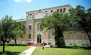
Sinton.
San Patricio County is part of the Corpus Christi, TX Metropolitan Statistical Area.
Etymology - Origin of San Patricio County Name
the Mexican Municipality of San Patricio
Demographics:
County QuickFacts: CensusBureau Quick Facts
San Patricio County History
In 1828, 200 Irish Catholic families, recruited from Ireland and the Irish population of New York City, contracted with the Mexican government to settle on 80 leagues of land in this area. By 1836, about 500 people lived in the colony on 84 Mexican land grants. During the Texas Revolution, most fled from the colony because of fighting in the area. By 1841, a small number of permanent residents had returned. When Texas was annexed by the United States in 1845, the area was stabilized by the presence of US troops under Gen. Zachary Taylor. In 1845, the county was formed (San Patricio is Spanish for Saint Patrick, the primary patron saint of the colonists home country of Ireland), and Corpus Christi was designated as the county seat. The following year, the county south of the Nueces River was reorganized as Nueces County, and San Patricio became its county seat. In 1848, additional counties were formed out of San Patricio, which further reduced its size. Its county seat is Sinton
Handbook of Texas Online
In 1828 empresarios John McMullen and James McGloin contracted with the
government of Mexico to settle 200 Irish Catholic families on eighty leagues of land in the area. The first groups
of families, recruited from the Irish population of New York, landed at El C?ano and Matagorda in late 1829; two
other groups soon followed. After a brief stopover at the old Refugio mission, the colonists proceeded to the north
side of the Nueces River and established the town of San Patricio de Hibernia, named after the patron saint of
Ireland. In 1834 the colony was legally established as the Municipality of San Patricio in the Mexican state of
Coahuila and Texas. By 1836 eighty-four land grants had been made in the colony,
and about 500 people were living there. The area was engulfed in fighting during the early stages of the Texas
Revolution. Fort Lipantitlan, built in 1833 across the Nueces near the colony,
surrendered to a company of the colony's settlers in 1835. In February 1836 a detachment of Texans commanded by
Francis W. Johnson encountered a Mexican force in the town of San Patricio. All
but four of the Texans were killed or captured. Most of the colonists subsequently moved to Victoria and other
havens. San Patricio County was established in 1836 by the Congress of the new Republic of Texas.
Far larger than the current county, the original San Patricio County included territory later incorporated into
other counties. Its original residents were slow to move back into the area, however, for fear of the periodic
Mexican incursions; a Mexican force under Gen. Rafael Vasquez raided the San
Patricio area as late as 1842. The county was officially designated a "depopulated area" by the government during
most of this time, though traders, soldiers, and various adventurers traveled through. By 1841 San Patricio County
once again had a small number of more or less permanent residents. The area was not really stabilized, however,
until Gen. Zachary Taylor moved his army into the region after Texas was annexed
by the United States in 1845. Taylor's army briefly camped near the site of present Rockport, and after the Mexican
War began, reinforcements and supplies for the American army flowed through the
county. In 1845 Corpus Christi was designated the county's seat of government and remained so until 1846, when San
Patricio County lost all of its territory south of the Nueces River to the newly established Nueces County. That
year the town of San Patricio became San Patricio County's seat. In 1848 more new counties were formed, and the
county was further reduced in size More at
Keith Guthrie, "SAN PATRICIO COUNTY," Handbook of Texas Online (http://www.tshaonline.org/handbook/online/articles/hcs04),
accessed January 24, 2016. Uploaded on June 15, 2010. Modified on January 31, 2012. Published by the Texas State Historical Association.
Geography: Land and Water
As reported by the Census Bureau, the county has a total area of 707 square miles (1,831 km2), of which, 692
square miles (1,791 km2) of it is land and 15 square miles (40 km2) of it (2.18%) is water.
Neighboring Counties
Bordering counties are as follows:
- Bee County (north)
- Refugio County (north)
- Aransas County (northeast)
- Nueces County (south)
- Jim Wells County (southwest)
- Live Oak County (northwest)
- The Gulf of Mexico is situated to the east of the county.
Education


Click Image to Enlarge
