


Click Image to Enlarge
Texas Counties
Texas is divided into two hundred and fifty-four counties, more than any other state. Texas was originally divided into municipalities, a unit of local government under Spanish and Mexican rule. When the Republic of Texas gained its independence in 1836, there were 23 municipalities, which became the original Texas counties. Many of these would later be divided into new counties. The most recent county to be created was Kenedy County in 1921. The most recent county to be organized was Loving County in 1931Wise County, Texas
Wise County Education, Geography, and History
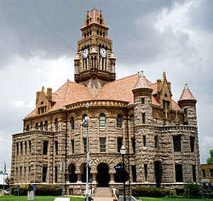
Wise County is a county located in the state of Texas. Based on the 2010 census, the population was 59,127. Its county seat is Decatur.
Wise County is part of the Dallas-Fort Worth-Arlington, TX Metropolitan Statistical Area.
Etymology - Origin of Wise County Name
Henry Alexander Wise, the future thirty-eighth governor of Virginia who supported the annexation of Texas while a member of the United States House of Representatives
Demographics:
County QuickFacts: CensusBureau Quick Facts
Wise County History
On November 10, 1837 the Battle of the Knobs was fought in what is now Wise County between about 150 Indian warriors and just 18 Republic of Texas soldiers under Lieutenant A. B. Benthuysen. Despite being heavily outnumbered, the Texas soldiers held their ground, with an estimated 50 Indians killed or wounded and 10 of the Texans dead. Settlers began coming into the area not long afterwards. Wise County itself was founded in 1856. It was named after Virginia Congressman Henry A. Wise, who had supported Texas annexation by the United States Its county seat is Decatur.
Handbook of Texas Online
The first known inhabitants of Wise County were probably Wichita Indians, a nomadic plains group that depended
upon the buffalo for food and other necessities. In 1540, when the Coronado
expedition came through the area east of the site of present Decatur, there were
several Indian villages between the Trinity and Red rivers. The Wichita period ended around 1835, as various Caddo
Indian groups filtered into the region. At the time that the first white settlers came to the area, one village of
approximately sixty-five Delaware Indians led by Jim Ned remained in Wise
County. Jim Ned and his peaceful band befriended the whites, and various hills, streams, and communities were named
after the Indian leader. Hostile groups of Kichai Indians also lived in the area near Bridgeport during the period,
and they raided white communities in Fannin County. Generals Edward H. Tarrant and James Smith
led expeditions against them during the 1840s and early 1850s. By 1855 the permanent Indian settlements had moved to
reservations in West Texas. The history of white settlement in Wise County began with Sam Woody, who moved to Deep
Creek (then in Cooke County) in 1854. His original log cabin remains as a historic site. Many other settlers, eager
to take advantage of the state preemption grants of 160 acres of land, followed Woody into the area. District
surveyors from Cooke County in the north and Denton County to the east mapped out the area, most of which was drawn
from Cooke County. Wise County was officially established by legislative act on January 23, 1856, and was named in
honor of Henry A. Wise, a United States Congressman from Virginia, who, during the 1840s, supported the annexation
of Texas. The county seat, Decatur (originally named Taylorsville), was selected by a countywide election and,
though challenged after the courthouse burned in 1895, has remained the seat of government to the present. The
majority of Wise County settlers were immigrants from southern states, though only fifty-three of the county's 3,160
white residents owned slaves in 1860. Prior to the Civil War cattle and sheep
production were the major industries; cotton was not introduced into the county until the 1870s. Most residents
engaged in open-range ranching through the 1880s; the two most prominent ranches, owned by W. H. Hunt and Daniel
Waggoner, were located in western Wise County. The predominantly southern
populace supported secession in 1861 and raised five Confederate companies that
fought in the Civil War. The removal of federal troops from the frontier left outlying settlements at the mercy of
hostile Comanches and other plains Indians. Texas militia units, formed to patrol from the Red River to the Rio
Grande, set up a post in Decatur. Local volunteer groups also defended the frontier communities. Nevertheless, many
farms were abandoned, as fearful residents moved into towns for protection against Indian attack. More at
B. Jane England, "WISE COUNTY," Handbook of Texas Online (http://www.tshaonline.org/handbook/online/articles/hcw14),
accessed January 24, 2016. Uploaded on June 15, 2010. Published by the Texas State Historical Association.
Geography: Land and Water
As reported by the Census Bureau, the county has a total area of 923 square miles (2,390 km2), of which, 905
square miles (2,343 km2) of it is land and 18 square miles (47 km2) of it (1.97%) is water.
Neighboring Counties
Bordering counties are as follows:
- Montague County (north)
- Cooke County (northeast)
- Denton County (east)
- Tarrant County (southeast)
- Parker County (south)
- Jack County (west)
Education
The following school districts lie entirely within Wise County:
Alvord Independent School District
Boyd Independent School District
Bridgeport Independent School District
Chico Independent School District
Decatur Independent School District
Paradise Independent School District
Northwest Independent School District
Slidell Independent School District
The following private educational institutions serve Wise County:
Victory Christian Academy
The following higher education institutions serve Wise County:
Weatherford College


Click Image to Enlarge
