

Highest Peaks & Summits in the US
Highest Mountain and Peaks in each of the US States
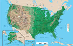
Profiles the highest mountain in each of the 50 US states with a brief description, elevation, and ranking. Links to an interactive topo map of each high point.
WARNING: Wilderness conditions can change suddenly. All hikers should plan accordingly, including bringing flashlight, first aid equipment, extra food and clothing. Weather conditions may alter your plans; you should always be prepared to spend an unplanned night in the woods before entering the back country. Back country hiking trails can be rugged and rough - they are not maintained as park walkways - wear proper footwear!
Highest Peaks (Mountains) |
||
|---|---|---|
| State Rank |
Peak |
Elev (Feet) |
| Alabama 35 |
Cheaha Mountain | 2,405 |
| The Creek Indians named it Cheaha meaning "high place" - an appropriate name, as Cheaha Mountain in Lineville, Alabama is the highest point in Alabama, at 2,407 feet above sea level.Cheaha Mountain dominates the skyline of nearby towns in Eastern Alabama. It stands only 2,407' high, but stands 1,500' above the surrounding plains. Thick forests cover the mountain, while providing rock climbing areas such as the Rock Garden, Pulpit Rock, and Bald Rock and various hiking trails. Cheaha State Park offers a lodge, a resturant and other amenities. Visitors can overlook the valley from the park's restaurant. | ||
| Alaska 01 |
Mount McKinley | 20,320 |
| Mount McKinley is the highest peak in North America. It's official elevation is 20,310 feet (6,190 m) established by the United States Geological Survey in September, 2015. It is a huge snowy mass, flanked by five giant glaciers, Peters Glacier, Muldrow Glacier, Traleika Glacier, Ruth Glacier and Kahiltna Glacier. Kahiltna Glacier is the longest glacier in the Alaska range. Mount McKinley dominates the horizon from as far south as Cook Inlet, 200 miles away, and as far north as Fairbanks, 150 miles away. Its steep unbroken south slope rises 17,000 feet in twelve miles. Five major ridges extend from the summit, and many spurs and buttresses extend from these. | ||
| Arizona 12 |
Humphreys Peak | 12,633 |
| Humphreys Peak is the highest peak in Arizona. It was named after General A.A. Humphreys, a US chief of Engineers. Humphreys Peak rises in the Kachina Peaks Wilderness Area, immediately north of Flagstaff. The area is volcanic in origin, as is apparent by the conal shapes of some of the neighboring peaks. There are two main routes that lead to the top. The Humphreys Peak Trail and the Weatherford Trail, but Humphreys is now heavily eroded and has lost its symmetry. On a clear day on the summit, the view to the northwest includes the rim of the Grand Canyon. Usual access to Humphreys is via the Arizona Snow Bowl, a popular ski lodge located just south of the mountain. Humphreys Peak is sacred to several Native American tribes. | ||
| Arkansas 34 |
Mount Magazine (Signal Hill) | 2,753 |
| At 2,753 feet, Mount Magazine is Arkansas's highest mountain. The peak is in the Boston Mountains. Two peaks are situated atop the plateau, Signal Hill and Mossback Ridge. From Cameron Bluff, the trail winds down the mountain to a broad bench where virgin oak, gum and ash are found. This trail is listed in both the day and overnight hiking sections due to the versatility offered by the variety of access points, distances, and terrain. Signal Hill and the Greenfield and East End picnic areas are near the summit. Mount Magazine is the site of the annual "Mount Magazine International Butterly Festival". This is truly a unique mountain setting, offering some of the most expansive views in Arkansas. | ||
| California 02 |
Mount Whitney | 14,494 |
| Mount Whitney, is in the Sierra Nevada range of mountains, and is in California, it reaches a height of 4417m (14,494 ft). It is the highest summit in the 48 American joined states. The peak is reachable by an 11-mile hiking trail. Wilderness permits are required year-round and overnight camping is subject to a quota between late May and mid-October. Mount Whitney is the 17th highest in America. During the winter months opportunities exist for sking and snowbording. The Mount Whitney Trail is the easiest and most popular route to the summit, other most favorite trails are, Mountaineers' Route, East Face, East Buttress, and the North Slope. | ||
| Colorado 03 |
Mount Elbert | 14,433 |
| Mt. Elbert at 14,433 ft elevation is the highest point in Colorado. It is the second highest mountain in the adjacent 48 states. (Mount Whitney, 14,494 ft., is highest). Located in the Sawatch Range in the Colorado Rockies, Elbert is a massive mountain, easily ascended by its long, smooth ridges. There are five main routes to the summitt, the two most popular routes are, the South Mt. Elbert Trail and the North Mt. Elbert Trail, both being well travelled. Samuel H. Elbert (1833-1899) was an outstanding and widely known civic leader in the Territory and State of Colorado. Mt. Elbert, Elbert County, and the town of Elbert, Colorado were all named in his honor. | ||
| Connecticut 36 |
Frissell-S. Slope | 2380 |
| While Bear Mountain is the highest summit in Connecticut, the highest point in that state is on the south slope of Mount Frissell, along the Mount Frissell trail, a little to the west of the summit. Mount Frissell is one of only three US state highpoints that are the highest point in the state but not exactly the summit of a mountain. | ||
| Delaware 49 |
Ebright Azimuth | 442 |
| The highest benchmark monument in Delaware is located on Ebright Road. This horizontal control mark denotes an elevation of 447.85 feet above sea level. The Delaware Geological Survey through its relationship with the National Geodetic Survey has determined that this benchmark monument is in the vicinity of the highest natural elevation in the state. | ||
| Florida 50 |
Lakewood (Britton Hill) | 345 |
| The highest point in the state is Britton Hill in Lakewood Park near the Alabama border. It is part of a small forest, soaring to 345 feet above sea level, this high point is the lowest of the 50 states. Only rarely is it snow-capped. It is the only state highest point comprised of sand. Britton Hill is named for the retired postmistress of Lakewood. It is located in Paxton, Florida. | ||
| Georgia 25 |
Brasstown Bald | 4784 |
| The highest point in the state of Georgia is Brasstown Bald, located about 45 minutes from the town of Helen. It lies close to the North Carolina border and is in the heart of the Appalachian Mountain chain. It is about and hour and a half north of Atlanta. Brasstown Bald rises beautifully 4,784 feet above sea level. On clear days, four states can be seen from the summit of the Bald. | ||
| Hawaii 06 |
Mauna Kea | 13796 |
| Mauna Kea is the tallest mountain in the Hawaiian Chain. Its summit rises to an elevation of 4,205m above sea level and it is located on the island of Hawaii. The Mauna Key Trail is six miles in length (one way). It is the second largest in subaerial surface area of the five shield volcanoes that comprise the island of Hawaii. | ||
| Idaho 11 |
Borah Peak | 12662 |
| At an elevation of 12,662 feet Borah Peak is the highest peak in Idaho. Borah Peak lies in the Lost River Range of the Challis National Forest in East-Central Idaho, rising above a fairly arid region. The Peak consists of bare grey limestone. The standard route to the summit is fittingly named Chickenout Ridge. In 1934 it was named for state senator, William Borah. | ||
| Illinois 45 |
Charles Mound | 1235 |
| Charles Mound, hill, an ancient burial mound 1,235 ft. (378 m) high, NW Illinois, near the town of Galena and less than 1/2 mile from the Wisconsin line. The area actually has some rolling hills in a land of plains, Charles Mound stands as the tallest natural feature in Illinois at 1,235 feet above sea level. | ||
| Indiana 44 |
Hoosier Hill | 1257 |
| The highest point in Indiana is Hoosier Hill in Franklin Township at 1,257 feet above sea level. The highpoint is in Wayne County - about 10 miles north of I-70. The actual highpoint is privately owned. Road signs indicate the location of the highpoint. | ||
| Iowa 42 |
Hawkeye Point | 1670 |
| Southeast of the town of Ocheyedan, the Mound rises an impressive 170 feet above the surrounding flood plain. It is one of the highest points in Iowa--1670 feet above sea level. The material making up the Mound is chiefly sand and gravel with small boulders of various types, including rocks of many different kinds. There are granites, Sioux quartzite and limestone. While the site is privately owned, the owners have supported the site as a tourist destination and have worked with the county to make sure it is easy to get to. | ||
| Kansas 28 |
Mount Sunflower | 4039 |
| At 4,039 feet above sea level, Mount Sunflower is the highest point in Kansas. Located in Wallace County, just east of the Kansas/Colorado border, Mount Sunflower is more than 3,300 feet above the state's topographic low point in Montgomery County in southeastern Kansas. Much of Mount Sunflower's elevation is due to the uplift of the Rocky Mountains to the west. | ||
| Kentucky 27 |
Black Mountain | 4145 |
| Black Mountain runs along the Kentucky-Virginia border through Harlan and Bell counties. The highest point in Kentucky, 4,145 feet above sea level, is on Black Mountain near Lynch in Harlan county. Black Mountain is tied to the coal mining of the surrounding area. The summit is reached by a narrow road that turns off to the right coming from Appalachia, Virginia. The FAA radar dome is nearby, but below the summit. | ||
| Louisiana 48 |
Driskill Mountain | 535 |
| Driskill Mountain, located 7 miles southeast of Arcadia, is the highest point in Louisiana at 535 feet above sea level and is the third lowest in the country. This area is very densely forested. | ||
| Maine 22 |
Katahdin (Baxter Peak) | 5267 |
| Katahdin is a huge mountain with several summits, somewhat shaped like a horseshoe. Baxter Peak, the 5,267 foot high point, is the northern terminus of the Appalachian Trail. A narrow ridge called the Knife Edge connects Baxter Peak to South Baxter Peak, Chimney Peak, and Pamola Peak. The mountain being a mile above sea level towers above low Maine lakes and forests. The flowers and wildlife found on this mountain are typical of the mountains found in northern New England. | ||
| Maryland 32 |
Backbone Mountain | 3360 |
| The highest point in Maryland is Hoye-Crest on Backbone Mountain, at 3,360 feet above sea level about two miles north of the mountain's highest point in West Virginia. Backbone Mountain is a long ridge that runs diagonally southwest-to-northeast in the extreme southwest corner of Maryland, extending into West Virginia. It is a ridge of the Allegheny Mountains. | ||
| Massachusetts 31 |
Greylock | 3491 |
| Mount Greylock is located in the Berkshire Mountains. The 3,491-foot peak, accessible by car, is the highest peak in Massachusetts, and offers visitors views of up to 100 miles. The summit offers great views of the Green Mountains to the north, Catskills to the southwest, and the Adirondacks to the northwest. On a clear day you can see the White Mountains of New Hampshire. The 92-foot high War Veteran's Memorial Tower, built in 1932 (restored in 1975)is open daily during the summer and fall. | ||
| Michigan 38 |
Mount Arvon | 1979 |
| Mount Arvon is located in the Huron mountain range in the north central upper peninsula. Mount Curwood in Baraga County was recognized as thehighest point in Michigan. In 1982, however, the US Department of Interior's Geological Survey team gathered new measurements and found Mount Curwood to be slightly lower in elevation than nearby Mount Arvon. Mount Curwood measured 1,978.24 feet above sea level and Mount Arvon registered at 1,979.238 feet above sea level. | ||
| Minnesota 37 |
Eagle Mountain | 2301 |
| Eagle Mountain is the tallest point in the state of Minnesota. It rises over 300 feet above Brule Lake in the Boundry Waters Canoe Area. The US Geological Survey has installed a metal plaque marking Minnesota's official highest point. The hike to the summit can be made in about 2 1/2 hours. At 2,301 feet above sea level, the peak is lofty for a Midwestern summit, but small by mountaineering standards. | ||
| Mississippi 47 |
Woodall Mountain | 806 |
| Woodall Mountain, near Iuka, is the state's highest point of elevation, and rests peacefully at the base of the Appalachian Mountains. Pickwick Lake and Tishomingo State Park are popular stops. A brushy ravine separates the eastern and western summits of the mountain. | ||
| Missouri 41 |
Taum Sauk | 1772 |
| Taum Sauk Mountain stands above others as the highest point in Missouri, rising to 1,772 feet located in the St. Francois Mountains. Almost 1.5 billion years ago, volcanic eruptions of hot ash settled and cooled to form rhyolite. Erosion has left only the roots of these mountains behind, now dotted by oak-hickory forest and rocky glades. | ||
| Montana 10 |
Granite Peak | 12799 |
| The Custer National Forest is home to 12,799 ft. Granite Peak, the tallest mountain in Montana. Granite Peak is located in the Absaroka-Beartooth Wilderness, an arduous 21 to 25 mile trek (round trip) from either of three approaches. | ||
| Nebraska 20 |
Panorama Point | 5424 |
| In the extreme southwest corner of the Banner County, thirty three miles from Kimball, rises the highest point in Nebraska overlooking three states, Nebraska, Colorado and Wyoming. This site, 5,424 feet above sea level, looks more like a rise in a pasture than the highest point in the state. | ||
| Nevada 09 |
Boundary Peak | 13143 |
| Of the 11.86 million acres of the heavily visited Inyo National Forest split between Nevada and California, only 60,654 lie in Nevada. In that portion, you will find this one lonely Wilderness, the state's smallest. But this Wilderness makes up in height what it lacks in size, with Boundary Peak, at 13,140 feet, rating as the highest point in Nevada. The peak overlooks, as might be expected, the California border, and rises above the White Mountains, a high and dry range from which colorful canyons descend eastward into desert land. | ||
| New Hampshire 18 |
Mount Washington | 6288 |
| The highest mountain in the northeast, Mount Washington. There is Cog Railroad running to the summit from the west and an auto road from the east. South of the peak is the AMC's Lakes of the Clouds hut. At the base of the east side is the AMC's Pinkham Notch Visitors Center. The highest surface wind ever recorded on earth was on the summit of Mt Washington, 231 MPH on April 12, 1934 | ||
| New Jersey 40 |
High Point | 1803 |
| The High Point monument is located in Montague Township at the highest point in the state of New Jersey. From the parking lot, 1,803 feet above sea level, or the observation deck 220 feet up you can see for miles around. On a clear day you can see New Jersey, New York, and Pennsylvania. | ||
| New Mexico 08 |
Wheeler Peak | 13161 |
| The Wheeler Peak Wilderness includes almost 20,000 acres. Lying along the top of the Sangre De Cristo mountain range Wheeler Peak Wilderness is characterized by high rugged terrain. Elevations range from a low of 7,650 feet to a high of 13,161 feet at Wheeler Peak, the highest point in the State of New Mexico. | ||
| New York 21 |
Mount Marcy | 5344 |
| The highest point in New York, situated in New York's Adirondack Park, a rugged 335,000-acre High Peaks Wilderness, the largest wild area in the East. | ||
| North Carolina 16 |
Mount Mitchell | 6684 |
| In the crest of the timeworn Black Mountains lies the summit of Mount Mitchell, the highest point east of the Mississippi. For those who ascend this peak, will find breathtaking views of the Blue Ridge Mountains, rolling ridges and fertile valleys. The mountain was named for Dr. Elisha Mitchell, professor at the University of North Carolina, who first measured its height in 1835. In 1857, Dr. Mitchell set out to verify his measurement of the peak and perished at the foot of a waterfall on the mountain slope. On the summit is Mount Mitchell State Park, comprised of 1,224 acres. | ||
| North Dakota 30 |
White Butte | 3506 |
| White Butte near Amidon is North Dakota's highest point at 3,506 feet. Pure white sandstone dominates the landscape near South Heart in southwestern North Dakota. | ||
| Ohio 43 |
Campbell Hill | 1550 |
| Also known as Mount Campbell, Campbell Hill is the highest point in Ohio at 1549 feet above sea level. It is located two miles east of Bellefountaine on Rt. 540. During the 1950s, the 664th Aircraft Control and Warning Squadron was stationed on Mount Campbell. Today the Ohio Hi-Point Career Center, a joint-vocational school, is located on the site. | ||
| Oklahoma 23 |
Black Mesa | 4973 |
| Located in Cimarron County, Oklahoma, Black Mesa Nature Preserve consists of approximately 1,600 acres which the Conservancy has conveyed to the Oklahoma Tourism and Recreation Department with a management agreement. The preserve protects about 60% of the mesa top in Oklahoma in addition to talus slopes and plains habitat. A native granite monument marks the highest point in Oklahoma - 4,973 feet above sea level. | ||
| Oregon 13 |
Mount Hood | 11239 |
| Mount Hood (45.4N, 121.7W) is the tallest mountain in Oregon. It is 45 miles (75 km) east-southeast of Portland, Oregon. Mount Hood is a stratovolcano made of lava flows, domes, and volcaniclastic deposits. Most of the volcano is andesite composition. The main cone of Mount Hood formed about 500,000 years ago. In the last 15,000 years the volcano has had four eruptive periods. During the most recent eruptive period, 250-180 years ago, lava domes collapsed and produced numerous pyroclastic flows and lahars which buried the southwest flank of the mountain. | ||
| Pennsylvania 33 |
Mount Davis | 3213 |
| The highest point in Pennsylvania is Mount Davis at 3,213 feet. Mount Davis is located on the next ridge west of the Allegheny Front, in southern Somerset County, which is in the 12th District. This ridge comes into Pennsylvania from West Virginia and stops just north of Mount Davis, while the other ridges in the area run much farther to the north, especially Allegheny Ridge. Mount Davis has an ovservation tower and trails, and is part of Forbes State Forest. | ||
| Rhode Island 46 |
Jerimoth Hill | 812 |
| Rhode Island has two distinct regions: the lowlands of the Narragansett Basin and southern coast and the upland's rolling hills of the north and west. Rhode Island's highest point is only 812 ft, Jerimoth Hill, in Foster. | ||
| South Carolina 29 |
Sassafras Mountain | 3560 |
| Pickens County, northwest South Carolina on North Carolina border 30 miles northwest of Greenville. The summit, owned by the Duke Energy Company, is open to the public without restriction (other than you have to walk 100 yards up a paved trail). It straddles the North Carolina border. | ||
| South Dakota 15 |
Harney Peak | 7242 |
| As well as being the South Dakota high point, Harney Peak is the tallest peak in North America east of the Rocky Mountains. It lies in the beautiful Black Hills, a region with a unique natural history. The range exists like an island in the surrounding prairie grassland. | ||
| Tennessee 17 |
Clingmans Dome | 6643 |
| Rising 6,643 feet above the Great Smoky Mountains, Clingman's Dome is the highest point along the Appalachian Trail and provides a 360?#8218;°view of the surrounding mountains. From it's 54 foot observation tower the average viewing distance is about 22 miles, but on a clear pollution free day, views can amplify as far as 100 miles into 7 states. | ||
| Texas 14 |
Guadalupe Peak | 8749 |
| The highest point in Texas at 8,749 feet. This is part of the Guadalupe Mountains National Park, which is located near the Texas / New Mexico border at the far western edge of our forecast area. | ||
| Utah 07 |
Kings Peak | 13528 |
| Kings Peak is the highest peak in Utah. It is located in the High Uintas Wilderness Area, roughly two hours east of Salt Lake City. The Uintas are the only major mountain range in the United States that run in an east - west direction. They feature several peaks over 4,000 meters. Kings Peak rises just south of the main Uintas crest. | ||
| Vermont 26 |
Mount Mansfield | 4393 |
| Mount Mansfield is the highest of Vermont's peaks at an elevation of 4,393 feet. When viewed from the east, the mountain has a profile of a human face with a forehead, nose, lips, chin and Adam's apple. Mansfield summit (the chin is the highest point) offers views of the Green Mountain range, east to New Hampshire's White Mountains and west across Lake Champlain to New York's Adirondacks. | ||
| Virginia 19 |
Mount Rogers | 5729 |
| The Mount Rogers area contains some of the most rugged terrain and spectacular scenery in Virginia. Mount Rogers, because of its hard, resistant rhyolite bedrock, is the highest point of elevation in the state - 5729 feet above sea level. The region differs climatically from the surrounding area. | ||
| Washington 04 |
Mount Rainier | 14410 |
| Mount Rainier is the highest and third most voluminous volcano of the Cascade Range. The main cone of this stratovolcano has formed since 730,000 years ago. Mount Rainier is potentially the most dangerous volcano in the Cascades because it is very steep, covered in large amounts of ice and snow, and near a large population that lives in lowland drainages. Numerous debris avalanches start on the volcano. The largest debris avalanche traveled more than 60 miles (100 km) to Puget Sound. The most recent eruption was about 2,200 years ago and covered the eastern half of the park with up to one foot (30 cm) of lapilli, blocks, and bombs | ||
| West Virginia 24 |
Spruce Knob | 4863 |
| At 4,861 feet above sea level, Spruce Knob is West Virginia's highest peak. From this rugged alpine peak, you can view grassy openings and pastures or look down on forested ridges as far as the eye can see. | ||
| Wisconsin 39 |
Timms Hill | 1951 |
| Timms hill, the highest point in Wisconsin from across Timms Lake. The state's four highest recorded elevations are Timms Hill, Pearson
Hill, Sugarbush Hill, and Rib Mountain, but none exceeds 2,000 feet in altitude. These sites are concentrated in the north central portion of the state. |
||
| Wyoming 05 |
Gannett Peak | 13804 |
| Gannett Peak is the highest peak in the Wind River Range, and the highest peak in Wyoming. It rises on the Continental Divide, just southeast of Yellowstone National Park and the Teton range. It is a snow peak in a range of rock peaks. It is flanked by five glaciers and its summit is snow-capped. | ||
Almanac Online

Information on people & places that make US a great place to live,
visit, or study.

Search
© Copyright 2004-2024, eRD (eReferenceDesk.com) owned and operated by Joseph L Ferguson. All rights reserved.