


Click Image to Enlarge
Arkansas Counties
The first of the Arkansas' seventy-five present-day counties created, Arkansas County was formed on 13 December 1813, when this area was part of the Missouri Territory.Cleburne County, Arkansas
Cleburne County Education, Geography, and History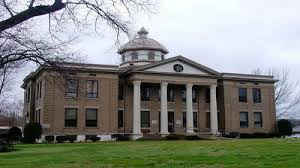
Cleburne County is a county located in the state of Arkansas. Based on the 2010 census, the population was 25,970. The county seat and most populous city is Heber Springs. The county was formed on February 20, 1883 as the last of Arkansas's 75 counties to be formed. Cleburne county is named for Confederate General Patrick Cleburne.
Etymology - Origin of Cleburne County Name
Cleburne county is named for Patrick Ronayne Cleburne, a Confederate general in the Civil War. Patrick Ronayne Cleburne (March 16 or March 17, 1828 - November 30, 1864) was an Anglo-Irish soldier, serving in the British Army and as a major general in the Confederate States Army during the American Civil War, killed at the Battle of Franklin.
Demographics:
County QuickFacts: CensusBureau Quick Facts
Cleburne County History
Cleburne county was created in February 20, 1883, from parts of Independence, Van Buren, and White counties and named for Patrick R. Cleburne, an Arkansas Major General of the Confederate Army, was the 75th and last county formed in Arkansas. The county seat is Heber Springs. The Greers Ferry hydroelectric dam, a 40,000 acre reservoir, made way for a recreational boom that has steadily continued since 1963. Thousands of visitors visit this area each year. Fishing, boating, and hunting in the area are big. A visitors' center, national fish hatchery for rainbow trout, the dam and powerhouse overlook, and a natural trail along with the icy-cold Little Red River filled with trout makes it a popular place. In Heber Springs, a 10-acre city park features seven mineral springs. The beautifully restored courthouse, which sits on the town square, is listed on the National Register of Historical Places. Industrial development, cattle and poultry farming, and tourism makes up the economic base of the county. Fishing tournaments, conventions, reunions, and craft shows provide family entertainment for the local citizens as well as many visitors. Saturday nights come alive in Heber Springs with country music.
Cleburne county is an alcohol prohibition or dry county.
Geography: Land and Water
As reported by the Census Bureau, the county has a total area of 592 square miles (1,530 km2), of which 554 square miles (1,430 km2) is land and 38 square miles (98 km2) (6.5%) is water. Much of the water area in the County includes Greers Ferry Lake, which extends westward into neighboring Van Buren County.
The landscape of the county is rugged: mountainous in the north to rugged, rolling terrain in the south.
Neighboring Counties
Bordering counties are as follows:
- Northeast: Independence County
- Southeast: White County
- Southwest: Faulkner County
- West: Van Buren County
- Northwest: Stone County
Education


Click Image to Enlarge
