


Click Image to Enlarge
Arkansas Counties
The first of the Arkansas' seventy-five present-day counties created, Arkansas County was formed on 13 December 1813, when this area was part of the Missouri Territory.Conway County, Arkansas
Conway County Education, Geography, and History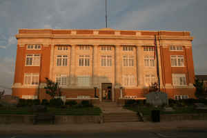
Conway County is a county located in the state of Arkansas. Based on the 2010 census, the
population was 21,273. The county
seat is
Morrilton. The county was formed on October 20, 1825, from a portion of Pulaski County.
Conway is named for Henry Wharton Conway, who was the
territorial delegate to the US Congress.
In 2010, the center of population of Arkansas was located in Perry County, near the city of Plumerville.
Etymology - Origin of Conway County Name
Conway is named for Henry Wharton Conway, a territorial delegate to the United States House of Representatives. Henry Wharton Conway (March 18, 1793 - November 9, 1827) was a delegate to the United States House of Representatives from the Arkansas Territory.
Demographics:
County QuickFacts: CensusBureau Quick Facts
Conway County History
Conway county was created in October 20, 1825, from territory taken from Pulaski County and was named for Henry Wharton Conway, a member of the Arkansas territorial delegation to Congress. Morrilton is the county seat. The county seat is Morrilton. The county lies in the Ozark foothills with world-renowned Petit Jean Mountain as a breathtaking landmark. The Rockerfeller Museum of Automobiles is a great tourist attraction. Elsewhere, the Arkansas River, Lake Over cup, and Cadron Creek provide floating and excellent fishing, which attracts not only local citizens but tourists as well. Conway County is home of Winrock Farms, the agricultural enterprise founded on Petit Jean Mountain by the late Arkansas Gov. Winthrop Rockefeller. Approximately 6,000 acres are used in the production of purebred Santa Gertrudis cattle.
Geography: Land and Water
As reported by the Census Bureau, the county has a total area of 567 square miles (1,470 km2), of which 552 square miles (1,430 km2) is land and 14 square miles (36 km2) (2.5%) is water. It is the fifth-smallest county in Arkansas by area.
Conway County landscape is rolling farmlands, forested ridges, isolated mountains and lakes.
On top of Petit Jean mountain is Petit Jean State Park and known as the flagship of the Arkansas state park system. Cedar Falls is located in the park, and is one of the highest waterfalls in the South.
Neighboring Counties
Bordering counties are as follows:
- Northeast: Van Buren County
- Southeast: Faulkner County
- Southwest: Perry County; Yell County
- Northwest: Pope County
Education


Click Image to Enlarge
