


Click Image to Enlarge
Arkansas Counties
The first of the Arkansas' seventy-five present-day counties created, Arkansas County was formed on 13 December 1813, when this area was part of the Missouri Territory.Grant County, Arkansas
Grant County Education, Geography, and History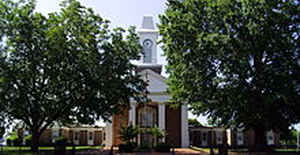
Grant County is a county in the state of Arkansas. Its
population was 17,853 at the 2010 United States Census. The
county seat is
Sheridan. Grant County was established on February
4,1869 and was formed from Jefferson County, Hot Spring County and
Saline County. Grant county is named for Ulysses S.
Grant who had been elected President of the United States in November
1868.
Grant County is included in the Little Rock-North Little Rock-Conway, AR Metropolitan Statistical Area.
Etymology - Origin of Grant County Name
Grant county is named for Ulysses Simpson Grant, the eighteenth president of the United States. Ulysses S. Grant, born Hiram Ulysses Grant (April 27, 1822 - July 23, 1885), was an American general and the eighteenth President of the United States (1869-1877). He achieved international fame as the leading Union general in the American Civil War.
Demographics:
County QuickFacts: CensusBureau Quick Facts
Grant County History
The first restoration Legislature from territory taken from Hot Spring, Jefferson and Saline counties created Grant County on February 4, 1869. It was named for Ulysses S. Grant who had been elected President of the United States in November 1868. The county seat is Sheridan. Grant County is a large, rural county of rolling, pine-covered hills owned by big timber companies. The pine-covered cutover land is a sanctuary for many bird species. The Saline River winds through Grant County and into the Quachita River in southern Arkansas. Fishing and hunting are extremely popular. Jenkins Ferry State Park, a Civil War battle site, features swimming, picnicking and a boat launch ramp into the Saline River. The Grant County Museum exhibits artifacts of area history going back to the Indian cultures. The Paleo Indians, the Archaic, and the Mound Builders inhabited Grant County for some time. The Caddo and the Quapaw may have hunted the area. Displaced Cherokee and Choctaw owned land there in the early 1800s. The County Courthouse is a beautiful red brick structure. Some Materials were reused from the old 1910 courthouse. The corner markers of the old building were placed in the pillars of the new structure along with a time capsule. Also preserved from the earlier courthouse is the first public clock in the county. It was hand wound and is housed in the seventy-six foot cupola and is illuminated from within at night
Geography: Land and Water
As reported by the Census Bureau, the county has a total area of 633 square miles (1,640 km2), of which 632 square miles (1,640 km2) is land and 1.1 square miles (2.8 km2) (0.2%) is water. Grant County is considered part of the Arkansas Timberlands geographical area.
Grant County is a large, rural county of rolling, pine-covered hills owned by big timber companies. The pine-covered cutover land is a sanctuary for many bird species. The Saline River winds through Grant County and into the Quachita River in southern Arkansas. Fishing and hunting are extremely popular.
Neighboring Counties
Bordering counties are as follows:
- North: Pulaski County
- East: Jefferson County
- Southeast: Cleveland County
- Southwest: Dallas County
- West: Hot Spring County
- Northwest: Saline County
Education


Click Image to Enlarge
