


Click Image to Enlarge
Arkansas Counties
The first of the Arkansas' seventy-five present-day counties created, Arkansas County was formed on 13 December 1813, when this area was part of the Missouri Territory.Hot Spring County, Arkansas
Hot Spring County Education, Geography, and History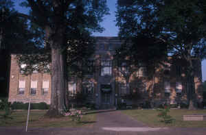
Hot Spring County is a county located in the state of Arkansas. Based on the 2010 census, the population was 32,923. The county seat is Malvern. Hot Spring County was formed on November 2, 1829, from a portion of Clark County. The county is named for the hot springs at Hot Springs, Arkansas, which were within its boundaries until Garland County was formed in 1874.
Hot Spring County comprises the Malvern, AR Micropolitan Statistical Area, which is included in the Hot Springs-Malvern, AR Combined
Statistical Area.
Etymology - Origin of Hot Spring County Name
Hot Spring county is named for the hot springs at the town of that name which were within the borders of the county at the time of its formation. The city takes its name from the natural thermal water that flows from 47 springs on the western slope of Hot Springs Mountain in the historic downtown district of the city. About a million gallons of 143-degree water flow from the springs each day.
Demographics:
County QuickFacts: CensusBureau Quick Facts
Hot Spring County History
Hot Spring county was created on November 2, 1829, by the Territorial Legislature from a part of Clark County, the county's name came from the natural hot springs that later became world famous as a part of Garland County. The county seat is Malvern.
Hot Spring County is represented in the Arkansas State Senate by Republican Alan Clark, a Hot Springs businessman. In the Arkansas House of
Representatives, it is represented by a Republican as well, Laurie Rushing, a real estate broker from Hot Springs. Hot Spring County's economy base is beef and dairy cattle, and cultivation of hay, soybeans and rice. Industrial development includes lumber mills, brick plants, metals, and small
industry. Many residents currently commute out of the county for work. The county has many varieties (65) of valuable minerals including the nation's greatest concentrations of novaculite
and vanadium and magnet ore, which is in the roadbed of US Highway 270.
Malvern calls itself the "Brick Capital of the World." In July of each
year Brick fest is celebrated with arts, crafts, games, and
entertainment. The county courthouse, constructed in 1936 by the WPA, is
built of local brick. It is an alcohol prohibition or dry county.
Geography: Land and Water
As reported by the Census Bureau, the county has a total area of 622 square miles (1,610 km2), of which 615 square miles (1,590 km2) is land and 7.0 square miles (18 km2) (1.1%) is water.
The landscape is forested ridges, and river bottomland, with the Ouachita Mountains in the north and west and rolling hills in the southeast. Lake Catherine, set in a forest of tall pines and hardwoods, offers a getaway for fishing and other water sports, and the State Park offers campsites, cabins, hiking trails, and a marina. The Ouachita River, which runs through the county, is well known for its fishing and floating. Many campers enjoy the area and return year after year.
Neighboring Counties
Bordering counties are as follows:
- Northeast: Saline County
- East: Grant County
- Southeast: Dallas County
- Southwest: Clark County
- Northwest: Montgomery County; Garland County
Education


Click Image to Enlarge
