


Click Image to Enlarge
Arkansas Counties
The first of the Arkansas' seventy-five present-day counties created, Arkansas County was formed on 13 December 1813, when this area was part of the Missouri Territory.Marion County, Arkansas
Marion County Education, Geography, and History 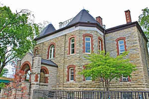
Marion County is a county located in the state of Arkansas. Based on the 2010 census, the
population was 16,653. The county seat is Yellville.
Marion County is Arkansas's 35th county and was created in 1835.
The county is named for General Francis Marion, the famous "Swamp Fox" of the Revolutionary
War.
The county included part of what is now Searcy County, Arkansas, with many opposing to dividing them, which helped fueled the bloody Tutt-Everett
War between 1844 and 1850.
Etymology - Origin of Marion County Name
Marion County is named for Francis Marion, the American Revolutionary War general who was nicknamed the "Swamp Fox". Francis Marion (February 26, 1732 - February 27, 1795) is considered one of the fathers of modern guerrilla warfare, and is credited in the lineage of the United States Army Rangers.
Demographics:
County QuickFacts: CensusBureau Quick Facts
Marion County History
Marion county was formed on November 3, 1835, from Izard County, first called Searcy County, was renamed in 1836 to tribute of Francis Marion, a Revolutionary War General. Yellville is the county seat. Prior to its occupation by white settlers, this County Seat was an Indian village. It is one of the oldest settlements in Arkansas and has been under the flags of Spain, France, the United States, the Confederate States of America, the Territory of Louisiana, the Territory of Missouri, and the Territory and State of Arkansas. One third of the county is under water that offers many water activities. Ranger Boat and Flippin Bass Boat Manufacturers are located in the county. Part of the Buffalo River runs through the county and features camping, hiking, canoeing, hunting, and fishing. The Lower Buffalo Wilderness Area is the state's largest wilderness area. Bull Shoals Lake has 19 parks scattered around its 1,000 mile shoreline. The Ozark villages are populated by crafters from spring to late fall that brings a large number of visitors to this area.
Geography: Land and Water
As reported by the Census Bureau, the county has a total area of 640 square miles (1,700 km2), of which 597 square miles (1,550 km2) is land and 43 square miles (110 km2) (6.8%) is water.
The landscape of Marion County is the rugged and mountainous, Ozark Mountains, inhabited for years by bluff-dwelling Native Americans and, later, by European settlers. Part of the Buffalo River runs through the county and features camping, hiking, canoeing, hunting, and fishing.
Neighboring Counties
Bordering counties are as follows:
- Northeast: Ozark County, Mo.
- East: Baxter County
- South: Searcy County
- West: Boone County
- Northwest: Taney County, Mo.
Education


Click Image to Enlarge
