


Click Image to Enlarge
Arkansas Counties
The first of the Arkansas' seventy-five present-day counties created, Arkansas County was formed on 13 December 1813, when this area was part of the Missouri Territory.Newton County, Arkansas
Newton County Education, Geography, and History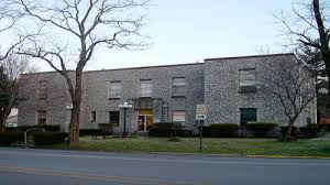
Newton County is a county located in the state of Arkansas. Based on the 2010 census, the
population was 8,330. The county
seat is
Jasper. Newton County. Newton county was formed on December 14, 1842.
The county is named for Thomas W. Newton, an Arkansas
Congressman.
Newton County is part of the Harrison , AR Micropolitan Statistical Area.
Etymology - Origin of Newton County Name
Newton county is named for Thomas W. Newton, a state senator. Thomas Willoughby Newton (18 January 1804 - 22 September 1853) was a Whig member of the United States House of Representatives from the State of Arkansas.
Demographics:
County QuickFacts: CensusBureau Quick Facts
Newton County History
Newton county was created in 1842 and named after Thomas W. Newton, an Arkansas congressman, in which the Choctaw Indians once lived in the hill country. Travel writers have selected scenic Highway 7 as one of the top 10 scenic drives in the country. The elevation ranges from 700 feet to 2,561 feet. The Ozark National Forest provides wilderness hiking, backpacking, camping, and hunting. The Buffalo National River, the nation's first federally protected river, is one of the last free-flowing streams in mid-America and offers clear blue water for fishing and canoeing along the towering limestone bluffs. The county seat is Jasper where the county courthouse is located. The courthouse building is unique. The old county courthouse was destroyed by fire in 1938, and the present building reflects a determination that this kind of disaster would never happen again. Not only is the entire building fireproof, but also every room is a fireproof vault. The outside walls and the cross walls are granite quarried from the bed of the Little Buffalo River and the floors are cement. The cornerstone of the building carries a reminder of the post-depression years: "USA - 1939 - WPA." The county is an alcohol prohibition or dry county.
Geography: Land and Water
As reported by the Census Bureau, the county has a total area of 823 square miles (2,130 km2), of which 821 square miles (2,130 km2) is
land and 2.3 square miles (6.0 km2) (0.3%) is water.
Newton County lies almost completely within the rugged Boston Mountain range of the Ozark Mountains where elevations exceed 2,500 feet (760 m).
The Buffalo National River runs through the county from west to east. Highway 7, which
traverses the county from north to south, has been rated as one of the most scenic drives in the region.
Neighboring Counties
Bordering counties are as follows:
- Northeast: Boone County
- East: Searcy County
- Southeast: Pope County
- Southwest: Johnson County
- West: Madison County
- Northwest: Carroll County
Education


Click Image to Enlarge
