


Click Image to Enlarge
Arkansas Counties
The first of the Arkansas' seventy-five present-day counties created, Arkansas County was formed on 13 December 1813, when this area was part of the Missouri Territory.Pope County, Arkansas
Pope County Education, Geography, and History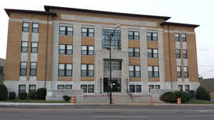
Pope County is a county located in the state of Arkansas. Based on the 2010 census, the
population was 61,754. The county
seat is
Russellville. The county was formed on November 2, 1829, from a portion of Crawford County.
Pope county is named for John Pope, the third governor
of the Arkansas Territory.
Pope County is part of the Russellville, AR Micropolitan Statistical Area.
Etymology - Origin of Pope County Name
Pope county is named for John Pope, (1770-1845) , a governor of the Arkansas Territory. John Pope was a United States Senator from Kentucky, a member of the United States House of Representatives from Kentucky, Secretary of State of Kentucky, and Governor of Arkansas Territory.
Demographics:
County QuickFacts: CensusBureau Quick Facts
Pope County History
Pope County history began about 186 years ago with the June 1813 establishment of an Indian agency. Major William L. Lovely was appointed as an agent to the Cherokee Indians and established the agency. This area was near the center of the Cherokee settlements in Arkansas. Dwight Mission was later located near the agency and was the first non-Indian settlement in Pope County established in 1820. The first school in Arkansas opened at the mission on January 1, 1822. Pope County was originally formed on November 2, 1829, from part of Crawford County. Later, part of Van Buren County was added to it and still later a part of Johnson and Yell Counties were added to it. It was named for John Pope, the third Arkansas Territorial Governor. The City of Pottsville lies east of Russellville and recently celebrated its 100'h anniversary. The history of the town really began in 1820 when Kirkbride Potts settled and homesteaded 160 acres. It is an alcohol prohibition or dry county.
Geography: Land and Water
As reported by the Census Bureau, the county has a total area of 831 square miles (2,150 km2), of which 813 square miles (2,110 km2) is land and 18 square miles (47 km2) (2.2%) is water.
To the north lies the Ozark National Forest with many and varied recreational areas, hunting, fishing, camping floating, hiking trails and perhaps the only bayou in the country featuring whitewater.
Neighboring Counties
Bordering counties are as follows:
- Northeast: Searcy County; Van Buren County
- Southeast: Conway County
- Southwest: Yell County; Logan County
- Northwest: Johnson County; Newton County
Education


Click Image to Enlarge
