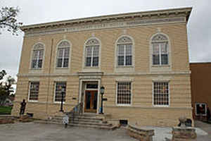
Baca County, Colorado
Baca County Education, Geography, and History
Baca County is the southeastern most of the 64 counties in the state of Colorado. Based on the 2010 census, the population was 3,788. The county seat is Springfield. Baca County was created on April 16, 1889 from Las Animas County. The county is named in honor of pioneer and Colorado territorial legislator Felipe Baca.
Etymology - Origin of Baca County Name
Baca County is named in honor of the prominent Baca family of Trinidad, Colorado, members of which had settled early in the area.
Demographics:
County QuickFacts: CensusBureau Quick Facts
Baca County History
Baca County was created by the Colorado legislature on April 16, 1889, out of the eastern portions of Las Animas County. Baca County was named in honor of pioneer and Colorado territorial legislator Felipe Baca.
Previous to the 1880s there was little activity in the county, other than along the Cutoff Branch of the Santa Fe Trail that crosses its
farthest southeastern corner. The 1910s saw wet years and expansion due to the increase in acreage that could be homesteaded. World War I also
brought increased demand for agricultural products. The arrival of the Santa Fe Railroad in 1926 created new towns and a population increase.
The Dust Bowl arrived in the 1930s, with Baca County being one of the hardest hit areas. This prompted soil conservation efforts by the
federal government. Part of this effort was the purchase of cultivated land by the government in order to return it to grassland. Today the
US Forest Service supervises 220,000 acres of Comanche National Grassland which was purchased in the 1930s. These areas include Carizzo
Creek and Picture Canyon. The Colorado Division of Wildlife maintains the recreational areas at Two Buttes Lake and Turk's Pond.
Geography: Land and Water
As reported by the Census Bureau, the county has a total area of 2,557 square miles (6,623 km2),
of which, 2,556 square miles (6,619 km2) of it is land and 1 square miles (4 km2) of it (0.05%) is
water.
Baca County is located in the southeastern corner of Colorado. New Mexico and Oklahoma border it on the south, with Kansas on the east.
The county is located within the province of the Great Plains, and ranges from 3,500 feet to 5,280 elevation above sea level. The climate is semi-arid, with an average annual precipitation of about 12 inches in northwest corner to about 17 inches in the southeastern corner. The county seat, Springfield is located in the southeast corner of the state and is a farming and cattle ranching community.
Neighboring Counties
Bordering counties are as follows:
- North: Prowers County
- Northeast: Stanton County, Kan.
- East: Morton County, Kan.
- South: Cimarron County, Okla.
- Southwest: Union County, N.M.
- West: Las Animas County
- Northwest: Bent County
Education


