


Colorado Geography: The Land
Geography and Landforms of Colorado
Find an overview of Colorado geography, topography, geographic land regions, land areas, and major rivers.
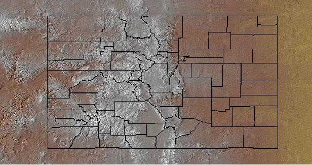
Access Colorado almanac, furnishing more details on the state geography, geographical and land regions, climate and weather, elevation, land areas, bordering states, and other statistical data.Colorado is located in the center of the western half of the continental United States and is the eighth largest state. Its average elevation of 6,800 feet is the highest of any state in the nation.
The Great Plains region covers, roughly, the eastern 2/5 of the state. On their western edge the plains give way to the Rocky Mountains, which run north-south through central Colorado. The mountains are divided into several ranges that make up two generally parallel belts, with the Front Range and a portion of the Sangre de Cristo Mts. on the east and the Park Range, Sawatch Mts., and San Juan Mts. on the west. Mt. Elbert (14,433 ft/4,399 m) is the highest peak in the U.S. Rocky Mts. The mountain ranges are separated by high valleys and basins called parks. These include North Park, Middle Park, South Park, Estes Park, and San Luis Park. The Continental Divide runs north-south along the Rocky Mts. in Colorado.
Colorado Highest, Lowest, & Mean Elevations |
|
|---|---|
| Mean Elevation | 6,800 ft. |
| Highest Point | Mt. Elbert 14,433 ft. |
| Lowest Point | Arkansas River 3,350 ft. |
Colorado Land Area (Square Miles) |
|
| Geographic Center | In Park County, 30 mi. NW of Pikes Peak Longitude: 105° 38.5'W Latitude: 38° 59.9'N |
| Total Area | 104,093.57 sq. mi. 8th |
| Land Area | 103,717.53 sq. mi. 99.64% |
| Water Area | 376.04 sq. mi. 0.36% |
| Forested Land Area | 32.1% |
| Dimensions (Length - Width) |
380 miles - 280 miles |
Colorado: Physiographic Regions
Five different physiographic provinces and three subprovinces are found within Colorado.
The topography of the state can be broadly classified into five different provinces:
- the Great Plains in the east,
The Great Plains includes the three subprovinces: the Colorado Piedmont, Raton Basin and High Plains. - the Southern Rocky Mountains in the center,
- the Middle Rocky Mountains in the northwest
- the Colorado Plateau in the west and the
- Wyoming Basin in the north.
Colorado Plateau
(Colorado Plateau Province)
{Intermontane Plateaus}
The Colorado Plateau is centered on the four corners area and extends into Colorado, Utah, Arizona, and New Mexico. It is an area of tablelands with moderate to high relief dissected by narrow and widely-spaced stream valleys. The Colorado Plateau is characterized by limited precipitation, cold winters and hot summers. Lowest elevations are covered with arid shrublands with grass interspersed. Sagebrush is dominant over large areas, with cottonwoods along perennial water courses. At moderate elevations, woodland vegetation is dominated by pinyon pine and juniper, with various shrubs intermixed. Montane forest is in high elevations, with ponderosa pine and Douglas fir dominant to the south and lodgepole pine and aspen farther north.
The Colorado Plateau covers most of the western portion of the state. It is a region of high plateaus and deep canyons carved by the Colorado, Gunnison, and other rivers. It runs along the western 1/5 of the state and a small area known as the Intermontane Basin lies in the northwest corner of Colorado. The Intermontane Basin, characterized by rolling forested hills, plateaus and plenty of sagebrush, is the smallest land area in Colorado.
Wyoming Basin
As its name suggests, the Wyoming Basin is primarily in Wyoming but also extends into northern Colorado, southern Montana, and very small parts of northeast Utah and southeast Idaho. The area consists of broad intermountain basins interrupted by isolated hills and low mountains that merge to the south into a dissected plateau. It is basically a shrubsteppe, dominated by sagebrush and shadscale, interspersed with areas of shortgrass prairie. Higher elevations are in mountain shrub vegetation, with coniferous forest atop the highest areas.
Middle Rocky Mountains
The Middle Rocky Mountains occupy a narrow strip along the Idaho-Wyoming border. The area comprises
several ranges that trend north-south and northwest-southeast and rise to between 7,000 and 10,000 feet (2,100 and 3,000 metres). Grass- and sagebrush-covered
plateaus and valleys and a few small lakes are found between the ranges.
It includes the north-south trending Wasatch Range, comprised mainly of pre-Cenozoic sedimentary and Cenozoic silicic plutonic rocks, and the east-west
trending Uinta Mountains, comprised mainly of Precambrian sedimentary and metamorphic rocks.
Southern Rocky Mountains
Central Colorado makes up the bulk of the Southern Rockies, which extend into northern New Mexico and southern Wyoming. Steep, rugged mountains cover this region, and vegetation varies greatly on the basis of elevation and aspect. Alpine tundra gives way to various coniferous forests often with aspen intermixed. Ponderosa pine is at lower elevations, pinyon-juniper below that, and grasslands in the lowest areas. Because of topography, weather, avalanches, fire, insect outbreaks, and disease, forests in the Southern Rocky Mountains tend to be patchier than in many other areas. The landscape is thus a complex mosaic of open meadows and forest stands of varying age and species composition.
The central portion of the state is covered by the Rocky Mountains. Because of the presence of the high peaks in this range, Colorado has been given the nickname "Roof of the World." The state has 51 out of the 80 peaks in North America over 14,000 feet. Colorado's highest point, Mount Elbert (14,431 feet) is found here. The headwaters of 6 major rivers originate in the mountains of this region - the Colorado, the North Platte, the South Platte, the Arkansas, the Republican, and the Rio Grande. Five mountain ranges make up the Colorado Rocky Mountains; the Front Range, the Sangre de Cristo Mountains, the Park Range, the Sawatch Range and the San Juan Mountains. The Continental Divide runs through the Colorado Rockies. Rivers east of the Divide flow toward the Mississippi River; those to the west flow toward the Pacific Ocean.
Great Plains
The Great Plains includes the three sub-provinces: the Colorado Piedmont, Raton Basin and High Plains.
This physiographic area is located almost entirely in central New Mexico. Major landforms are valleys, lowlands, outwash plains, and alluvial fans and terraces. The middle reach of the Rio Grande is found here. Grama and galleta grasses and four-wing saltbush occur along with sand sage at lower elevations, pinyon-juniper at higher elevations, and conifers are in the scattered mountain ranges. Riparian strips along water courses have cottonwood-willow and non-native salt cedar.
To the east, Colorado has high plains and rolling prairies that rise westward to the Rockies. Livestock production and the farming of both irrigated and dry land takes place in this Great Plains region. It is part of the Interior Plain of North America that runs from Canada in the north, through the United States, to Mexico in the south. The Great Plains region covers, roughly, the eastern 2/5 of the state. The land is flat and dry, sloping gently upward from east to west to meet the Rocky Mountains.
The Colorado Piedmont is the geologic term for an area along the base of the foothills of the Front Range in north central Colorado in the United States. The region consists of a broad hilly valley, just under 5000 ft (1500 m) in elevation, stretching north and northeast from Denver in the valley of the South Platte River, as well as along the Arkansas River valley southward from Colorado Springs. The region includes much of the populated and cultivated area of Colorado. The name Colorado Piedmont also refers to the physiographic section of the Great Plains province
The Central Shortgrass Prairie Physiographic Area covers much of eastern Colorado and smaller portions of western Kansas, southwestern Nebraska, and southeastern Wyoming.
The region contains flat to gently rolling topography, with occasional canyons and bluffs. Elevations within Colorado range from about 975 m (3,200
ft) in Prowers County to about 1800 m (6,000 ft) around Limon and near the foothills of the Rockies. Principal rivers include the South Platte, Arikaree,
Big Sandy, Republican, and Arkansas. Precipitation is low, less than 50 cm (20 in) per year with most of that falling in spring and summer; total precipitation
varies greatly between years at a given location and varies significantly more than in mixed grass or tallgrass systems (Wiens 1972). Mean monthly
temperatures range from -12¡C (10¡F) in winter to 38¡C (100¡F) in summer. Localized severe weather is not uncommon, and blizzards, hailstorms, and
tornadoes occur in most years.
The dominant habitat in this physiographic area is shortgrass prairie. Shortgrass is dominated by two low-growing warm-season grasses, blue grama and
buffalo grass; western wheatgrass is also present, along with taller vegetation including widespread prickly-pear cactus and yucca, and cholla in the
south. Sandsage prairie is found where sandy soils occur, and is dominated by sand sagebrush and the grasses sand bluestem and prairie sand-reed. Mixed
grass (needle-and-thread, side-oats grama) and tallgrass (big bluestem, little bluestem, switchgrass) communities occur locally
The Raton Basin is a geologic structural basin in southern Colorado and northern New Mexico. It takes its name from Raton Pass and the town of Raton, New Mexico. In extent, the basin is approximately 50 miles (80 km) east-west, and 90 miles (140 km) north-south, in Huerfano and Las Animas Counties, Colorado, and Colfax County, New Mexico.

