


Click Image to Enlarge
Colorado Counties
Colorado currently has sixty-four counties. In February 1866, the first new county, Las Animas, was created. Alamosa was created in 1913, and in 2001, Broomfield was recognized as a city-county, bringing a total of 64 counties.Colorado Counties: History and Information
Find a brief history of Colorado Counties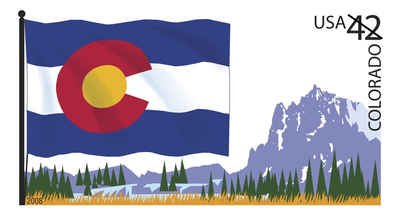
The geography of the state of Colorado is diverse, encompassing both rugged mountainous terrain, vast plains, desert lands, desert canyons, and mesas . The state was named for the Colorado River, which Spanish explorers named the Rio Colorado for the ruddy (Spanish: colorado) silt the river carried from the mountains. On August 1, 1876, US President Ulysses S. Grant signed a proclamation admitting Colorado to the Union as the 38th state. Colorado is nicknamed the "Centennial State" because it became a state in the centennial year of the United States Declaration of Independence.
This is a list of the 64 counties of the US State of Colorado. The counties of Colorado are important components of government since the state has no secondary civil subdivisions such as townships.
When the Colorado Territory first began creating counties in 1861, 17 counties (Summit, Larimer, Weld, Boulder, Gilpin, Clear Creek, Jefferson, Arapahoe, Douglas, Lake, Conejos, Costilla, Park, Fremont, El Paso, Pueblo, and Huerfano) and a Cheyenne Reserve were formed. In February 1866, the first new county, Las Animas, was created, followed by Saguache in December of that year. Bent County was created in February 1870, followed by Greenwood the following month. On February 2, 1874, Grand County and Elbert County were formed, and on February 10, La Plata, Hinsdale, and Rio Grande counties were created. Greenwood was absorbed into Bent on February 5. The last county to be created under the Colorado Territory name was San Juan County, created three months before statehood. By the time Colorado became a state on August 1, 1876, it had only 26 counties. In January 1877, Routt and Ouray were formed, which was followed by Gunnison and Custer counties in March. In February 1879, Chaffee County was created. From February 8?#8364;"10, 1879, Lake county was renamed Carbonate County. In 1881, Dolores County and Pitkin County were created. In 1883, Montrose, Mesa, Garfield, Eagle, Delta, and San Miguel counties were formed, leaving the total number of counties at 39. The number rose to 40 in 1885 with the creation of Archuleta County on April 14. Washington County and Logan County were both created in 1887. Between February 19 and April 16 in 1889, Morgan, Yuma, Cheyenne, Otero, Rio Blanco, Phillips, Sedgwick, Kiowa, Kit Carson, Lincoln, Prowers, Baca, and Montezuma counties were formed, bringing the total to 55. By 1900, Mineral County and Teller County had been added. On November 15, 1902, Arapahoe County split into Adams in the north and Denver was recognized as a consolidated city-county. By 1912, Jackson County, Moffat County, and Crowley County had been created. Alamosa was created in 1913, and in 2001, Broomfield was recognized as a city-county, bringing a total of 64 counties
As an administrative branch of government, counties do not have a court system of their own. They possess no inherent legislative powers and may exercise only those delegated to them by the General Assembly
The basic organizational structure of all Colorado counties is the same, except for the home rule counties and the City and County of Denver, Pitkin County and Weld County. Denver is organized under a charter pursuant to article XX of the Colorado Constitution. Pitkin and Weld counties are organized pursuant to article XIV, section 16, of the Colorado Constitution and C.R.S. 30-11-501, et seq., which allow voters of a county to adopt a home rule charter establishing the organization and structure of county government, and pursuant to C.R.S 30-35-101, et seq., which further implement constitutional provisions regarding home rule.
| History of Colorado Counties | ||||
|---|---|---|---|---|
| County | 2000 Population |
Square Miles |
County Seat | Created |
| Adams County | 363,857 | 1,192 | Brighton | 1901 |
| Alamosa County | 14,966 | 723 | Alamosa | 1913 |
| Arapahoe County | 487,967 | 803 | Littleton | 1861 |
| Archuleta County | 9,898 | 1,349 | Pagosa Springs | 1885 |
| Baca County | 4,517 | 2,556 | Springfield | 1889 |
| Bent County | 5,998 | 1,514 | Las Animas | 1870 |
| Boulder County | 291,288 | 742 | Boulder | 1861 |
| Broomfield City and County | 38,282 | 34 | Broomfield | 2001 |
| Chaffee County | 16,242 | 1,014 | Salida | 1861 |
| Cheyenne County | 2,231 | 1,782 | Cheyenne Wells | 1889 |
| Clear Creek County | 9,322 | 396 | Georgetown | 1861 |
| Conejos County | 8,400 | 1,287 | Conejos | 1861 |
| Costilla County | 3,663 | 1,227 | San Luis | 1861 |
| Crowley County | 5,518 | 789 | Ordway | 1911 |
| Custer County | 3,503 | 739 | Westcliffe | 1877 |
| Delta County | 27,834 | 1,142 | Delta | 1883 |
| Denver City and County | 554,636 | 153 | Denver | 1901 |
| Dolores County | 1,844 | 1,067 | Dove Creek | 1881 |
| Douglas County | 175,766 | 840 | Castle Rock | 1861 |
| Eagle County | 41,659 | 1,688 | Eagle | 1883 |
| El Paso County | 516,929 | 2,127 | Colorado Springs | 1861 |
| Elbert County | 19,872 | 1,851 | Kiowa | 1874 |
| Fremont County | 46,145 | 1,533 | Canon City | 1861 |
| Garfield County | 43,791 | 2,948 | Glenwood Springs | 1883 |
| Gilpin County | 4,757 | 150 | Central City | 1861 |
| Grand County | 12,442 | 1,850 | Hot Sulphur Springs | 1874 |
| Gunnison County | 13,956 | 3,239 | Gunnison | 1877 |
| Hinsdale County | 790 | 1,118 | Lake City | 1874 |
| Huerfano County | 7,862 | 1,591 | Walsenburg | 1861 |
| Jackson County | 1,577 | 1,613 | Walden | 1909 |
| Jefferson County | 527,056 | 772 | Golden | 1861 |
| Kiowa County | 1,622 | 1,771 | Eads | 1889 |
| Kit Carson County | 8,011 | 2,161 | Burlington | 1889 |
| La Plata County | 43,941 | 1,692 | Durango | 1874 |
| Lake County | 7,812 | 377 | Leadville | 1861 |
| Larimer County | 251,494 | 2,601 | Fort Collins | 1861 |
| Las Animas County | 15,207 | 4,773 | Trinidad | 1866 |
| Lincoln County | 6,087 | 2,586 | Hugo | 1889 |
| Logan County | 20,504 | 1,839 | Sterling | 1887 |
| Mesa County | 116,255 | 3,328 | Grand Junction | 1883 |
| Mineral County | 831 | 876 | Creede | 1893 |
| Moffat County | 13,184 | 4,742 | Craig | 1911 |
| Montezuma County | 23,830 | 2,037 | Cortez | 1889 |
| Montrose County | 33,432 | 2,241 | Montrose | 1883 |
| Morgan County | 27,171 | 1,286 | Fort Morgan | 1889 |
| Otero County | 20,311 | 1,263 | La Junta | 1889 |
| Ouray County | 3,742 | 542 | Ouray | 1877 |
| Park County | 14,523 | 2,201 | Fairplay | 1861 |
| Phillips County | 4,480 | 688 | Holyoke | 1889 |
| Pitkin County | 14,872 | 970 | Aspen | 1881 |
| Prowers County | 14,483 | 1,640 | Lamar | 1889 |
| Pueblo County | 141,472 | 2,389 | Pueblo | 1866 |
| Rio Blanco County | 5,986 | 3,221 | Meeker | 1889 |
| Rio Grande County | 12,413 | 913 | Del Norte | 1874 |
| Routt County | 19,690 | 2,362 | Steamboat Springs | 1877 |
| Saguache County | 5,917 | 3,169 | Saguache | 1866 |
| San Juan County | 558 | 388 | Silverton | 1876 |
| San Miguel County | 6,594 | 1,286 | Telluride | 1861 |
| Sedgwick County | 2,747 | 548 | Julesburg | 1889 |
| Summit County | 23,548 | 608 | Breckenridge | 1861 |
| Teller County | 20,555 | 557 | Cripple Creek | 1899 |
| Washington County | 4,926 | 2,521 | Akron | 1887 |
| Weld County | 180,936 | 3,993 | Greeley | 1861 |
| Yuma County | 9,841 | 2,366 | Wray | 1889 |

Click Image to Enlarge
